

4 datasets found for "State Plane Zones"
-
Federal
Rongowai-CYGNSS Airborne Level 1 Science Data Record Version 1.0
National Aeronautics and Space Administration —
The Rongowai Level 1 Science Data Record Version 1.0 dataset is generated by the University of Auckland (UoA) Rongowai Science Payloads Operations Centre in New... -
Federal
ASTER L2 Surface Emissivity V004
National Aeronautics and Space Administration —
The Terra Advanced Spaceborne Thermal Emission and Reflection Radiometer (ASTER) Surface Emissivity (AST_05) is produced using the Temperature/Emissivity Separation... -
Federal
Coastal Wetland Elevation and Carbon Flux Inventory with Uncertainty, USA, 2006-2011
National Aeronautics and Space Administration —
This dataset provides maps of coastal wetland carbon and methane fluxes and coastal wetland surface elevation from 2006 to 2011 at 30 m resolution for coastal... -
Federal
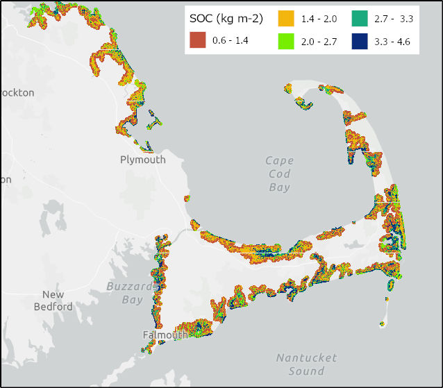
Soil Organic Carbon Distributions in Tidal Wetlands of the Northeastern USA
National Aeronautics and Space Administration —
This dataset provides estimates of soil organic carbon (SOC) in tidal wetlands for the northeastern United States. The data cover the period 1998-2018. Northeastern...
4 datasets found for "State Plane Zones"