
-
Federal
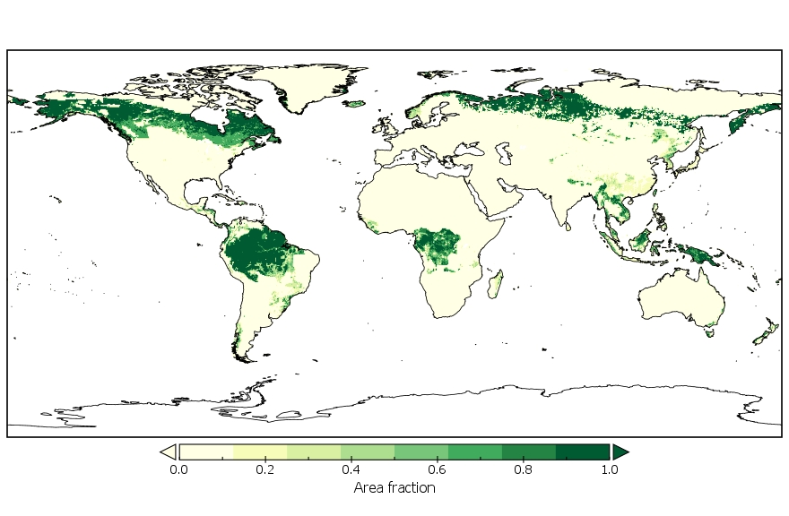
LUH1: Harmonized Global Land Use for Years 1500-2100, V1
National Aeronautics and Space Administration —
These data represent fractional land use and land cover patterns annually for the years 1500 - 2100 for the globe at 0.5-degree (~50-km) spatial resolution. Land use... -
Federal
GIBS Web Map Tile Service (WMTS)
National Aeronautics and Space Administration —
The WMTS implementation standard provides a standards-based solution for serviing digital maps using predefined image tiles. Through the constructs of the... -
Federal
LUH2-GCB2019: Land-Use Harmonization 2 Update for the Global Carbon Budget, 850-2019
National Aeronautics and Space Administration —
This dataset, referred to as LUH2-GCB2019, includes 0.25-degree gridded, global maps of fractional land-use states, transitions, and management practices for the... -
Federal
Global 30-Year Mean Monthly Climatology, 1961-1990 (New et al.)
National Aeronautics and Space Administration —
This is a dataset of mean monthly surface climate measurements over global land areas, excluding Antarctica, for the period 1961-1990. Values were interpolated from... -
Federal
Global 10-Year Mean Monthly Climatology, 1901-1990 (New et al.)
National Aeronautics and Space Administration —
This is a data set of 10-year mean monthly surface climate data over global land areas, excluding Antarctica, for the period 1901-1990. The data set is gridded at 0.5... -
Federal
Global Monthly Climatology for the Twentieth Century (New et al.)
National Aeronautics and Space Administration —
This is a data set of mean monthly surface climate data over global land areas, excluding Antarctica, for nearly all of the twentieth century. The data set is gridded... -
Federal
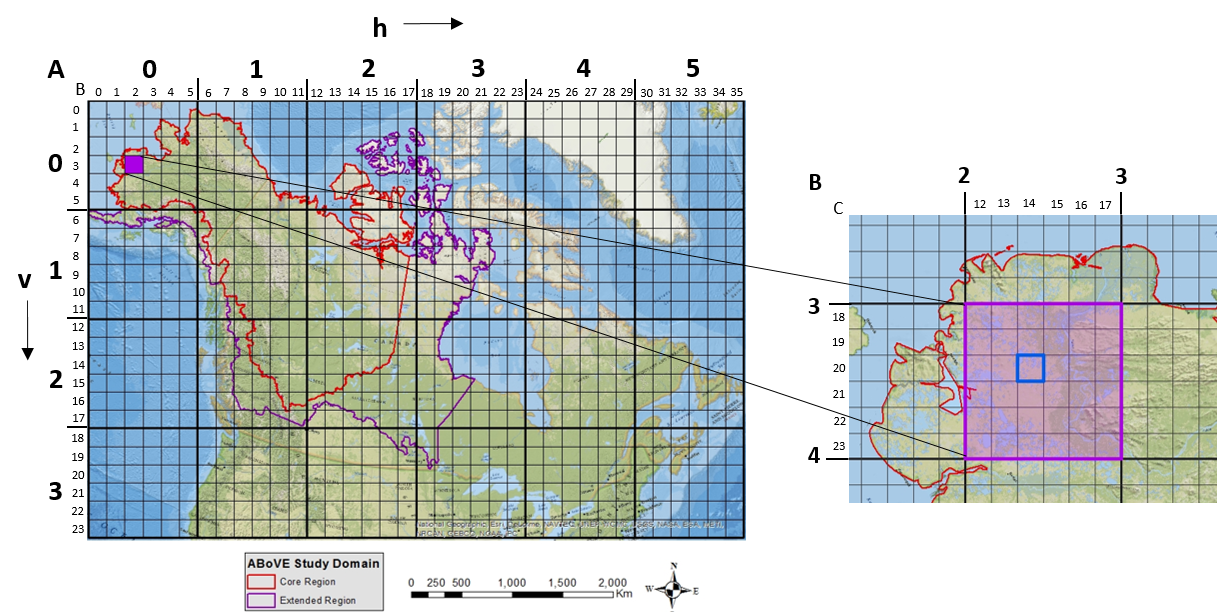
ABoVE: Study Domain and Standard Reference Grids, Version 2
National Aeronautics and Space Administration —
The Arctic - Boreal Vulnerability Experiment (ABoVE) has developed two standardized spatial data products to expedite coordination of research activities and to... -
Federal
SAFARI 2000 Monthly Climatology for the 20th Century (New et al.)
National Aeronautics and Space Administration —
This is a data set of mean monthly surface climate data over Southern Africa for nearly all of the twentieth century. The data set is gridded at 0.5 degree... -
Federal
Vulcan: High-Resolution Annual Fossil Fuel CO2 Emissions in USA, 2010-2015, Version 3
National Aeronautics and Space Administration —
The Vulcan version 3.0 annual dataset provides estimates of annual carbon dioxide (CO2) emissions from the combustion of fossil fuels (FF) and CO2 emissions from... -
Federal
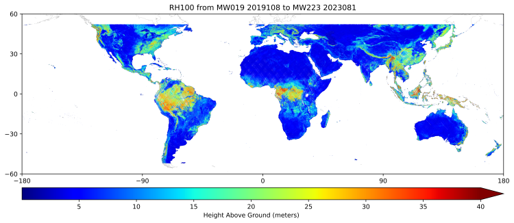
GEDI L3 Gridded Land Surface Metrics, Version 2
National Aeronautics and Space Administration —
This dataset provides Global Ecosystem Dynamics Investigation (GEDI) Level 3 (L3) gridded mean canopy height, standard deviation of canopy height, mean ground... -
Federal
LBA Regional Land Cover from AVHRR, 8-km, 1984 (DeFries et al.)
National Aeronautics and Space Administration —
This data set is a subset of an 8-km global land cover product (DeFries et al. 1998). This subset was created for the study area of the Large Scale Biosphere-... -
Federal
CSR TELLUS GRACE-FO Level-3 Monthly Ocean Bottom Pressure Anomaly Release 6.3 version 04
National Aeronautics and Space Administration —
This data set is produced by the Center for Space Research (CSR) GRACE-FO (Gravity Recovery and Climate Experiment Follow-On) program and derives the ocean bottom... -
Federal
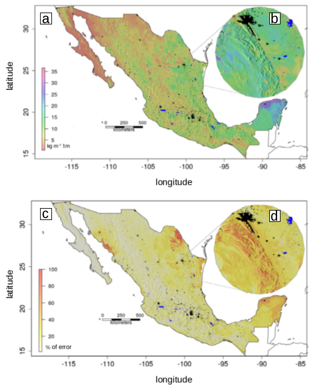
Soil Organic Carbon Estimates and Uncertainty at 1-m Depth across Mexico, 1999-2009
National Aeronautics and Space Administration —
This dataset provides an estimate of soil organic carbon (SOC) in the top one meter of soil across Mexico at a 90-m resolution for the period 1999-2009. Carbon... -
Federal
LBA Regional Land Cover from AVHRR, 1-Degree, 1987 (Defries and Townshend)
National Aeronautics and Space Administration —
This data set consists of a subset for the study area of the Large Scale Biosphere-Atmosphere Experiment in Amazonia (LBA) in South America (i.e., longitude 85 deg to... -
Federal
SAFARI 2000 Land Cover from AVHRR, 8-km, 1984 (DeFries et al.)
National Aeronautics and Space Administration —
This data set consists of a southern African subset of the University of Maryland (UMD) 8-km Global Land Cover product in ASCII GRID and binary image files formats.... -
Federal
Global 30-Year Mean Monthly Climatology, 1901-1960 (New et al.)
National Aeronautics and Space Administration —
This is a data set of 30-year mean monthly surface climate data over global land areas, excluding Antarctica, for the period 1901-1960. The data set is gridded at 0.5... -
Federal
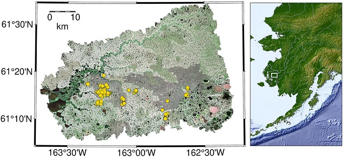
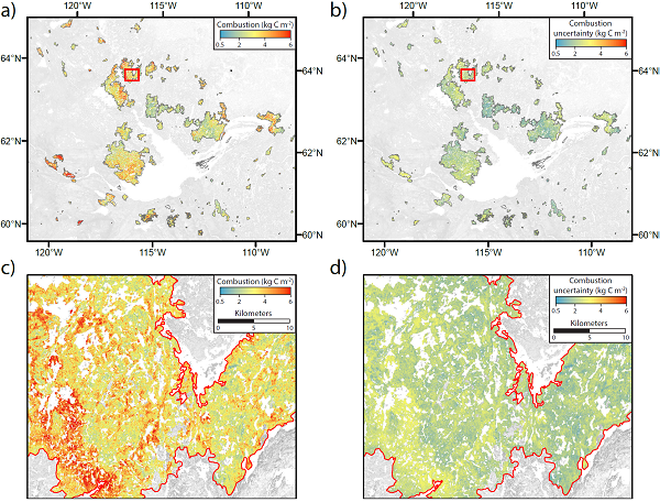
ABoVE: Wildfire Carbon Emissions and Burned Plot Characteristics, NWT, CA, 2014-2016
National Aeronautics and Space Administration —
This dataset provides estimates of wildfire carbon emissions and uncertainties at 30-m resolution, and measurements collected at burned and unburned field plots from... -
Federal
SAFARI 2000 Land Cover from AVHRR, 1-Deg, 1987 (Defries and Townshend)
National Aeronautics and Space Administration —
This data set consists of a southern African subset of the University of Maryland (UMD) 1-degree Global Land Cover product in ASCII GRID and binary image formats. The... -
Federal
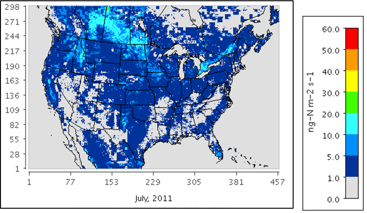
Mechanistic Module for Soil Nitrogen Emissions for CMAQ Model, North America, 2011
National Aeronautics and Space Administration —
This model product provides source code, input data files, and example model outputs for a new mechanistic soil nitrogen (N) module in-line with the Community...

Official websites use .gov
A
.gov website belongs to an official government
organization in the United States.
Secure .gov websites use HTTPS
A
lock (
) or https:// means you’ve safely connected to
the .gov website. Share sensitive information only on official,
secure websites.