
-
Federal
Fast Longwave And SHortwave Fluxes (FLASHflux) Clouds and Radiative Swath (SSF) TERRA-FM1 data in netCDF Version 4B
National Aeronautics and Space Administration —
FLASH_SSF_Terra-FM1-MODIS_Version4B is the Fast Longwave And Shortwave Radiative Fluxes (FLASHFlux) Clouds and Radiative Swath (SSF) TERRA-FM1 data in netCDF Version... -
Federal
NASA 3D Models: Skylab
National Aeronautics and Space Administration —
Skylab model. Polygons: 27533 Vertices: 15041 -
Federal
An Unexpectedly Large Count of Trees in the West African Sahara and Sahel
National Aeronautics and Space Administration —
This dataset provides georeferenced polygon vectors of individual tree canopy geometries for dryland areas in West African Sahara and Sahel that were derived using... -
Federal
BioSCape Vegetation Surveys Berg and Eerste River Catchments, South Africa, 2022-2023
National Aeronautics and Space Administration —
This dataset contains vegetation plot survey data collected at 36 sites across the Berg and Eerste River catchments in the Western Cape, South Africa collected during... -
Federal
SatCORPS CERES GEO Edition 4 Meteosat-9 Southern Hemisphere Version 1.0
National Aeronautics and Space Administration —
CER_GEO_Ed4_MET09_SH_V01 is the Satellite Cloud and Radiation Property retrieval System (SatCORPS) Clouds and the Earth's Radiant Energy System (CERES) Geostationary... -
Federal
SatCORPS CERES GEO Edition 4 GOES-13 Northern Hemisphere Version 1.0
National Aeronautics and Space Administration —
CER_GEO_Ed4_GOE13_NH_V01 is the Satellite Cloud and Radiation Property retrieval System (SatCORPS) Clouds and the Earth's Radiant Energy System (CERES) Geostationary... -
Federal
Fast Longwave And SHortwave Fluxes (FLASHflux) NOAA-20 Clouds and Radiative Swath (SSF) Version1B
National Aeronautics and Space Administration —
FLASH_SSF_NOAA20-FM6-VIIRS_Version1B data are near real-time CERES observed TOA fluxes, clouds, and parameterized surface fluxes, not officially calibrated. The Fast... -
Federal
SatCORPS CERES GEO Edition 4 GOES-13 Southern Hemisphere Version 1.0
National Aeronautics and Space Administration —
CER_GEO_Ed4_GOE13_SH_V01 is the Satellite Cloud and Radiation Property retrieval System (SatCORPS) Clouds and the Earth's Radiant Energy System (CERES) Geostationary... -
Federal
BOREAS SERM Forest Cover Data Layers of the SSA in Vector Format
National Aeronautics and Space Administration —
The forest cover data provided by Saskatchewan Environment and Resource Management, Forestry Branch - Inventory Unit (SERM-FBIU) are basically a digital version of... -
Federal
ABoVE: Lake Growing Season Green Surface Reflectance Trends, AK and Canada, 1984-2019
National Aeronautics and Space Administration —
This dataset provides an annual time series of Landsat green surface reflectance and the derived annual trend during the growing season (June and July) for 472,890... -
Federal
LBA-ECO LC-07 Wetland Extent, Vegetation, and Inundation: Lowland Amazon Basin
National Aeronautics and Space Administration —
This data set provides a map of wetland extent, vegetation type, and dual-season flooding state of the entire lowland Amazon basin. As described in Hess et al.... -
Federal
FLASHFlux Daily Gridded TOA and Surfaces/Clouds data Version 4C
National Aeronautics and Space Administration —
FLASH_TISA_Terra-NOAA20_Version4C is the Fast Longwave And SHortwave Fluxes (FLASHFlux) Daily Gridded Top-of-Atmosphere (TOA) and Surfaces/Clouds Version 4C data... -
Federal
Northern and Mid-Latitude Soil Database, Version 1, R1
National Aeronautics and Space Administration —
The U.S. Department of Agriculture, Agriculture and Agri-Food Canada, the Russian Academy of Agricultural Sciences, the University of Copenhagen Institute of... -
Federal
NACP Peatland Land Cover Map of Upper Peninsula, Michigan, 2007-2011
National Aeronautics and Space Administration —
This dataset provides a land cover map focused on peatland ecosystems in the upper peninsula of Michigan. The map was produced at 12.5-m resolution using a multi-... -
Federal
Fast Longwave And SHortwave Fluxes (FLASHflux) Clouds and Radiative Swath (SSF) data in netCDF
National Aeronautics and Space Administration —
FLASH_SSF_NOAA20-FM6-VIIRS_Version1A data are near real-time CERES observed TOA fluxes, clouds, and parameterized surface fluxes, not officially calibrated. The Fast... -
Federal
SatCORPS CERES GEO Edition 4 GOES-15 Southern Hemisphere Version 1.0
National Aeronautics and Space Administration —
CER_GEO_Ed4_GOE15_SH_V01 is the Satellite Cloud and Radiation Property retrieval System (SatCORPS) Clouds and the Earth's Radiant Energy System (CERES) Geostationary... -
Federal
Soil Carbon Estimates in 20-cm Layers to 1-meter Depth, Conterminous US, 1970-1993
National Aeronautics and Space Administration —
This data set provides a soil map with estimates of soil carbon (C) in g C/m2 for 20-cm layers from the surface to one meter depth for the conterminous United... -
Federal
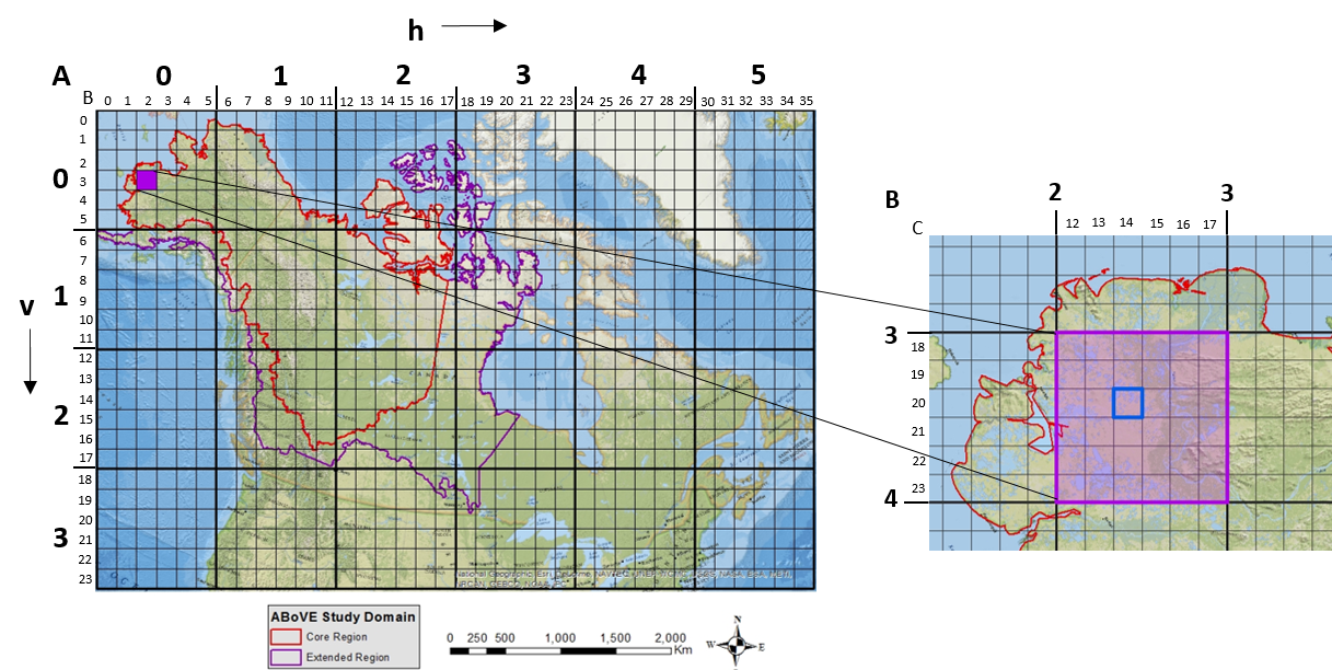
ABoVE: Study Domain and Standard Reference Grids, Version 2
National Aeronautics and Space Administration —
The Arctic - Boreal Vulnerability Experiment (ABoVE) has developed two standardized spatial data products to expedite coordination of research activities and to... -
Federal
BOREAS TGB-12 Soil Carbon and Flux Data of NSA-MSA in Raster Format
National Aeronautics and Space Administration —
The BOREAS TGB-12 team made measurements of soil carbon inventories, carbon concentration in soil gases, and rates of soil respiration at several sites. This data set... -
Federal
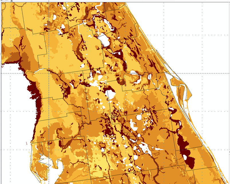
BOREAS Follow-On DSP-10 Regridded Peatland Maps
National Aeronautics and Space Administration —
These images were produced by aggregating 1' gridded data layers derived from the polygon-based Peatlands of Canada Database (Tarnocai et al., 2000) to 10'...

Official websites use .gov
A
.gov website belongs to an official government
organization in the United States.
Secure .gov websites use HTTPS
A
lock (
) or https:// means you’ve safely connected to
the .gov website. Share sensitive information only on official,
secure websites.