
-
Federal
Declassified Satellite Imagery 2 (2002)
National Aeronautics and Space Administration —
Declassified satellite images provide an important worldwide record of land-surface change. With the success of the first release of classified satellite photography... -
Federal
CORONA Satellite Photographs from the U.S. Geological Survey
National Aeronautics and Space Administration —
The first generation of U.S. photo intelligence satellites collected more than 860,000 images of the Earth’s surface between 1960 and 1972. The classified military... -
Federal
Global Earthquake Proportional Economic Loss Risk Deciles
National Aeronautics and Space Administration —
The Global Earthquake Proportional Economic Loss Risk Deciles is a 2.5 minute grid of earthquake hazard economic loss as proportions of Gross Domestic Product (GDP)... -
Federal
Ocean Color
National Aeronautics and Space Administration —
Satellite-derived Ocean Color Data sets from historical and currently operational NASA and International Satellite missions including the NASA Coastal Zone Color... -
Federal
ECOSTRESS Gridded Downscaled Meteorology Instantaneous L3 Global 70 m V002
National Aeronautics and Space Administration —
The ECOsystem Spaceborne Thermal Radiometer Experiment on Space Station (ECOSTRESS) mission measures the temperature of plants to better understand how much water... -
Federal
MetOp-C ASCAT Level 2 25.0km Ocean Surface Wind Vectors in Full Orbit Swath
National Aeronautics and Space Administration —
This dataset contains operational near-real-time Level 2 ocean surface wind vector retrievals from the Advanced Scatterometer (ASCAT) on MetOp-C at 25 km sampling... -
Federal
Global Cyclone Proportional Economic Loss Risk Deciles
National Aeronautics and Space Administration —
The Global Cyclone Proportional Economic Loss Risk Deciles is a 2.5 minute grid of cyclone hazard economic loss as proportions of Gross Domestic Product (GDP) per... -
Federal
LBA-ECO LC-14 Modeled Deforestation Scenarios, Amazon Basin: 2002-2050
National Aeronautics and Space Administration —
This data set provides the results of the two modeled scenarios for future patterns of deforestation across the Amazon Basin from 2002 to 2050. This larger defined... -
Federal
GLIMS Glacier Database, Version 1
National Aeronautics and Space Administration —
Global Land Ice Measurements from Space (GLIMS) is an international initiative with the goal of repeatedly surveying the world's estimated 200,000 glaciers. GLIMS... -
Federal
LUH1: Harmonized Global Land Use for Years 1500-2100, V1
National Aeronautics and Space Administration —
These data represent fractional land use and land cover patterns annually for the years 1500 - 2100 for the globe at 0.5-degree (~50-km) spatial resolution. Land use... -
Federal
Global Volcano Total Economic Loss Risk Deciles
National Aeronautics and Space Administration —
Global Volcano Total Economic Loss Risk Deciles is a 2.5 minute grid of global volcano total economic loss risks. First, subnational distributions of Gross Domestic... -
Federal
NASA Landsat Data Collection
National Aeronautics and Space Administration —
The NASA Landsat Data Collection (NLDC) is a compilation of Landsat multispectral scanner (MSS) scenes and Landsat thematic mapper (TM) scenes. This compilation of... -
Federal
MODIS/Terra Land Surface Temperature/3-Band Emissivity Daily L3 Global 1km SIN Grid Night V006
National Aeronautics and Space Administration —
The MOD21A1N Version 6 data product was decommissioned on July 31, 2023. Users are encouraged to use the MOD21A1N Version 6.1 data product.A new suite of Moderate... -
Federal
China Dimensions Data Collection: China Maps Bibliographic Database
National Aeronautics and Space Administration —
The China Maps Bibliographic Database is an historical collection of bibliographic information for more than 400 maps of China. The information resides in a... -
Federal
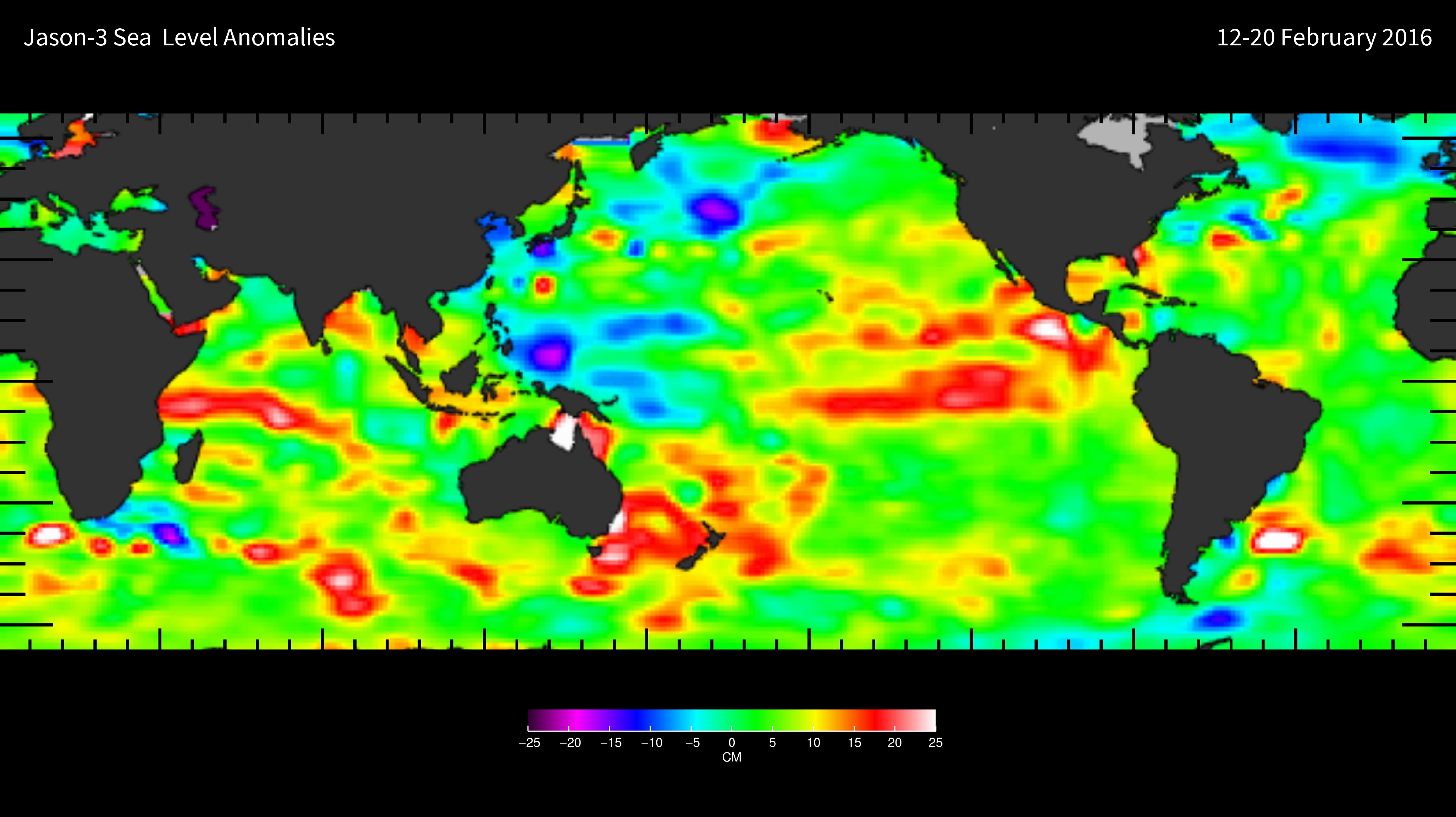
Jason-3 Wet Path Delay Correction
National Aeronautics and Space Administration —
This dataset provides supplementary wet tropospheric corrections for historical Jason-3 observations (https://www.ncei.noaa.gov/archive/accession/Jason3-xGDR). Recent... -
Federal
MODIS/Terra Land Surface Temperature/3-Band Emissivity Daily L3 Global 1km SIN Grid Day V061
National Aeronautics and Space Administration —
A suite of Moderate Resolution Imaging Spectroradiometer (MODIS) Land Surface Temperature and Emissivity (LST&E) products are available in Collection 6.1. The... -
Federal
High Mountain Asia CMIP6 Monthly and Yearly Water Balance Projections, 2016-2099 for Parts of Afghanistan, Tajikistan, Kyrgyzstan, and Pakistan V001
National Aeronautics and Space Administration —
This High Mountain Asia (HMA) data set comprises a suite of monthly and yearly water balance model (WBM) projections for the years 2016 – 2099, covering parts of... -
Federal
UC Berkeley CYGNSS Level 3 Daily RWAWC Watermask Version 3.2
National Aeronautics and Space Administration —
The CYGNSS Level 3 UC Berkeley Watermask Record Version 3.2 was developed by CYGNSS investigators in the Department of Civil and Environmental Engineering at the... -
Federal
ABoVE: Wetland Vegetation Classification for Peace-Athabasca Delta, Canada, 2019
National Aeronautics and Space Administration —
This dataset contains land cover classification focused on water and wetland vegetation communities over the Peace-Athabasca Delta, Canada. Four classification maps...

Official websites use .gov
A
.gov website belongs to an official government
organization in the United States.
Secure .gov websites use HTTPS
A
lock (
) or https:// means you’ve safely connected to
the .gov website. Share sensitive information only on official,
secure websites.