

15 datasets found for "Forest Service"
-
Federal
Global Forest Ecosystem Structure and Function Data For Carbon Balance Research
National Aeronautics and Space Administration —
A comprehensive global database has been assembled to quantify CO2 fluxes and pathways across different levels of integration (from photosynthesis up to net ecosystem... -
Federal
NACP Integrated Wildland and Cropland 30-m Fuel Characteristics Map, U.S.A., 2010
National Aeronautics and Space Administration —
The data set provides a 30-m comprehensive fuelbed characteristics map for both the wildland and cropland areas of the conterminous United States (CONUS) for 2010.... -
Federal
CMS: Terrestrial Carbon Stocks, Emissions, and Fluxes for Conterminous US, 2001-2016
National Aeronautics and Space Administration —
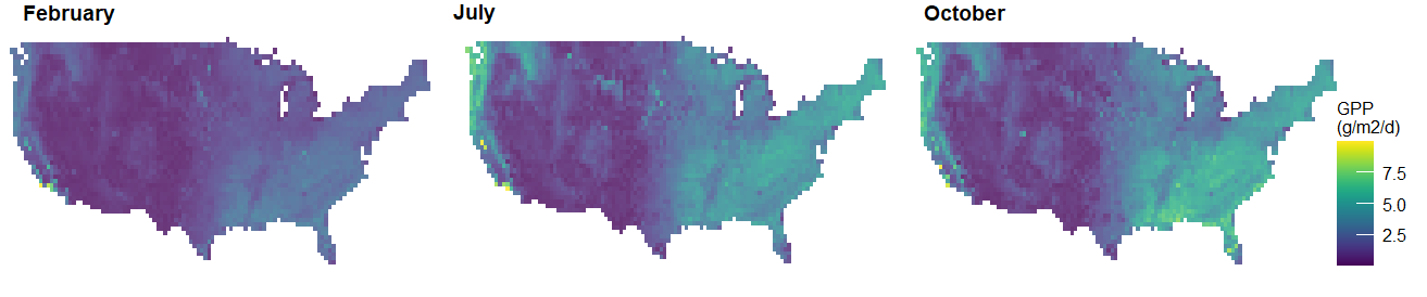
This dataset provides estimates of carbon pools, fluxes, and associated uncertainties across the contiguous USA (CONUS) at 0.5-degree resolution for all terrestrial... -
Federal
BOREAS TE-07 Dendrology Data
National Aeronautics and Space Administration —
The BOREAS TE-07 team collected data sets in support of its efforts to characterize and interpret information on the sapflow and dendrology of boreal vegetation. This... -
Federal
Carbon Pools across CONUS using the MaxEnt Model, 2005, 2010, 2015, 2016, and 2017
National Aeronautics and Space Administration —
This dataset provides annual estimates of six carbon pools, including forest aboveground live biomass, belowground biomass, aboveground dead biomass, belowground dead... -
Federal
NACP Regional: Original Observation Data and Biosphere and Inverse Model Outputs
National Aeronautics and Space Administration —
This data set contains the originally-submitted observation measurement data, terrestrial biosphere model output data, and inverse model simulations that various... -
Federal
NPP Multi-Biome: Production and Mortality for Eastern US Forests, 1962-1996, R1
National Aeronautics and Space Administration —
There are two data files (tab-delimited .txt format) with this data set that provide estimates of above-ground biomass per county; county-level annual above-ground... -
Federal
NACP NAFD Project: Forest Disturbance Intensity for CONUS from Landsat, 1986-2015
National Aeronautics and Space Administration —
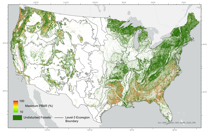
This dataset contains estimates of forest disturbance intensity for the conterminous United States from 1986 to 2015. It quantifies the severity/intensity of forest... -
Federal
NACP Aboveground Biomass and Carbon Baseline Data, V.2 (NBCD 2000), U.S.A., 2000
National Aeronautics and Space Administration —
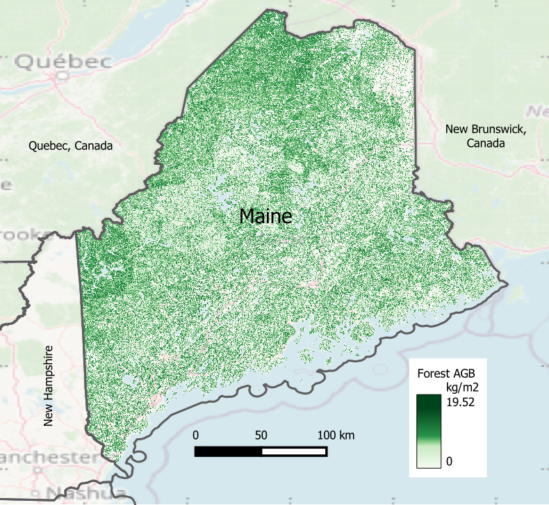
The NBCD 2000 (National Biomass and Carbon Dataset for the Year 2000) data set provides a high-resolution (30 m) map of year-2000 baseline estimates of basal area-... -
Federal
MAPSS: Mapped Atmosphere-Plant-Soil System Model, Version 1.0
National Aeronautics and Space Administration —
MAPSS (Mapped Atmosphere-Plant-Soil System) is a landscape to global vegetation distribution model that was developed to simulate the potential biosphere impacts and... -
Federal
High Resolution Land Cover-Specific Solar-Induced Fluorescence, Midwestern USA, 2018
National Aeronautics and Space Administration —
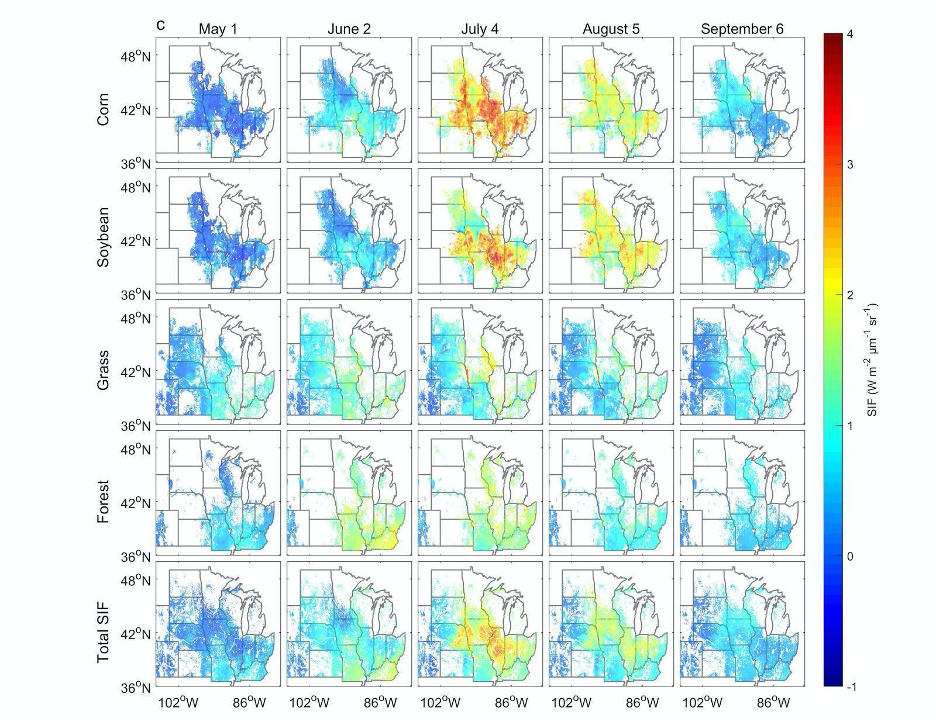
This dataset provides estimated solar-induced chlorophyll fluorescence (SIF) of specific vegetation types and total SIF under clear-sky and real/cloudy conditions at... -
Federal
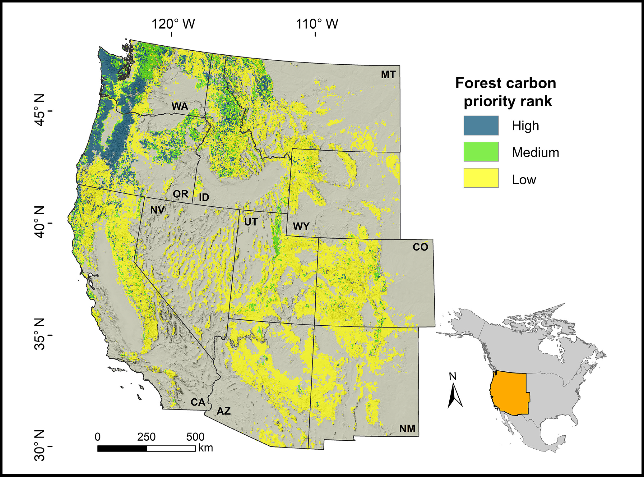
Forest Preservation Ranking and Vertebrate Species Richness, Western USA, 2020-2099
National Aeronautics and Space Administration —
This dataset provides related gridded outputs of future modeled forest carbon sequestration priority and related species richness and habitat suitability for the...
15 datasets found for "Forest Service"