

11 datasets found for "Fire"
-
Federal
Pyrocumulonimbus Events over British Columbia in August 2017: Results from the NASA GEOS Earth System Model
National Aeronautics and Space Administration —
Model data associated with the manuscript submitted in Atmospheric Chemistry and Physics Journal, titled, " Pyrocumulonimbus Events over British Columbia in 2017: The... -
Federal
NACP Integrated Wildland and Cropland 30-m Fuel Characteristics Map, U.S.A., 2010
National Aeronautics and Space Administration —
The data set provides a 30-m comprehensive fuelbed characteristics map for both the wildland and cropland areas of the conterminous United States (CONUS) for 2010.... -
Federal
SAFARI 2000 Global Burned Area Map, 1-km, Southern Africa, 2000
National Aeronautics and Space Administration —
The Global Burned Area 2000 initiative (GBA2000) was launched by the Global Vegetation Mapping Unit of the Joint Research Centre of the European Commission, in... -
Federal
LBA-ECO LC-23 ASTER and MODIS Fire Data Comparison for Brazil: 2003-2004
National Aeronautics and Space Administration —
This data set contains data associated with MODIS fire maps generated using two different algorithms and compared against fire maps produced by ASTER. These data... -
Federal
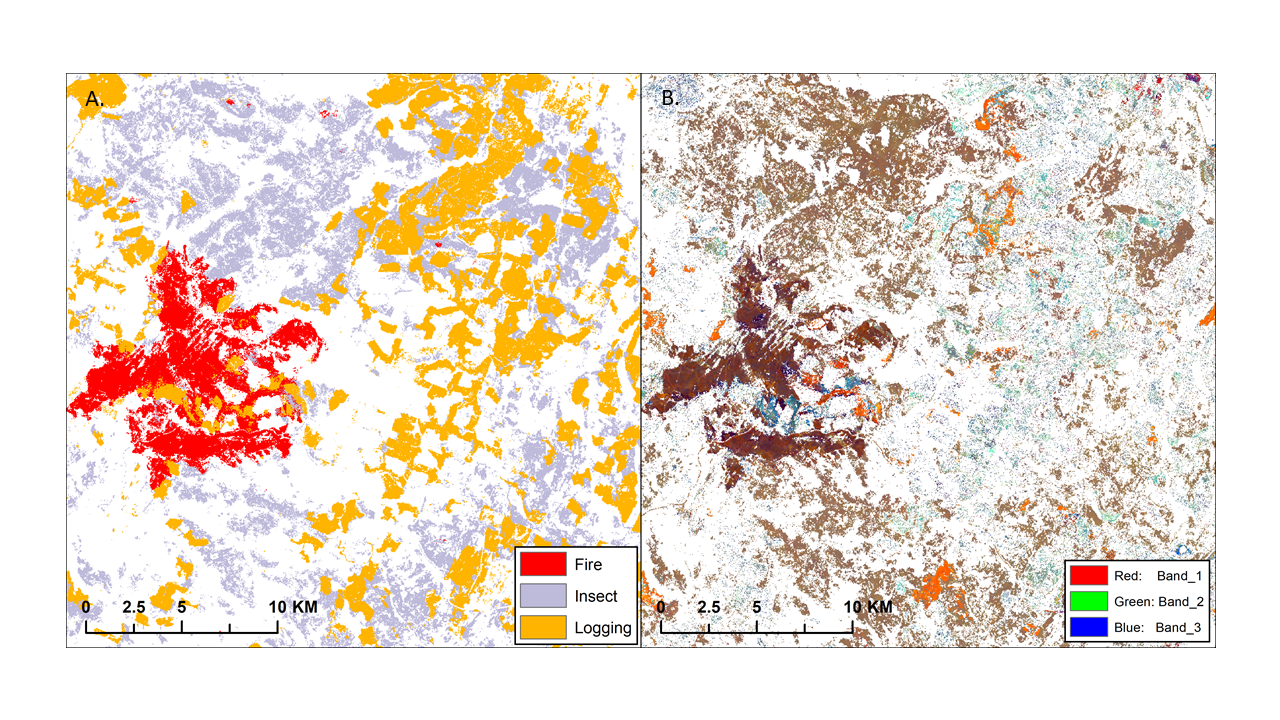
ABoVE: Landsat-derived Annual Disturbance Agents Across ABoVE Core Domain, 1987-2012
National Aeronautics and Space Administration —
This dataset provides spatial data on disturbance agents of fire, insects, and logging in the Arctic Boreal Vulnerability Experiment (ABoVE) core domain at an annual... -
Federal
ABoVE: Burn Severity of Soil Organic Matter, Northwest Territories, Canada, 2014-2015
National Aeronautics and Space Administration —
This dataset provides maps at 30-m resolution of landscape surface burn severity (surface litter and soil organic layers) from the 2014-2015 fires in the Northwest... -
Federal
ABoVE: Vegetation Composition across Fire History Gradients on the Y-K Delta, Alaska
National Aeronautics and Space Administration —
This dataset provides ecological field data that were collected during July 2017 and July 2018 from 43 plots spanning gradients of fire history in the upland tundra... -
Federal
ABoVE: Burn Severity, Fire Progression, Landcover and Field Data, NWT, Canada, 2014
National Aeronautics and Space Administration —
This data set provides peatland landcover classification maps, fire progression maps, and vegetation community biophysical data collected from areas that were burned... -
Federal
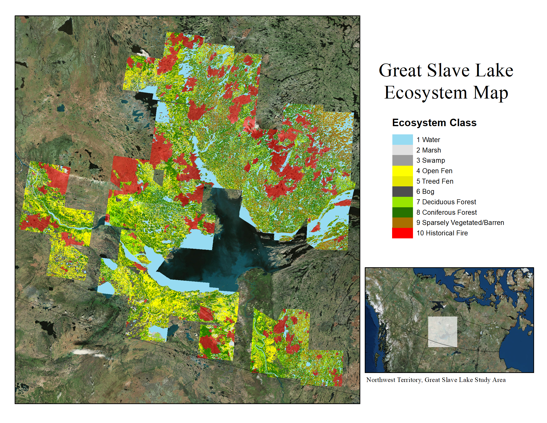
ABoVE: Ecosystem Map, Great Slave Lake Area, Northwest Territories, Canada, 1997-2011
National Aeronautics and Space Administration —
This dataset provides an ecosystem type map at 12.5 meter pixel spacing and 0.2 ha minimum mapping unit for the area surrounding Great Slave Lake, Northwest... -
Federal
LBA-ECO LC-07 Validation Overflight for Amazon Mosaics, Video, 1999
National Aeronautics and Space Administration —
This data set presents georeferenced digital video files from Validation Overflight for Amazon Mosaics (VOAM) aerial video surveys as part of the Large-Scale... -
Federal
RLC Forest Fire Images in Russia, 1998-1999
National Aeronautics and Space Administration —
This data set is made up of images of forest fires in Russia from NOAA's Operational Significant Event Imagery (OSEI) archive (http://www.osei.noaa.gov) for the 1998...
11 datasets found for "Fire"