
-
Federal
CERES and GEO-Enhanced TOA, Within-Atmosphere and Surface Fluxes, Clouds and Aerosols 3-Hourly Terra-Aqua Edition4A NGDA
National Aeronautics and Space Administration —
CER_SYN1deg-3Hour_Terra-Aqua-MODIS_Edition4A is the Clouds and the Earth's Radiant Energy System (CERES) and geostationary (GEO)-Enhanced Top of Atmosphere (TOA),... -
Federal
SatCORPS CERES GEO Edition 4 GOES-13 Northern Hemisphere Version 1.0
National Aeronautics and Space Administration —
CER_GEO_Ed4_GOE13_NH_V01 is the Satellite Cloud and Radiation Property retrieval System (SatCORPS) Clouds and the Earth's Radiant Energy System (CERES) Geostationary... -
Federal
Fast Longwave And SHortwave Fluxes (FLASHflux) Clouds and Radiative Swath (SSF) TERRA-FM1 data in netCDF Version 4B
National Aeronautics and Space Administration —
FLASH_SSF_Terra-FM1-MODIS_Version4B is the Fast Longwave And Shortwave Radiative Fluxes (FLASHFlux) Clouds and Radiative Swath (SSF) TERRA-FM1 data in netCDF Version... -
Federal
CERES Clouds and Radiative Swath Aqua FM3 MODIS Edition2C
National Aeronautics and Space Administration —
CER_CRS_Aqua-FM3-MODIS_Edition2c is the Clouds and the Earth's Radiant Energy System (CERES) Clouds and Radiative Swath (CRS) Aqua-Flight Model 3 (FM3) Moderate-... -
Federal
CERES Bidirectional Scans NPP FM5 Edition1-CV
National Aeronautics and Space Administration —
CER_BDS_NPP-FM5_Edition1-CV is the Clouds and the Earth's Radiant Energy System (CERES) Bidirectional Scans (BDS) Suomi National Polar-orbiting Partnership (NPP)... -
Federal
MISR Level 1A Engineering Data file Type 1 V002
National Aeronautics and Space Administration —
MI1AENG1_2 is the Multi-angle Imaging SpectroRadiometer (MISR) Level 1A Engineering Data file Type 1 version 2. It is the Reformatted Annotated Level 1A product for... -
Federal
CGRO/EGRET Photon Lists and Maps
National Aeronautics and Space Administration —
The Energetic Gamma-Ray Experiment Telescope (EGRET), which operated from 1991-April until 2000-May, was sensitive to photons in the energy range from about 30 MeV to... -
Federal
CERES Bidirectional Scans JPSS-1 FM6 Edition1-CV
National Aeronautics and Space Administration —
CER_BDS_J01-FM6_Edition1-CV is the Clouds and the Earth's Radiant Energy System (CERES) Bidirectional Scans (BDS) Joint Polar Satellite System 1 (NOAA-20) Flight... -
Federal
XMM-Newton Optical Monitor Serendipitous UV Source Survey Catalog, v6.1
National Aeronautics and Space Administration —
The 2023 release of the XMM OM Serendipitous Ultraviolet Source Survey (XMM-SUSS6.1) Catalog, a catalog of optical/UV sources detected by the Optical Monitor (OM) on-... -
Federal
CERES Bidirectional Scans Aqua FM4 Edition1-CV
National Aeronautics and Space Administration —
CER_BDS_Aqua-FM4_Edition1-CV is the Clouds and the Earth's Radiant Energy System (CERES) Bidirectional Scans (BDS) Aqua Flight Model 4 (FM4) Edition 1-CV data... -
Federal
CERES MODIS Cloud Retrievals in ISCCP-D2like Format Daytime Aqua FM4 Edition3A NGDA
National Aeronautics and Space Administration —
CER_ISCCP-D2like-Day_Aqua-FM4-MODIS_Edition3A is the Clouds and the Earth's Radiant Energy System (CERES) Moderate Resolution Imaging Spectroradiometer (MODIS) Cloud... -
Federal
CERES Bidirectional Scans Terra FM1 Edition1-CV
National Aeronautics and Space Administration —
CER_BDS_Terra-FM1_Edition1-CVis the Clouds and the Earth's Radiant Energy System (CERES) Bidirectional Scans (BDS) Terra Flight Model 1 (FM1) Edition1-CV data... -
Federal
MCXC Meta-Catalog of X-Ray Detected Clusters of Galaxies
National Aeronautics and Space Administration —
The MCXC is the Meta-Catalog of the compiled properties of X-ray detected Clusters of galaxies. This very large catalog is based on publicly available ROSAT All Sky... -
Federal
Positions and Proper Motions Catalog
National Aeronautics and Space Administration —
The PPM database is the Catalog of Positions and Proper Motions. It combines the two catalogs for PPM North and PPM South, the Bright Stars Supplement to PPM, and the... -
Federal
MODIS/Terra+Aqua BRDF Model Parameters Daily L3 Global 1km SIN Grid V061
National Aeronautics and Space Administration —
The MCD19A3D Version 6.1 data product is a Moderate Resolution Imaging Spectroradiometer (MODIS) Terra and Aqua combined Bidirectional Reflectance Distribution... -
Federal
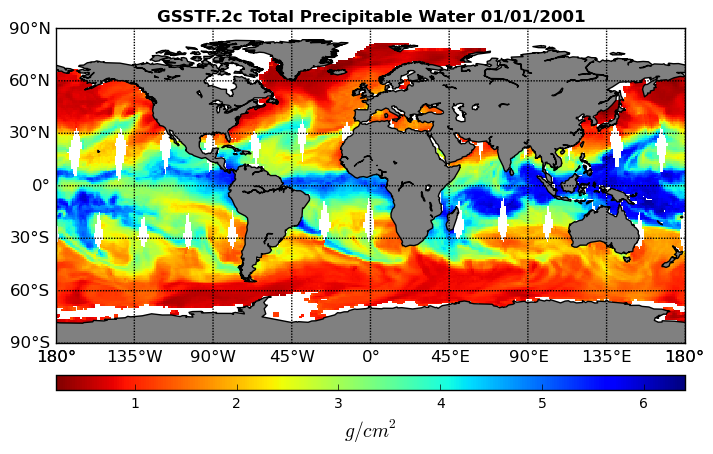
Goddard Satellite-Based Surface Turbulent Fluxes, 1x1 deg Daily Grid, Set1 V2c (GSSTF) at GES DISC
National Aeronautics and Space Administration —
These data are the Goddard Satellite-based Surface Turbulent Fluxes Version-2c (GSSTF2c) Dataset recently produced through a MEaSUREs funded project led by Dr. Chung-... -
Federal
FLUXNET Marconi Conference Gap-Filled Flux and Meteorology Data, 1992-2000
National Aeronautics and Space Administration —
Fluxes of carbon dioxide, water vapor, and energy exchange have been measured at 38 forest, grassland, and crop sites as part of the EUROFLUX and AmeriFlux projects.... -
Federal
Nimbus-7 Narrow Field of View (NFOV) Maximum Likelihood Cloud Estimation (MLCE) Data in Native Format
National Aeronautics and Space Administration —
NIMBUS7_NFOV_MLCE data are Nimbus 7 Narrow Field of View (NFOV) Maximum Likelihood Cloud Estimation (MLCE) Data in Native Format.The NIMBUS7_NFOV_MLCE data set uses... -
Federal
Rock glaciers, Austria, Version 1
National Aeronautics and Space Administration —
The Austrian Alps are part of the Eastern Alps which consist of three main mountain ranges. The Northern Alps as well as the Southern Alps are predominantly built of... -
Federal
CERES MODIS Cloud Retrievals in ISCCP-D2like Format Day Terra FM2 Edition3A NGDA
National Aeronautics and Space Administration —
CER_ISCCP-D2like-Day_Terra-FM2-MODIS_Edition3A is the Clouds and the Earth's Radiant Energy System (CERES) Moderate Resolution Imaging Spectroradiometer (MODIS) Cloud...

Official websites use .gov
A
.gov website belongs to an official government
organization in the United States.
Secure .gov websites use HTTPS
A
lock (
) or https:// means you’ve safely connected to
the .gov website. Share sensitive information only on official,
secure websites.