

14 datasets found for "93o텔레contiTEAM*-출장디비l"
-
Federal
CYGNSS Level 3 Ocean Microplastic Concentration Version 3.2
National Aeronautics and Space Administration —
The CYGNSS L3 Ocean Microplastic Concentration V3.2 dataset is provided by the CYGNSS Science Team of the University of Michigan.CYGNSS was launched on 15 December... -
Federal
SARP 2021 Data
National Aeronautics and Space Administration —
SARP_2021_Data is the data collected onboard the NASA DC-8 aircraft during the 2021 deployment of the Student Airborne Research Program (SARP) mission. Data... -
Federal
SARP 2018 Data
National Aeronautics and Space Administration —
SARP_2018_Data is the data collected onboard the NASA DC-8 aircraft during the 2018 deployment of the Student Airborne Research Program (SARP) mission. Data... -
Federal
CYGNSS Level 3 Soil Moisture Version 3.2
National Aeronautics and Space Administration —
The CYGNSS Level 3 Soil Moisture V3.2 dataset is provided by the CYGNSS Science Team of the University of Michigan. It estimates volumetric water content for soils... -
Federal
VISSR/GOES-1 Infrared Imagery on 70mm Film V001 (VISSRGOES1IMIR) at GES DISC
National Aeronautics and Space Administration —
VISSRGOES1IMIR is the Visible Infrared Spin-Scan Radiometer (VISSR) Infrared Imagery on 70mm Film data product from the first Geostationary Operational Environmental... -
Federal
CYGNSS Level 1 Calibrated Raw IF Version 1.0
National Aeronautics and Space Administration —
The CYGNSS Level 1 Calibrated Raw IF Version 1.0 dataset is produced by the CYGNSS Science Team of the University of Michigan, and it contains the first release,... -
Federal
MRIR/Nimbus-3 Level 1 Meteorological Radiation Data V001 (MRIRN3L1) at GES DISC
National Aeronautics and Space Administration —
MRIRN3L1 is the Nimbus-3 Medium-Resolution Infrared Radiometer (MRIR) Level 1 Meteorological Radiance Data product and contain radiances expressed as equivalent... -
Federal
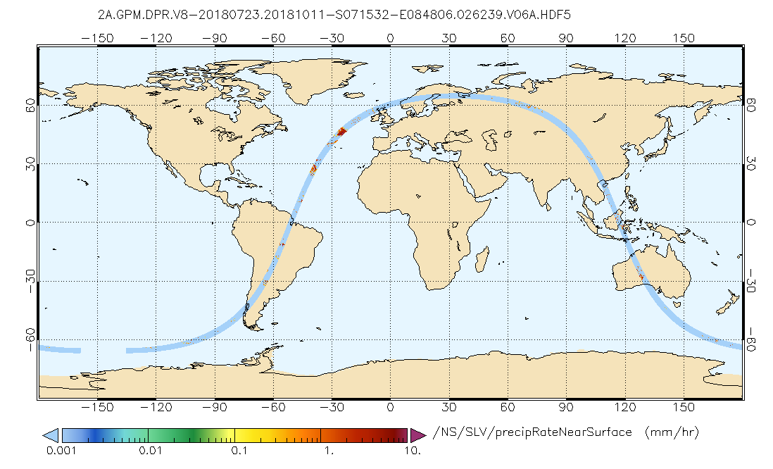
GPM DPR Precipitation Profile L2A 1.5 hours 5 km V07 (GPM_2ADPR) at GES DISC
National Aeronautics and Space Administration —
Version 07 is the current version of the data set. Older versions will no longer be available and have been superseded by Version 07..2ADPR provides single- and dual-... -
Federal
CYGNSS Level 2 Ocean Surface Heat Flux Science Data Record Version 3.2
National Aeronautics and Space Administration —
The CYGNSS level 2 ocean surface heat flux science data record version 3.2 dataset is provided as a service to the oceanographic and meteorological research... -
Federal
CYGNSS Level 1 Climate Data Record Version 1.1
National Aeronautics and Space Administration —
This Level 1 (L1) dataset contains the Version 1.1 Climate Data Record (CDR) of the geo-located Delay Doppler Maps (DDMs) calibrated into Power Received (Watts) and... -
Federal
BUV/Nimbus-4 Dark Current Study Master Data V001 (BUVN4L1DCM) at GES DISC
National Aeronautics and Space Administration —
The Nimbus-4 BUV Level-1 Dark Current Study Master Data is derived from the BUV Level 1 Radiance (RUT) product and contains the geophysical indices and... -
Federal
CYGNSS Level 2 Ocean Surface Heat Flux Science Data Record Version 1.0
National Aeronautics and Space Administration —
This dataset contains the Version 1.0 CYGNSS Level 2 Ocean Surface Heat Flux Science Data Record, which provides the time-tagged and geolocated ocean surface heat... -
Federal
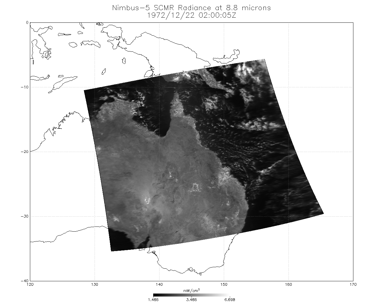
SCMR/Nimbus-5 Level 1 Calibrated and Geolocated Radiances V001 (SCMRN5L1RAD) at GES DISC
National Aeronautics and Space Administration —
SCMRN5L1RAD is the Nimbus-5 Surface Composition Mapping Radiometer (SCMR) Level 1 Calibrated and Geolocated Radiances data product. SCMR measured (1) terrestrial... -
Federal
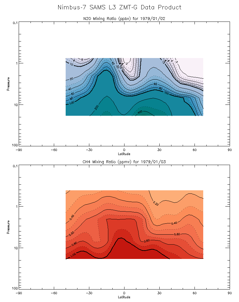
SAMS/Nimbus-7 Level 3 Zonal Means Composition Data V001 (SAMSN7L3ZMTG) at GES DISC
National Aeronautics and Space Administration —
SAMSN7L3ZMTG is the Nimbus-7 Stratospheric and Mesospheric Sounder (SAMS) Level 3 Zonal Means Composition Data Product. The Earth's surface is divided into 2.5-deg...
14 datasets found for "93o텔레contiTEAM*-출장디비l"