

15 datasets found for "45g텔WB7000II스웨디시디비상담ㄱ"
-
Federal
Global Distribution of Root Turnover in Terrestrial Ecosystems
National Aeronautics and Space Administration —
Estimates of root turnover rates were calculated from measurements of live root standing crop and belowground net primary production (BNPP) compiled from the primary... -
Federal
Rongowai-CYGNSS Airborne Level 1 Science Data Record Version 1.0
National Aeronautics and Space Administration —
The Rongowai Level 1 Science Data Record Version 1.0 dataset is generated by the University of Auckland (UoA) Rongowai Science Payloads Operations Centre in New... -
Federal
SAMS/Nimbus-7 Level 1 Radiance Data V001 (SAMSN7L1RAT) at GES DISC
National Aeronautics and Space Administration —
SAMSN7L1RAT is the gridded Nimbus-7 Stratospheric and Mesospheric Sounder (SAMS) Level 1 Radiance Data Product. The radiances were selected to derive gas... -
Federal
Daily Rainfall Data (FIFE)
National Aeronautics and Space Administration —
The FIFE Daily Rainfall Data Set contains daily precipitation values for 42 rain gauge stations within the Konza LTER portion of the FIFE site (i.e., Northwest... -
Federal
SARP 2014 Data
National Aeronautics and Space Administration —
SARP_2014_Data is the data collected onboard the NASA DC-8 aircraft during the 2014 deployment of the Student Airborne Research Program (SARP) mission. Data... -
Federal
SARP 2012 Data
National Aeronautics and Space Administration —
SARP_2012_Data is the data collected onboard the NASA P-3B aircraft during the 2012 deployment of the Student Airborne Research Program (SARP) mission. Data... -
Federal
CYGNSS Level 2 Climate Data Record Version 1.1
National Aeronautics and Space Administration —
This dataset contains the Version 1.1 CYGNSS Level 2 Climate Data Record which provides the time-tagged and geolocated average wind speed (m/s) and mean square slope... -
Federal
SCR/Nimbus-4 Level 1 Calibrated Radiances V001 (SCRN4L1RAD) at GES DISC
National Aeronautics and Space Administration —
SCRN4L1RAD is the Nimbus-4 Selective Chopper Radiometer (SCR) Level 1 Calibrated Radiances data product. The calibrated radiances are measured at 6 channels from 2.3... -
Federal
BUV/Nimbus-4 Level 2 Compressed Ozone Profile Data V005 (BUVN4L2CPOZ) at GES DISC
National Aeronautics and Space Administration —
The Nimbus-4 BUV Level 2 Compressed Ozone Profile Data collection or CPOZ contains total ozone, reflectivities, ozone mixing ratios and layer ozone amounts measured... -
Federal
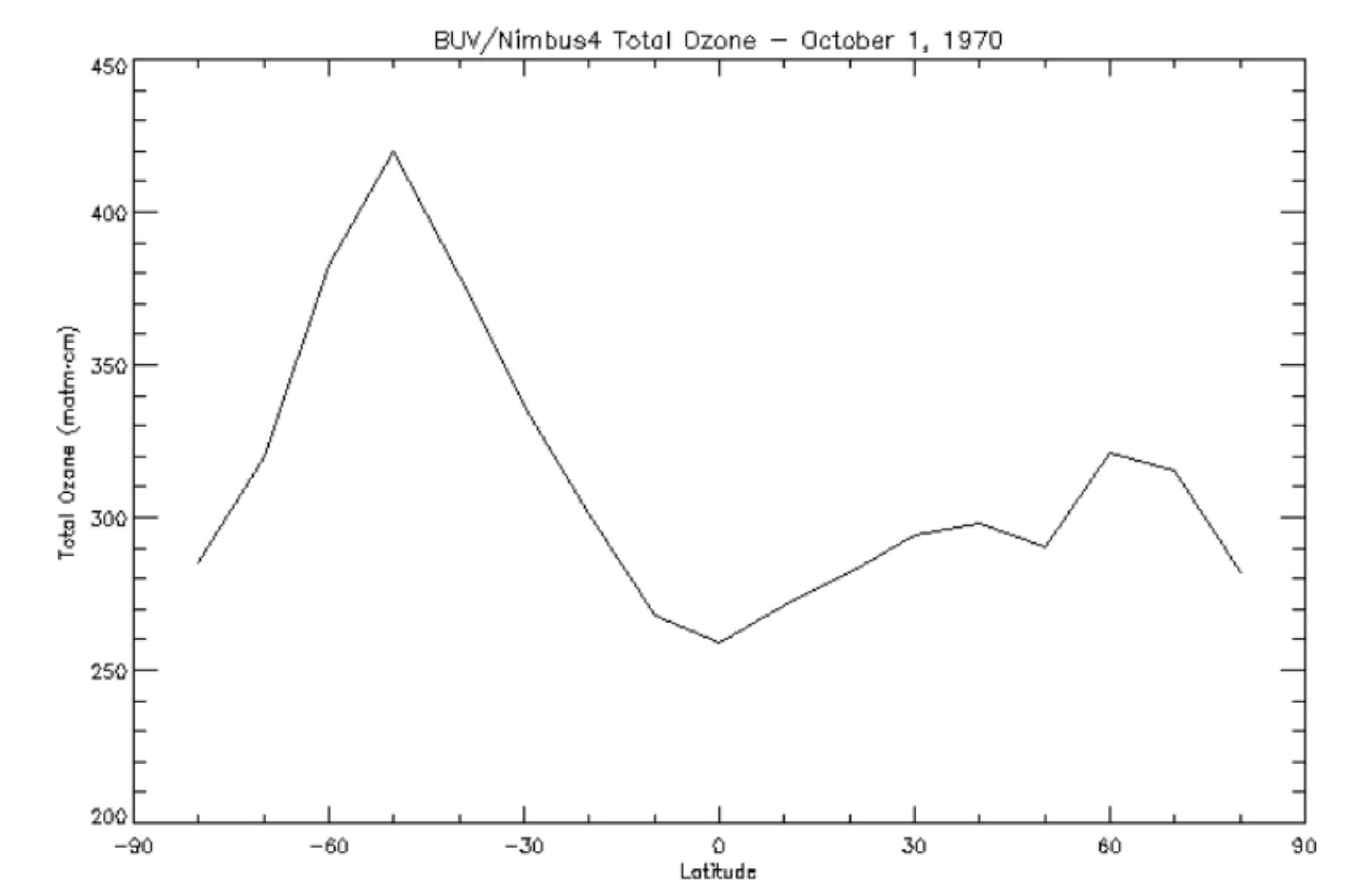
BUV/Nimbus-4 Level 3 Ozone Zonal Means V005 (BUVN4L3ZMT) at GES DISC
National Aeronautics and Space Administration —
The Nimbus-4 BUV Level 3 Ozone Zonal Means collection or ZMT contains total ozone, reflectivities, and ozone mixing ratios averaged in 10 degree latitude zones... -
Federal
VISSR/SMS-1 Level 1 Experimenter History Data V001 (VISSRSMS1L1EHT) at GES DISC
National Aeronautics and Space Administration —
VISSRSMS1L1EHT is the Visible Infrared Spin-Scan Radiometer (VISSR) Level 1 Experimenter History Tape (EHT) data product from the first Synchronous Meteorological... -
Federal
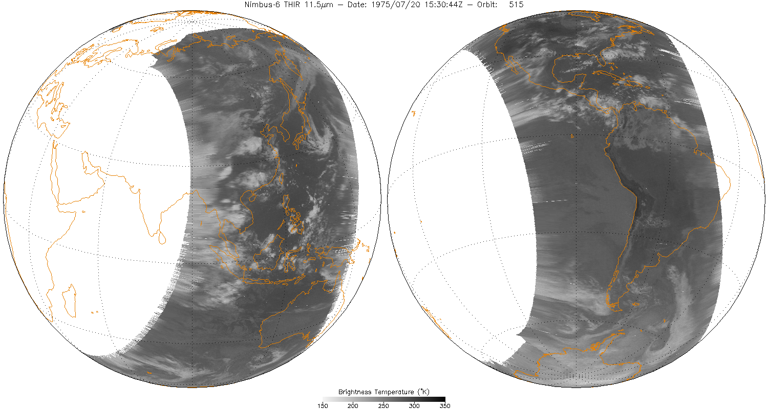
THIR/Nimbus-6 Level 1 Meteorological Radiation Data at 11.5 microns V001 (THIRN6L1CH115) at GES DISC
National Aeronautics and Space Administration —
THIRN6L1CH115 is the Nimbus-6 Temperature-Humidity Infrared Radiometer (THIR) Level 1 Meteorological Radiation Data at 11.5 microns product and contains radiances... -
Federal
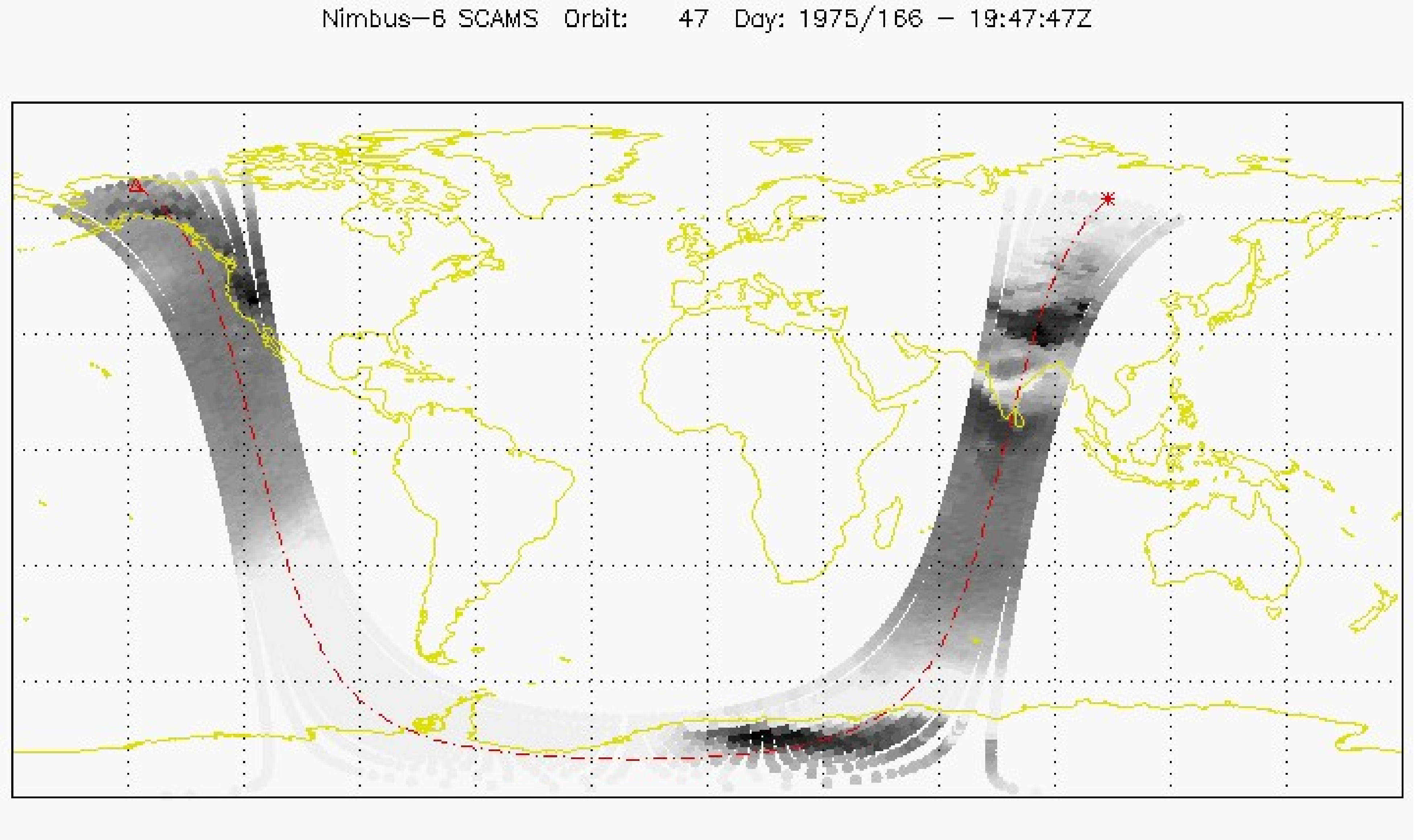
SCAMS/Nimbus-6 Level 2 Water Vapor and Temperature, as well as Antenna and Brightness Temperature V001 (SCAMSN6L2) at GES DISC
National Aeronautics and Space Administration —
The Nimbus-6 Scanning Microwave Spectrometer (SCAMS) Level 2 data product contains water vapor and temperature profiles, as well as antenna and brightness... -
Federal
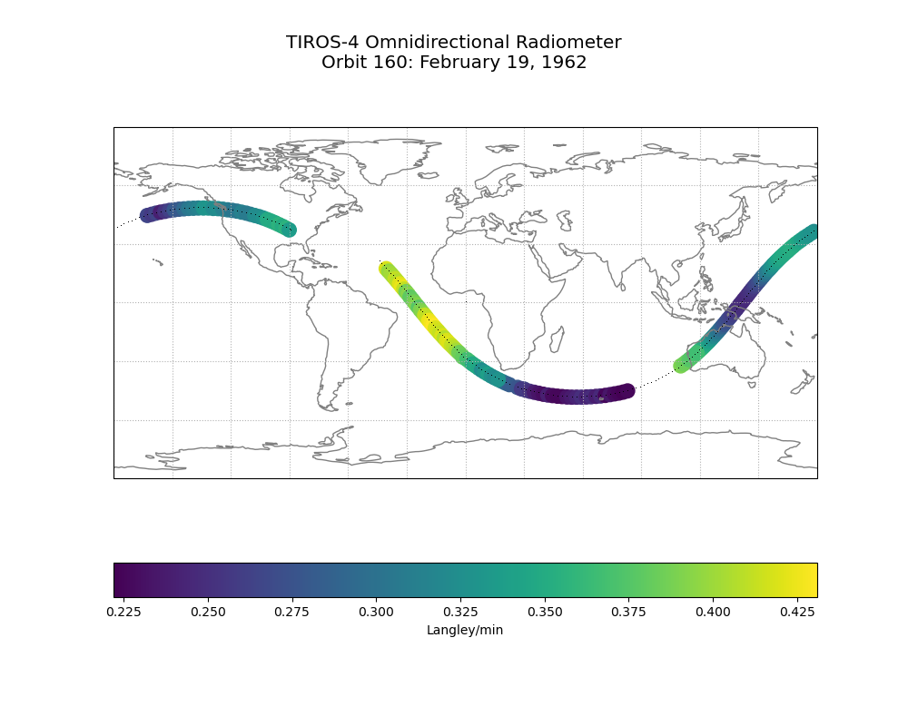
TIROS-4 Low-Resolution Omnidirectional Radiometer Level 1 Radiance Data V001 (TIROS4L1ORR) at GES DISC
National Aeronautics and Space Administration —
The TIROS-4 Low-Resolution Omnidirectional Radiometer Level 1 Radiance Data product contains the longwave radiation values in Langleys/min derived from the black and... -
Federal
CYGNSS Level 2 Climate Data Record Version 1.0
National Aeronautics and Space Administration —
This dataset contains the Version 1.0 CYGNSS Level 2 Climate Data Record which provides the time-tagged and geolocated average wind speed (m/s) and mean square slope...
15 datasets found for "45g텔WB7000II스웨디시디비상담ㄱ"