
-
Federal
CMAPSS Jet Engine Simulated Data
National Aeronautics and Space Administration —
Data sets consists of multiple multivariate time series. Each data set is further divided into training and test subsets. Each time series is from a different engine... -
Federal
Milling Wear
National Aeronautics and Space Administration —
Experiments on a milling machine for different speeds, feeds, and depth of cut. Records the wear of the milling insert, VB. The data set was provided by the UC... -
Federal
SMAPVEX12 Surface Roughness Data for Forest Area V001
National Aeronautics and Space Administration —
This data set contains surface roughness data collected at several forested sites as a part of the Soil Moisture Active Passive Validation Experiment 2012 (SMAPVEX12). -
Federal
MODIS/Terra Near Real Time (NRT) Calibrated Radiances 5-Min L1B Swath 250m
National Aeronautics and Space Administration —
The 250 meter MODIS Level 1B Near Real Time (NRT) data set contains calibrated and geolocated at-aperture radiances for 2 discrete bands located in the 0.62 to 0.88... -
Federal
VIIRS/JPSS1 Land Surface Temperature/Emissivity 8-Day L3 Global 0.05Deg CMG V002
National Aeronautics and Space Administration —
The NOAA-20 Visible Infrared Imaging Radiometer Suite (VIIRS) Land Surface Temperature and Emissivity (LST&E) 8-day Climate Modeling Grid Version 2 product... -
Federal
VIIRS/JPSS1 Moderate-Resolution Dual Gain Bands Calibrated Radiance 6-Min L1B Swath 750 m NRT
National Aeronautics and Space Administration —
The VIIRS/JPSS1 Moderate-Resolution Dual Gain Bands Calibrated Radiance 6-Min L1B Swath 750m Near Real Time (NRT) product, short-name VJ102GDC_NRT contains... -
Federal
VIIRS/JPSS1 Imagery Resolution 6 Min L1B Swath 375m NRT
National Aeronautics and Space Administration —
The VIIRS/JPSS1 Imagery Resolution 6-Min L1B Swath 375m Near REal Time (NRT), short-name VJ102IMG_NRT is among the VIIRS Level 1 and Level 2 swath products that are... -
Federal
Tree Canopy Cover for the Circumpolar Taiga-Tundra Ecotone: 2000-2005
National Aeronautics and Space Administration —
This data set provides a map of selected areas with defined tree canopy cover over the circumpolar taiga-tundra ecotone (TTE). Canopy cover was derived from the... -
Federal
NuSTAR Survey of Extended Chandra Deep Field South (ECDF-S) Source Catalog
National Aeronautics and Space Administration —
This table contains the source catalog from the Nuclear Spectroscopic Telescope Array (NuSTAR) survey of the Extended Chandra Deep Field South (hereafter, ECDFS),... -
Federal
Million Quasars Catalog (MILLIQUAS), Version 8 (2 August 2023)
National Aeronautics and Space Administration —
This table contains the Million Quasars (MILLIQUAS) Catalog, Version 8 (2 August 2023). It is a compendium of 907,144 type-I QSOs and AGN, largely complete from the... -
Federal
VIIRS/JPSS2 Imagery Resolution Terrain-Corrected Geolocation 6-Min L1 Swath 375m V2.1
National Aeronautics and Space Administration —
The VIIRS/JPSS2 Imagery Resolution Terrain Corrected Geolocation 6-Min L1 Swath 375 m, short-name VJ203IMG is the Joint Polar-orbiting Satellite System-2... -
Federal
ROSETTA-ORBITER 67P NAVCAM 2 COMET ESCORT 3 MTP021 V1.0
National Aeronautics and Space Administration —
This dataset contains ROSETTA NAVCAM RAW DATA of the Escort Phase 3 from 22nd Sep 2015 to 20th Oct 2015 when at the vicinity of target 67P/CG. -
Federal
ROSETTA-ORBITER 67P OSINAC 4 ESC3-MTP021 RDR-INFLDSTR V1.0
National Aeronautics and Space Administration —
This CODMAC level 4 data set contains solar stray-light corrected, in-field stray-light corrected, radiometric calibrated and geometric distortion corrected... -
Federal
GO JUP POS GLL TRAJECTORY MOON CENTERED COORDS V1.0
National Aeronautics and Space Administration —
This data set contains Galileo trajectory data in moon (Amalthea, Io, Europa, Ganymede, Callisto) centered coordinates for all of the near satellite encounters.... -
Federal
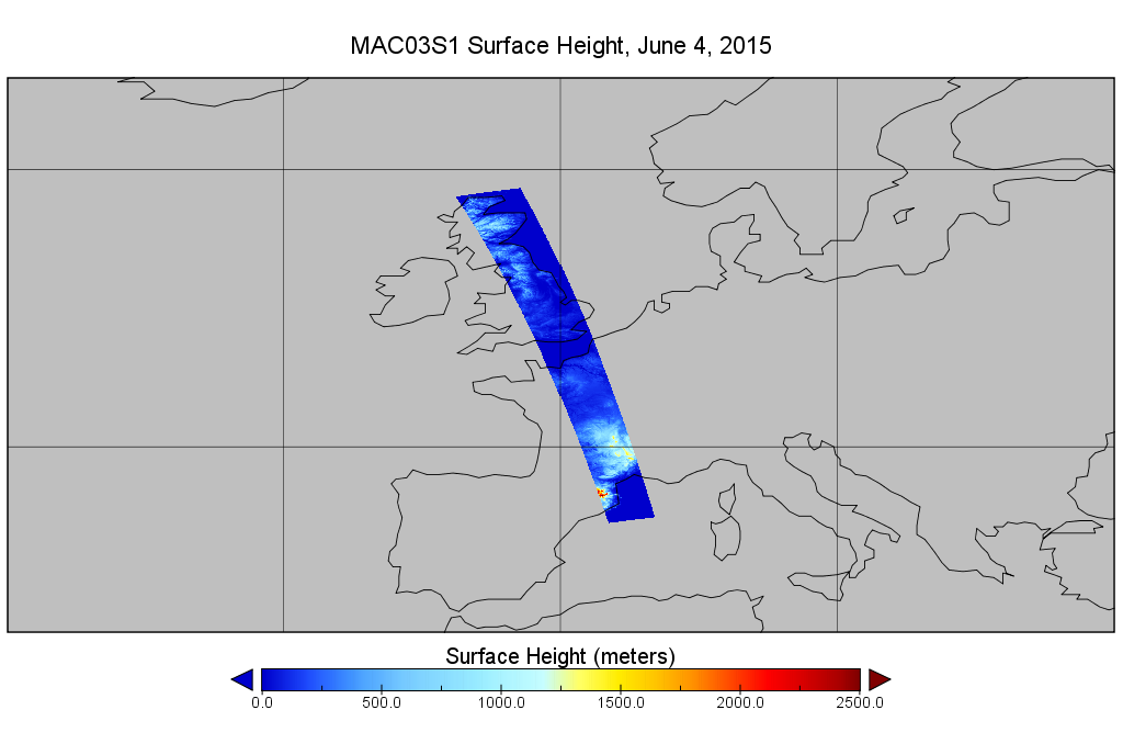
MODIS/Aqua Geolocation Fields 1km 5-Min 1A Wide Swath Subset along CloudSat V002 (MAC03S1) at GES DISC NGDA
National Aeronautics and Space Administration —
This is the wide-swath MODIS/Aqua subset along CloudSat field of view track. The goal of the wide-swath subset is to select and return MODIS data that are within... -
Federal
Aviation Safety Reporting System: Non-Tower Airport Incidents
National Aeronautics and Space Administration —
A sampling of reports involving operations at non-tower airports. -
Federal
2008 Environmental Performance Index (EPI)
National Aeronautics and Space Administration —
The 2008 Environmental Performance Index (EPI) centers on two broad environmental protection objectives: (1) reducing environmental stresses on human health, and (2)... -
Federal
SEAC4RS ER-2 Aircraft In-Situ Cloud Data
National Aeronautics and Space Administration —
SEAC4RS_Cloud_AircraftInSitu_ER2_Data are in-situ trace gas data collected onboard the ER-2 aircraft during the Studies of Emissions and Atmospheric Composition,... -
Federal
Planck Catalog of 143-GHz Compact Sources (PCCS) Release 2
National Aeronautics and Space Administration —
Planck was a European Space Agency (ESA) mission, with significant contributions from the National Aeronautics and Space Agency (NASA). It was the third generation of... -
Federal
OCO-3 Level 2 spatially ordered geolocated retrievals screened using the IMAP-DOAS Preprocessor (IDP), Forward Processing V10 (OCO3_L2_IMAPDOAS) at GES DISC
National Aeronautics and Space Administration —
Version 10 is the current version of the data set. Older versions will no longer be available and are superseded by Version 10. The Orbiting Carbon Observatory -3...

Official websites use .gov
A
.gov website belongs to an official government
organization in the United States.
Secure .gov websites use HTTPS
A
lock (
) or https:// means you’ve safely connected to
the .gov website. Share sensitive information only on official,
secure websites.