
-
Federal
ECCO Gent-McWilliams Ocean Bolus Velocity - Daily Mean llc90 Grid (Version 4 Release 4) recent views
National Aeronautics and Space Administration —
This dataset provides daily-averaged Gent-McWilliams ocean bolus velocity on the native Lat-Lon-Cap 90 (LLC90) model grid from the ECCO Version 4 Release 4 (V4r4)... -
Federal
AMPR FIRE III ACE V1 recent views
National Aeronautics and Space Administration —
The Advanced Microwave Precipitation Radiometer (AMPR) was deployed during the First ISCCP Regional Experiment-III Arctic Cloud Experiment (FIRE-III/ACE). AMPR data... -
Federal
ECCO Gent-McWilliams Ocean Bolus Velocity - Monthly Mean 0.5 Degree (Version 4 Release 4) recent views
National Aeronautics and Space Administration —
This dataset contains monthly-averaged Gent-McWilliams ocean bolus velocity interpolated to a regular 0.5-degree grid from the ECCO Version 4 revision 4 (V4r4) ocean... -
Federal
ECCO Sea-Ice Salt Plume Fluxes - Monthly Mean llc90 Grid (Version 4 Release 4) recent views
National Aeronautics and Space Administration —
This dataset provides monthly-averaged sea-ice salt plume fluxes on the native Lat-Lon-Cap 90 (LLC90) model grid from the ECCO Version 4 Release 4 (V4r4) ocean and... -
Federal
ASTER Global Water Bodies Database V001 NGDA recent views
National Aeronautics and Space Administration —
The ASTER Global Water Bodies Database (ASTWBD) Version 1 data product provides global coverage of water bodies larger than 0.2 square kilometers at a spatial... -
Federal
MERRA-2 tavg1_2d_flx_Nx: 2d,1-Hourly,Time-Averaged,Single-Level,Assimilation,Surface Flux Diagnostics 0.625 x 0.5 degree V5.12.4 (M2T1NXFLX) at GES DISC recent views
National Aeronautics and Space Administration —
M2T1NXFLX (or tavg1_2d_flx_Nx) is an hourly time-averaged 2-dimensional data collection in Modern-Era Retrospective analysis for Research and Applications version 2... -
Federal
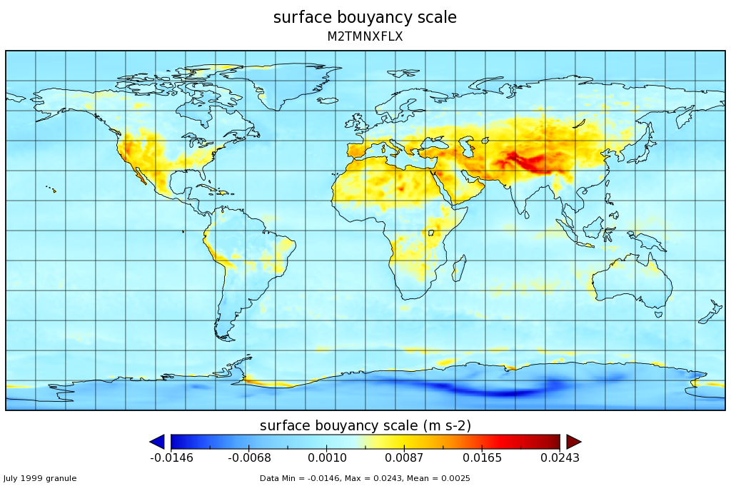
MERRA-2 tavgM_2d_flx_Nx: 2d,Monthly mean,Time-Averaged,Single-Level,Assimilation,Surface Flux Diagnostics 0.625 x 0.5 degree V5.12.4 (M2TMNXFLX) at GES DISC recent views
National Aeronautics and Space Administration —
M2TMNXFLX (or tavgM_2d_flx_Nx) is a time-averaged 2-dimensional monthly mean data collection in Modern-Era Retrospective analysis for Research and Applications... -
Federal
SASSIE Arctic Field Campaign Summary Ice Concentration Rankings from ML analysis of SBAND Images Fall 2022 recent views
National Aeronautics and Space Administration —
This dataset contains ice concentration rankings of S-band images from the S-BAND marine navigation radar collected during the 2022 Salinity and Stratification at the... -
Federal
GHRSST Level 4 MUR Global Foundation Sea Surface Temperature Analysis (v4.1) NGDA recent views
National Aeronautics and Space Administration —
A Group for High Resolution Sea Surface Temperature (GHRSST) Level 4 sea surface temperature analysis produced as a retrospective dataset (four day latency) and near-... -
Federal
ISLSCP II Global Sea Ice Concentration recent views
National Aeronautics and Space Administration —
This International Satellite Land Surface Climatology Project (ISLSCP) Initiative II data set, ISLSCP II Global Sea Ice Concentration, is based on the Goddard Space... -
Federal
SASSIE Arctic Field Campaign Shipboard S-Band Radar Level 3 Data Fall 2022 recent views
National Aeronautics and Space Administration —
This dataset contains images from the S-BAND marine navigation radar collected during the 2022 Salinity and Stratification at the Sea Ice Edge (SASSIE) campaign.... -
Federal
ECCO Atmosphere Surface Temperature, Humidity, Wind, and Pressure - Daily Mean 0.5 Degree (Version 4 Release 4) recent views
National Aeronautics and Space Administration —
This dataset contains daily-averaged atmosphere surface temperature, humidity, wind, and pressure interpolated to a regular 0.5-degree grid from the ECCO Version 4... -
Federal
Multi-Mission Optimally Interpolated Sea Surface Salinity Global Dataset V2 recent views
National Aeronautics and Space Administration —
This is a level 4 product on a 0.25-degree spatial and 4-day temporal grid. The product is derived from the level 2 swath data of three satellite missions: the... -
Federal
ECCO Ocean 3D Gent-Mcwilliams, Redi, and Background Vertical Diffusivity Coefficients for the Lat-Lon-Cap 90 (llc90) Native Model Grid (Version 4 Release 4) recent views
National Aeronautics and Space Administration —
This dataset provides 3D coefficients for the Gent-McWilliams and Redi parameterizations and background vertical diffusivity on the lat-lon-cap 90 (llc90) native... -
Federal
ECCO Ocean and Sea-Ice Surface Freshwater Fluxes - Daily Mean 0.5 Degree (Version 4 Release 4) recent views
National Aeronautics and Space Administration —
This dataset contains daily-averaged ocean and sea-ice surface freshwater fluxes interpolated to a regular 0.5-degree grid from the ECCO Version 4 revision 4 (V4r4)... -
Federal
GHRSST Level 3C North Atlantic Regional Subskin Sea Surface Temperature from the Advanced Very High Resolution Radiometer (AVHRR) on NOAA-19 (GDS2 version) recent views
National Aeronautics and Space Administration —
A Group for High Resolution Sea Surface Temperature (GHRSST) dataset for the North Atlantic Region (NAR) from the Advanced Very High Resolution Radiometer (AVHRR) on... -
Federal
RSS SMAP Level 3 Sea Surface Salinity Standard Mapped Image 8-Day Running Mean V4.0 Validated Dataset recent views
National Aeronautics and Space Administration —
The version 4.0 SMAP-SSS level 3, 8-Day running mean gridded product is based on the fourth release of the validated standard mapped sea surface salinity (SSS) data... -
Federal
ECCO Ocean Velocity - Monthly Mean llc90 Grid (Version 4 Release 4) recent views
National Aeronautics and Space Administration —
This dataset provides monthly-averaged ocean velocity on the native Lat-Lon-Cap 90 (LLC90) model grid from the ECCO Version 4 Release 4 (V4r4) ocean and sea-ice state... -
Federal
MERRA-2 tavg1_2d_int_Nx: 2d,1-Hourly,Time-Averaged,Single-Level,Assimilation,Vertically Integrated Diagnostics 0.625 x 0.5 degree V5.12.4 (M2T1NXINT) at GES DISC recent views
National Aeronautics and Space Administration —
M2T1NXINT (or tavg1_2d_int_Nx) is an hourly time-averaged 2-dimensional data collection in Modern-Era Retrospective analysis for Research and Applications version 2... -
Federal
ECCO Sea Surface Height - Daily Mean 0.5 Degree (Version 4 Release 4b) recent views
National Aeronautics and Space Administration —
This dataset contains daily-averaged dynamic sea surface height interpolated to a regular 0.5-degree grid from the ECCO Version 4 revision 4b (V4r4b) ocean and sea-...

Official websites use .gov
A
.gov website belongs to an official government
organization in the United States.
Secure .gov websites use HTTPS
A
lock (
) or https:// means you’ve safely connected to
the .gov website. Share sensitive information only on official,
secure websites.