
-
Federal
Daymet: Daily Surface Weather Data on a 1-km Grid for North America, Version 4 R1
National Aeronautics and Space Administration —
This dataset provides Daymet Version 4 R1 data as gridded estimates of daily weather parameters for North America, Hawaii, and Puerto Rico. Daymet variables include... -
Federal
GEDI L4A Footprint Level Aboveground Biomass Density, Version 1
National Aeronautics and Space Administration —
This dataset contains Global Ecosystem Dynamics Investigation (GEDI) Level 4A (L4A) predictions of the aboveground biomass density (AGBD; in Mg/ha) and estimates of... -
Federal
L2 Daily Solar-Induced Fluorescence (SIF) from ERS-2 GOME, 1995-2003
National Aeronautics and Space Administration —
This dataset provides Level 2 Solar-Induced Fluorescence (SIF) of Chlorophyll estimates derived from the Global Ozone Monitoring Experiment (GOME) instrument on the... -
Federal
AVIRIS-3 L2A Orthocorrected Surface Reflectance, Facility Instrument Collection
National Aeronautics and Space Administration —
This dataset contains Level 2A (L2A) surface reflectance images from the Airborne Visible / Infrared Imaging Spectrometer-3 (AVIRIS-3) instrument. This is the NASA... -
Federal
Pre-LBA ISLSCP Initiative I Data
National Aeronautics and Space Administration —
This data set contains hydrology, soils, radiation, cloud, and vegetation data from the International Satellite Land Surface Climatology Project (ISLSCP) Initiative... -
Federal
VEMAP 2: U.S. Annual Climate Change Scenarios
National Aeronautics and Space Administration —
The Vegetation/Ecosystem Modeling and Analysis Project (VEMAP) Phase 2 has developed a number of transient climate change scenarios based on coupled atmosphere-ocean... -
Federal
BioSCape Vegetation Surveys Berg and Eerste River Catchments, South Africa, 2022-2023
National Aeronautics and Space Administration —
This dataset contains vegetation plot survey data collected at 36 sites across the Berg and Eerste River catchments in the Western Cape, South Africa collected during... -
Federal
GEDI L3 Gridded Land Surface Metrics, Version 1
National Aeronautics and Space Administration —
This dataset provides Global Ecosystem Dynamics Investigation (GEDI) Level 3 (L3) gridded mean canopy height, standard deviation of canopy height, mean ground... -
Federal
ATom: L2 In Situ Measurements from NOAA Nitrogen Oxides and Ozone (NOyO3) Instrument
National Aeronautics and Space Administration —
This dataset provides in situ concentrations of nitric oxide (NO), nitrogen dioxide (NO2), total reactive nitrogen oxides (NOy), and ozone (O3) measured by the NOAA... -
Federal
MASTER: FireSense, California and Southern US, Spring 2025
National Aeronautics and Space Administration —
This dataset includes Level 1B (L1B) and Level 2 (L2) data products from the MODIS/ASTER Airborne Simulator (MASTER) instrument. The spectral data were collected as... -
Federal
Gridded GEDI Vegetation Structure Metrics and Biomass Density at Multiple Resolutions
National Aeronautics and Space Administration —
This dataset consists of near-global, analysis-ready, multi-resolution gridded vegetation structure metrics derived from NASA Global Ecosystem Dynamics Investigation... -
Federal
MASTER: Geological Earth Mapping Experiment (GEMx), California-Arizona, Summer 2023
National Aeronautics and Space Administration —
This dataset includes Level 1B (L1B) and Level 2 (L2) data products from the MODIS/ASTER Airborne Simulator (MASTER) instrument. The spectral data were collected... -
Federal
MASTER: Costa Rica Airborne Research and Technology Applications (CARTA), 2005
National Aeronautics and Space Administration —
This dataset includes Level 1B (L1B) data products from the MODIS/ASTER Airborne Simulator (MASTER) instrument. The spectral data were collected during 23 flights... -
Federal
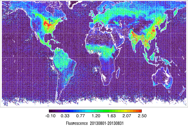
L2 Daily Solar-Induced Fluorescence (SIF) from MetOp-B GOME-2, 2013-2021
National Aeronautics and Space Administration —
This dataset provides Level 2 (L2) Solar-Induced Fluorescence (SIF) of chlorophyll estimates derived from the Global Ozone Monitoring Experiment 2 (GOME-2) instrument... -
Federal
LUH2-ISIMIP2b Harmonized Global Land Use for the Years 2015-2100
National Aeronautics and Space Administration —
This dataset provides 0.25-degree gridded, global, annual estimates of fractional land use and land cover patterns for the period 2015-2100, designed to support the... -
Federal
BOREAS HYD-08 Throughfall Data
National Aeronautics and Space Administration —
The BOREAS HYD-08 team made measurements of surface hydrological processes at the SSA (1996) and NSA OBS (1994) Tower Flux sites, supporting its research into point... -
Federal
Carbon Pools across CONUS using the MaxEnt Model, 2005, 2010, 2015, 2016, and 2017
National Aeronautics and Space Administration —
This dataset provides annual estimates of six carbon pools, including forest aboveground live biomass, belowground biomass, aboveground dead biomass, belowground dead... -
Federal
LBA-ECO LC-23 Vegetation Fire Data, Roraima , Brazil: 2003
National Aeronautics and Space Administration —
The ASTER high resolution satellite data are available for visible-near infrared (15m resolution), short wave infrared (30m), and thermal infrared (90m) bands. Two... -
Federal
LBA-ECO CD-06 Flux of CO2 from Amazon Mainstem Rivers, Tributaries, and Floodplains
National Aeronautics and Space Administration —
This data set provides estimates of monthly carbon dioxide (CO2) flux from the Amazon mainstem rivers, tributary stream networks, and their associated varzeas...

Official websites use .gov
A
.gov website belongs to an official government
organization in the United States.
Secure .gov websites use HTTPS
A
lock (
) or https:// means you’ve safely connected to
the .gov website. Share sensitive information only on official,
secure websites.