
-
Federal
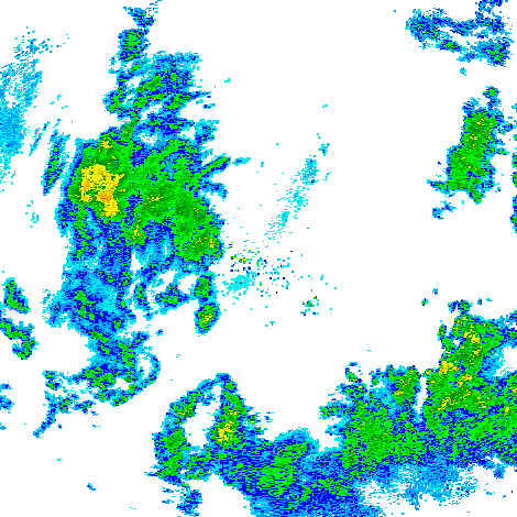
GPM Ground Validation Doppler on Wheels (DOW) OLYMPEX V2
National Aeronautics and Space Administration —
The GPM Ground Validation Doppler on Wheels (DOW) OLYMPEX V2 dataset was obtained by a dual-polarization and dual-frequency X-band mobile radar operated by the Center... -
Federal
GOES-R PLT Cloud Physics LiDAR (CPL) V1
National Aeronautics and Space Administration —
The GOES-R PLT Cloud Physics Lidar (CPL) dataset consists of backscatter coefficient, lidar depolarization ratio, layer top/base height, layer type, particulate... -
Federal
RSS SSM/I OCEAN PRODUCT GRIDS WEEKLY AVERAGE FROM DMSP F13 NETCDF V7
National Aeronautics and Space Administration —
The RSS SSM/I Ocean Product Grids Weekly Average from DMSP F13 netCDF dataset is part of the collection of Special Sensor Microwave/Imager (SSM/I) and Special Sensor... -
Federal
GPM GROUND VALIDATION ACHIEVE W-BAND CLOUD RADAR IPHEX V1
National Aeronautics and Space Administration —
The GPM Ground Validation ACHIEVE W-band Cloud Radar IPHEx dataset consists of cloud and light precipitation radar observations gathered during the Global... -
Federal
GPM GROUND VALIDATION TWO-DIMENSIONAL VIDEO DISDROMETER (2DVD) MC3E V1
National Aeronautics and Space Administration —
The GPM Ground Validation Two-Dimensional Video Disdrometer (2DVD) MC3E dataset was collected during the Midlatitude Continental Convective Clouds Experiment (MC3E),... -
Federal
Cloud Physics LiDAR (CPL) IMPACTS
National Aeronautics and Space Administration —
The Cloud Physics LiDAR (CPL) IMPACTS dataset consists of backscatter coefficient, lidar depolarization ratio, layer top/base height, layer type, particulate... -
Federal
GPM GROUND VALIDATION NEXRAD LEVEL II KDVN IFLOODS V1
National Aeronautics and Space Administration —
The GPM Ground Validation Next Generation Weather Radar (NEXRAD) Level II IFloodS datasets were collected from four sites (see Table 1) from March 29, 2013 to June... -
Federal
RSS SSM/I OCEAN PRODUCT GRIDS WEEKLY AVERAGE FROM DMSP F14 NETCDF V7
National Aeronautics and Space Administration —
The RSS SSM/I Ocean Product Grids Weekly Average from DMSP F14 netCDF dataset is part of the collection of Special Sensor Microwave/Imager (SSM/I) and Special Sensor... -
Federal
KCXX NEXRAD IMPACTS V1
National Aeronautics and Space Administration —
The KCXX NEXRAD IMPACTS dataset consists of Next Generation Weather Radar (NEXRAD) Level II surveillance data that were collected at 31 NEXRAD sites from January 1 to... -
Federal
GOES-R PLT Surface Radiance Red Lake V1
National Aeronautics and Space Administration —
The GOES-R PLT Surface Radiance Red Lake dataset consists of surface radiation budget, ultraviolet-B (UVB) and photosynthetically active radiation (PAR) flux,... -
Federal
NAMMA DIODE LASER HYGROMETER (DLH) V1
National Aeronautics and Space Administration —
The NAMMA Diode Laser Hygrometer (DLH) dataset uses the DLH, a near-infrared spectrometer operating from aircraft platforms, was developed by NASA's Langley and Ames... -
Federal
KOKX NEXRAD IMPACTS V1
National Aeronautics and Space Administration —
The KOKX NEXRAD IMPACTS dataset consists of Next Generation Weather Radar (NEXRAD) Level II surveillance data that were collected at 31 NEXRAD sites from January 1 to... -
Federal
NAMMA PRAIA CAPE VERDE RADIOSONDE V1
National Aeronautics and Space Administration —
The NAMMA Praia Cape Verde Radiosonde data used Sippican MarkIIa DGPS (LOS) radiosondes, which were launched in support of NASA African Monsoon Multidisciplinary... -
Federal
GPM Ground Validation NASA EPFL-LTE Parsivel DSD Data Lausanne, Switzerland V1
National Aeronautics and Space Administration —
The GPM Ground Validation NASA EPFL-LTE Parsivel DSD Data Lausanne, Switzerland dataset consists of a network of 16 Parsivel disdrometers deployed on the Ecole... -
Federal
GRIP FLIGHT TRACKS AND ANIMATIONS V1
National Aeronautics and Space Administration —
The GRIP Flight Tracks and Animations dataset includes both KML files and animation files. The KML files use Google Earth to show the flight tracks on a map. The... -
Federal
GRIP HURRICANE IMAGING RADIOMETER (HIRAD) V1
National Aeronautics and Space Administration —
The GRIP Hurricane Imaging Radiometer (HIRAD) V1 dataset contains measurements of brightness temperature taken at 4, 5, 6 and 6.6 GHz, as well as MERRA 2 m wind speed... -
Federal
GPM Ground Validation Two-Dimensional Video Disdrometer (2DVD) WFF V2
National Aeronautics and Space Administration —
The GPM Ground Validation Two-Dimensional Video Disdrometer (2DVD) WFF data were collected during the Global Precipitation Mission (GPM) Ground Validation (GV)... -
Federal
GPM GROUND VALIDATION TWO-DIMENSIONAL VIDEO DISDROMETER (2DVD) HYMEX V1
National Aeronautics and Space Administration —
The GPM Ground Validation Two-Dimensional Video Disdrometer (2DVD) HyMeX data was collected during the HYdrological cycle in Mediterranean EXperiment (HyMeX), which...

Official websites use .gov
A
.gov website belongs to an official government
organization in the United States.
Secure .gov websites use HTTPS
A
lock (
) or https:// means you’ve safely connected to
the .gov website. Share sensitive information only on official,
secure websites.