
-
Federal
OMPS-NPP L2 LP Ozone (O3) Vertical Profile swath daily 3slit V2.5 (OMPS_NPP_LP_L2_O3_DAILY) at GES DISC
National Aeronautics and Space Administration —
The OMPS-NPP L2 LP Ozone (O3) Vertical Profile swath daily 3slit collection contains ozone measured by the Ozone Mapping and Profiling Suite (OMPS) Limb-Profiler (LP)... -
Federal
NLDAS Mosaic Land Surface Model L4 Monthly 0.125 x 0.125 degree V2.0 (NLDAS_MOS0125_M) at GES DISC
National Aeronautics and Space Administration —
This data set contains thirty-seven fields simulated from the Mosaic land-surface model (LSM) for Phase 2 of the North American Land Data Assimilation System... -
Federal
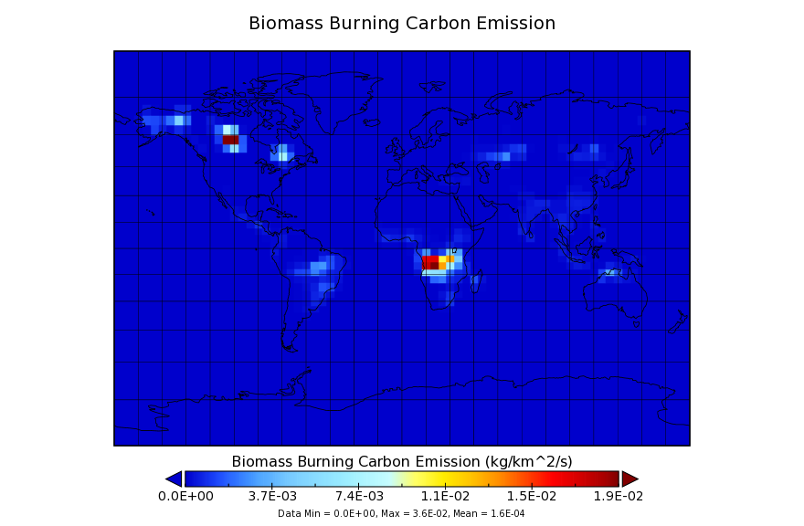
Carbon Monitoring System Carbon Flux for Fire L4 V1 (CMSFluxFire) at GES DISC
National Aeronautics and Space Administration —
This dataset provides the Carbon Flux for Fires.The NASA Carbon Monitoring System (CMS) is designed to make significant contributions in characterizing, quantifying,... -
Federal
GEOS-5 FP-IT 3D Time-Averaged Model-Layer Assimilated Data Geo-Colocated to OMI/Aura VIS 1-Orbit L2 Swath 13x24km V4 (OMVFPMET) at GES DISC
National Aeronautics and Space Administration —
The GEOS-5 FP-IT 3D Time-Averaged Model-Layer Assimilated Data Geo-Colocated to OMI/Aura VIS 1-Orbit L2 Swath 13x24km (OMVFPMET) product provides selected... -
Federal
AIRS/Aqua L3 Monthly Standard Physical Retrieval (AIRS+AMSU) 1 degree x 1 degree V006 (AIRX3STM) at GES DISC
National Aeronautics and Space Administration —
The Atmospheric Infrared Sounder (AIRS) is a grating spectrometer (R = 1200) aboard the second Earth Observing System (EOS) polar-orbiting platform, EOS Aqua. In... -
Federal
MLS/Aura Level 3 Daily Binned Temperature on Zonal and Similar Grids V005 (ML3DZT) at GES DISC
National Aeronautics and Space Administration —
ML3DZT is the EOS Aura Microwave Limb Sounder (MLS) daily binned on zonal and assorted vertical grids product for temperature derived from radiances measured by the... -
Federal
NOAA20 VIIRS High Resolution Level 3 monthly aerosol data, 0.1x0.1 degree grid Version 001 (AER_DBDT_M10KM_L3_VIIRS_NOAA20) at GES DISC
National Aeronautics and Space Administration —
This High-Resolution (0.1 x 0.1 degree) Level 3 monthly Aerosol Optical Depth (AOD) product is generated by combining two Visible Infrared Imaging Radiometer Suite... -
Federal
TROPESS Chemical Reanalysis Surface O3 2-Hourly 2-dimensional Product V1 (TRPSCRO32H2D) at GES DISC
National Aeronautics and Space Administration —
The TROPESS Chemical Reanalysis Surface O3 2-Hourly 2-dimensional Product contains surface concentrations of ozone. The data are part of the Tropospheric Chemical... -
Federal
MERRA-2 tavgU_2d_chm_Nx: 2d,diurnal,Time-Averaged,Single-Level,Assimilation,Carbon Monoxide and Ozone Diagnostics 0.625 x 0.5 degree V5.12.4 (M2TUNXCHM) at GES DISC
National Aeronautics and Space Administration —
M2TUNXCHM (or tavgU_2d_chm_Nx) is a time-averaged 2-dimensional monthly diurnal means data collection in Modern-Era Retrospective analysis for Research and... -
Federal
GPM AMSU-B on NOAA17 (GPROF) Climate-based Radiometer Precipitation Profiling L2 1.5 hours 16 km V07 (GPM_2AGPROFNOAA17AMSUB) at GES DISC
National Aeronautics and Space Administration —
Version 07 is the current version of the data set. Older versions will no longer be available and have been superseded by Version 07.The 'CLIM' products differ from... -
Federal
MLS/Aura Level 3 Daily Binned Water Vapor (H2O) Mixing Ratio on Assorted Grids V004 (ML3DBH2O) at GES DISC
National Aeronautics and Space Administration —
ML3DBH2O is the EOS Aura Microwave Limb Sounder (MLS) daily binned on various vertical grids product for water vapor (H2O) derived from radiances measured primarily... -
Federal
TROPICS03 L1B Orbital Geolocated Native-Resolution Brightness Temperatures V1.0
National Aeronautics and Space Administration —
The "Time-Resolved Observations of Precipitation structure and storm Intensity with a Constellation of Smallsats" (TROPICS) mission has a goal of providing nearly... -
Federal
Carbon Monitoring System Carbon Flux Total L4 V3 (CMSFluxTotal)
National Aeronautics and Space Administration —
This dataset provides the Carbon Flux for Posterior Total Carbon.The NASA Carbon Monitoring System (CMS) is designed to make significant contributions in... -
Federal
TROPESS CrIS-SNPP L2 for Mexico City Megacity, Summary Product V1 (TRPSYL2ALLCRSMGMEX) at GES DISC
National Aeronautics and Space Administration —
The TROPESS CrIS-SNPP L2 for Mexico City Megacity, Summary Product contains the vertical distribution of six retrieved atmospheric gases (CH4, CO, HDO, NH3, O3 and... -
Federal
Sentinel-5P TROPOMI Aerosol Layer Height 1-Orbit L2 5.5km x 3.5km V2 (S5P_L2__AER_LH_HiR) at GES DISC
National Aeronautics and Space Administration —
Starting from August 6th in 2019, Sentinel-5P TROPOMI along-track high spatial resolution (~5.5km at nadir) has been implemented.For data before August 6th of 2019,... -
Federal
Sounder SIPS: Suomi NPP CrIMSS Level 2 CLIMCAPS Full Spectral Resolution: retrieved atmospheric state V2.1 (SNDRSNIML2CPS) at GES DISC
National Aeronautics and Space Administration —
The CLIMCAPS (Community Long-term Infrared Microwave Coupled Product System) algorithm is used to analyze data from the Cross-track Infrared Sounder/Advanced... -
Federal
MLS/Aura L1 Radiances from Filter Banks for THz V004 (ML1RADT) at GES DISC
National Aeronautics and Space Administration —
ML1RADT is the EOS Aura Microwave Limb Sounder (MLS) product containing the level 1 radiances from the filter banks for the GHz radiometers. The data version is 4.2.... -
Federal
NLDAS Noah Land Surface Model L4 Monthly 0.125 x 0.125 degree V2.0 (NLDAS_NOAH0125_M) at GES DISC
National Aeronautics and Space Administration —
This data set contains fifty-two fields simulated from the Noah land-surface model (LSM) for Phase 2 of the North American Land Data Assimilation System (NLDAS-2).... -
Federal
ACOS GOSAT/TANSO-FTS Level 2 bias-corrected XCO2 and other select fields from the full-physics retrieval aggregated as daily files V9r (ACOS_L2_Lite_FP) at GES DISC
National Aeronautics and Space Administration —
Version 9r is the current version of the data set. Older versions will no longer be available and are superseded by Version 9r.The ACOS Lite files contain bias-... -
Federal
MERRA-2 inst6_3d_ana_Np: 3d,6-Hourly,Instantaneous,Pressure-Level,Analysis,Analyzed Meteorological Fields 0.625 x 0.5 degree V5.12.4 (M2I6NPANA) at GES DISC
National Aeronautics and Space Administration —
M2I6NPANA (or inst6_3d_ana_Np) is an instantaneous 3-dimensional 6-hourly data collection in Modern-Era Retrospective analysis for Research and Applications version 2...

Official websites use .gov
A
.gov website belongs to an official government
organization in the United States.
Secure .gov websites use HTTPS
A
lock (
) or https:// means you’ve safely connected to
the .gov website. Share sensitive information only on official,
secure websites.