

6 datasets found
-
Federal
Land Surface Atmospheric Boundary Interaction Product L3 V1(LANDMET) at GES DISC recent views
National Aeronautics and Space Administration —
This product is a multi-variate data compilation that reconciles the variation scales of these multiple measurements from varies resources, merges and maps them into... -
Federal
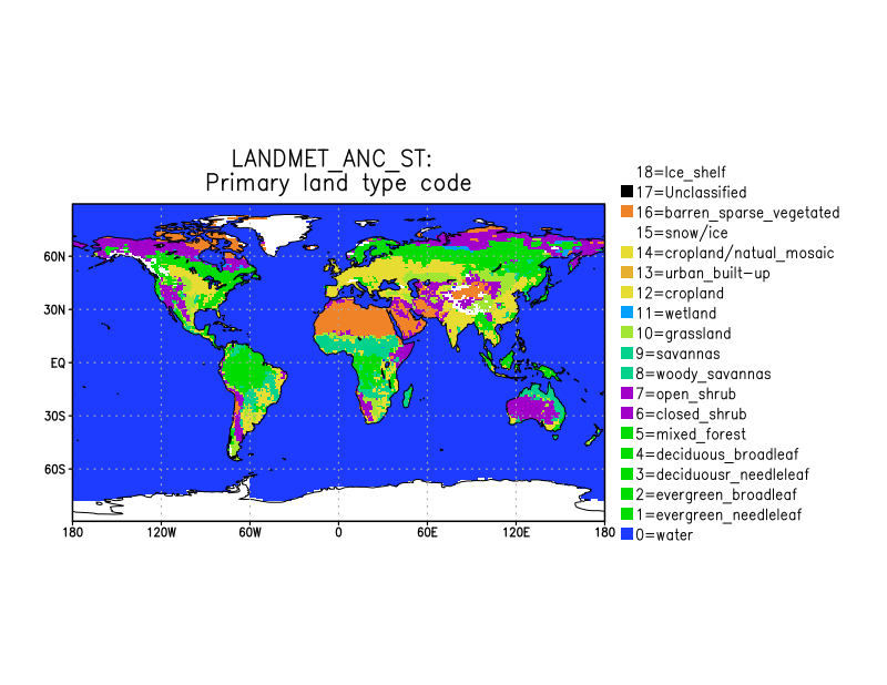
LANDMET Ancillary ISCCP Surface Type Data L3 V1 (LANDMET_ANC_ST) at GES DISC recent views
National Aeronautics and Space Administration —
This is an ancillary product containing the land surface type information includes, for each map grid cell, the type and coverage fractions of the top three surface... -
Federal
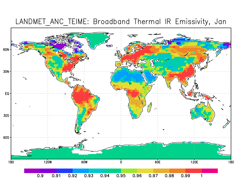
LANDMET Ancillary Monthly Mean Thermal Effective Infrared and Microwave Emissivity Data L3 V1 (LANDMET_ANC_TEIME) at GES DISC recent views
National Aeronautics and Space Administration —
This is an ancillary product, climatology monthly mean and standard deviation, containing a number of emissivity data. They are broadband thermal IR emissivity from... -
Federal
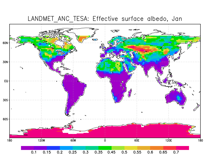
LANDMET Ancillary Monthly Mean Effective and Spectral Albedo Data L3 V1 (LANDMET_ANC_TESA) at GES DISC recent views
National Aeronautics and Space Administration —
This is an ancillary product containing the total effective surface albedo at solar wavelengths originated from the ISCCP FD radiative fluxes product, and the... -
Federal
Primary Ancillary Data Geo-Colocated to OMI/Aura UV2 1-Orbit L2 Swath 13x24km V4 (OMUANC) at GES DISC recent views
National Aeronautics and Space Administration —
The Primary Ancillary Data Geo-Colocated to OMI/Aura UV2 1-Orbit L2 Swath 13x24km (OMUANC) provides selected parameters from GEOS-5 Forward Processing for Instrument... -
Federal
Primary Ancillary Data Geo-Colocated to OMI/Aura VIS 1-Orbit L2 Swath 13x24km V4 (OMVANC) at GES DISC recent views
National Aeronautics and Space Administration —
The Primary Ancillary Data Geo-Colocated to OMI/Aura VIS 1-Orbit L2 Swath 13x24km (OMVANC) provides selected parameters from GEOS-5 Forward Processing for Instrument...
6 datasets found