

10,070 datasets found for "o20카발직장인DB✅텔thinkDB☆문발해선DB|"
-
Federal
Sentinel-6A MF Jason-CS L2 P4 Altimeter High Resolution (HR) STC Reduced Ocean Surface Topography
National Aeronautics and Space Administration —
Provides L2 high resolution (HR) short time critical (STC; 36-hour latency) altimetry from the Poseidon-4 SAR altimeter on the Sentinel-6A Michael Freilich... -
Federal
SBUV2/NOAA-19 Ozone (O3) Nadir Profile and Total Column 1 Day L2 V1 (SBUV2N19L2) at GES DISC
National Aeronautics and Space Administration —
The Solar Backscattered Ultraviolet (SBUV) from NOAA-19 Level-2 daily product (SBUV2N19L2) contains ozone nadir profile and total column data from retrievals... -
Federal
Satellite SPOT Extracted Data (FIFE)
National Aeronautics and Space Administration —
The Site Reflectances Extracted from SPOT HRV Imagery Data Set contains the average instrument corrected spectral radiances for each of the spectral bands (3 in XS... -
Federal
SEASAT SCATTEROMETER DEALIASED OCEAN WIND VECTORS (Wentz et al.)
National Aeronautics and Space Administration —
Contains Seasat-A Scatterometer (SASS) wind vector measurements for the entire Seasat mission, from July 1978 until October 1978. The data are global and presented... -
Federal
MODIS/Terra+Aqua BRDF/Albedo Nadir BRDF-Adjusted Ref Daily L3 Global 0.05Deg CMG V006
National Aeronautics and Space Administration —
The MCD43C4 Version 6 data product was decommissioned on July 31, 2023. Users are encouraged to use the MCD43C4 Version 6.1 data product.The Moderate Resolution... -
Federal
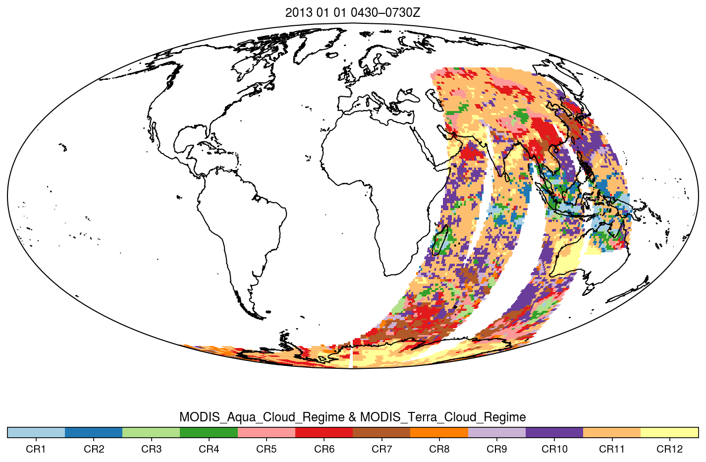
MODIS_CR_Equal_Area_3h
National Aeronautics and Space Administration —
The MODIS Collection 6.1 Equal-Area Three-Hourly Cloud Regime product. This product is a discrete classification of cloud fields at the mesoscale as observed by the... -
Federal
Gamma Ray Data: Peck (FIFE)
National Aeronautics and Space Administration —
Airborne soil moisture measurement is based on the difference between natural terrestrial gamma radiation flux measured for comparatively wet and dry soils. The... -
Federal
VIIRS/NPP Thermal Anomalies/Fire 6-Min L2 Swath 750m V001
National Aeronautics and Space Administration —
The VNP14 VIIRS Version 1 data product was decommissioned on April 8th, 2025. Users are encouraged to use Version 2 data products, which provide better calibration... -
Federal
VIIRS/NPP Vegetation Indices 16-Day L3 Global 0.05Deg CMG V001
National Aeronautics and Space Administration —
The VNP13C1 VIIRS Version 1 data product was decommissioned on April 8th, 2025. Users are encouraged to use Version 2 data products, which provide better calibration... -
Federal
VIIRS/NPP Vegetation Indices 16-Day L3 Global 1km SIN Grid V001
National Aeronautics and Space Administration —
The VNP13A2 VIIRS Version 1 data product was decommissioned on April 8th, 2025. Users are encouraged to use Version 2 data products, which provide better calibration...
10,070 datasets found for "o20카발직장인DB✅텔thinkDB☆문발해선DB|"