
-
Federal
VIIRS/JPSS2 Day/Night Band 6-Min L1B Swath SDR 750m NRT
National Aeronautics and Space Administration —
The Near Real Time (NRT) VIIRS Level 1 and Level 2 swath (VJ202DNB_NRT) product is single NASA VIIRS panchromatic Day-Night band (DNB) calibrated radiance product.... -
Federal
VIIRS/NPP Thermal Anomalies/Fire 6-Min L2 Swath 750m V002
National Aeronautics and Space Administration —
The Visible Infrared Imaging Radiometer Suite (VIIRS) Thermal Anomalies (VNP14) Version 2 product is produced in 6-minute temporal satellite increments (swaths) at... -
Federal
Waveglider data for the SPURS-1 N. Atlantic field campaign
National Aeronautics and Space Administration —
The SPURS (Salinity Processes in the Upper Ocean Regional Study) project is an oceanographic process study and associated field program that aim to elucidate key... -
Federal
VIIRS/NPP BRDF/Albedo Parameter 1 Band M5 Daily L3 Global 30 ArcSec CMG V002
National Aeronautics and Space Administration —
The NASA/NOAA Suomi National Polar-orbiting Partnership (Suomi NPP) Visible Infrared Imaging Radiometer Suite (VIIRS) Bidirectional Reflectance Distribution Function... -
Federal
VIIRS/NPP BRDF/Albedo Parameter 2 Band M10 Daily L3 Global 30 ArcSec CMG V002
National Aeronautics and Space Administration —
The NASA/NOAA Suomi National Polar-orbiting Partnership (Suomi NPP) Visible Infrared Imaging Radiometer Suite (VIIRS) Bidirectional Reflectance Distribution Function... -
Federal
VIIRS/NPP BRDF/Albedo NBAR at Solar Noon Band M8 Daily L3 Global 30ArcSec CMG V001
National Aeronautics and Space Administration —
The VNP43D86 Version 1 data product was decommissioned on July 31, 2025. Users are encouraged to use the VNP43D86 and VJ143D86 Version 2 data products.The NASA/NOAA... -
Federal
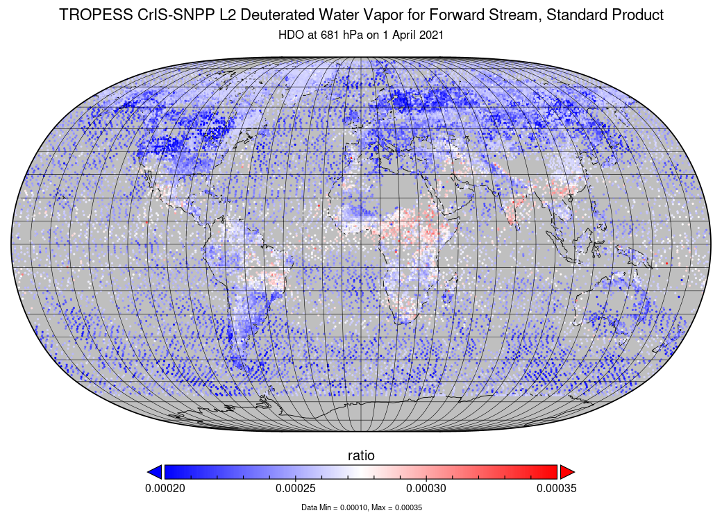
TROPESS CrIS-SNPP L2 Deuterated Water Vapor for Forward Stream, Standard Product V1 (TRPSDL2HDOCRSFS) at GES DISC
National Aeronautics and Space Administration —
The TROPESS CrIS-SNPP L2 Deuterated Water Vapor for Forward Stream, Standard Product contains the vertical distribution of the retrieved atmospheric state of semi-... -
Federal
MISR Level 3 Global Cloud public Product in netCDF format covering a day V002
National Aeronautics and Space Administration —
MI3DCLDN_2 is the Multi-angle Imaging SpectroRadiometer (MISR) Level 3 Global Cloud public Product in netCDF format covering a day version 2. It contains the public... -
Federal
MetOp-B ASCAT Scatterometer Inter-Calibrated ESDR Level 2 Ocean Surface Equivalent Neutral Wind Vectors and Wind Stress Vectors Version 1.1
National Aeronautics and Space Administration —
This dataset contains ocean surface wind vectors (equivalent neutral and true 10m) and wind stress vectors derived from satellite-based scatterometer observations... -
Federal
MISR L2 Aerosol Product subset for the ICARTT region V002
National Aeronautics and Space Administration —
CARMIAAE_002 is the MISR L2 Aerosol Product subset for the ICARTT region V002 product. It contains aerosol optical depth and particle type, with associated... -
Federal
LBA-ECO LC-01 Landsat MSS, TM, ETM+ Imagery, Northern Ecuadorian Amazon: 1973-2002
National Aeronautics and Space Administration —
This data set contains a time series of early Landsat-4 MSS satellite imagery as well as Landsat-5 TM and Landsat-7 ETM+ satellite imagery of the northern Ecuadorian... -
Federal
LBA-ECO CD-06 CO2 Exchange in River Systems Across the Amazon Basin: 2004-2007
National Aeronautics and Space Administration —
This data set provides measurements of carbon dioxide flux rates (FCO2), gas transfer velocity (k), and partial pressures (pCO2) at 75 sites on rivers and streams of... -
Federal
JERS-1 Synthetic Aperture Radar, 100-m Mosaics, South America: 1995-1996, R1
National Aeronautics and Space Administration —
This data set provides ~100-m resolution image mosaics of South America acquired during the low flood season between September and December 1995 and during the high... -
Federal
GOES-R PLT Colorado Lightning Mapping Array (LMA)
National Aeronautics and Space Administration —
The GOES-R PLT Colorado Lightning Mapping Array (LMA) dataset consists of total lightning data measured from the Colorado LMA (COLMA) network during the GOES-R Post... -
Federal
S-NPP CrIS IMG_COL: Array indices for collocated VIIRS observations V2 (SNDRSNCrISL1BIMGC) at GES DISC
National Aeronautics and Space Administration —
The Cross-track Infrared Sounder (CrIS) Level 1B Normal Spectral Resolution (NSR) data files contain radiance measurements along with ancillary spacecraft,... -
Federal
Ships of Opportunity for PACE (SO-PACE): Validation of water-leaving reflectances, IOPs, and plankton community metrics
National Aeronautics and Space Administration —
SO-PACE will make use of opportunistic instrument deployments on research vessels to produce measurements of hyperspectral Rrs spanning 350 nm - 750 nm using the... -
Federal
RSS SSM/I OCEAN PRODUCT GRIDS 3-DAY AVERAGE FROM DMSP F15 NETCDF V7
National Aeronautics and Space Administration —
The RSS SSM/I Ocean Product Grids 3-Day Average from DMSP F15 netCDF dataset is part of the collection of Special Sensor Microwave/Imager (SSM/I) and Special Sensor... -
Federal
MODIS/Terra+Aqua BRDF/Albedo Parameter2 Band2 Daily L3 Global 30ArcSec CMG V006
National Aeronautics and Space Administration —
The MCD43D05 Version 6 data product was decommissioned on July 31, 2023. Users are encouraged to use the MCD43D05 Version 6.1 data product.The MCD43D05 Version 6... -
Federal
MODIS/Terra+Aqua BRDF/Albedo Parameter1 Band4 Daily L3 Global 30ArcSec CMG V061
National Aeronautics and Space Administration —
The MCD43D10 Version 6.1 Bidirectional Reflectance Distribution Function and Albedo (BRDF/Albedo) Model Parameter dataset is produced daily using 16 days of Terra and... -
Federal
MODIS/Terra+Aqua BRDF/Albedo Black Sky Albedo VIS Daily L3 Global 30ArcSec CMG V061
National Aeronautics and Space Administration —
The MCD43D49 Version 6.1 Bidirectional Reflectance Distribution Function and Albedo (BRDF/Albedo) Black-Sky Albedo dataset is produced daily using 16 days of Terra...

Official websites use .gov
A
.gov website belongs to an official government
organization in the United States.
Secure .gov websites use HTTPS
A
lock (
) or https:// means you’ve safely connected to
the .gov website. Share sensitive information only on official,
secure websites.