
-
Federal
M 17 Chandra X-Ray Point Source Catalog
National Aeronautics and Space Administration —
This table contains some of the results from a Chandra ACIS observation of the stellar populations in and around the M17 H II region. The field reveals 886 sources... -
Federal
GLIMPSE 3D Epoch 1 Catalog
National Aeronautics and Space Administration —
GLIMPSE3D is the third in a series of large area projects to map selected regions of the Galactic plane using the Spitzer Space Telescope Infrared Array Camera... -
Federal
LIS 0.1 DEGREE VERY HIGH RESOLUTION GRIDDED LIGHTNING ANNUAL CLIMATOLOGY (VHRAC) V1
National Aeronautics and Space Administration —
The LIS 0.1 Degree Very High Resolution Gridded Lightning Annual Climatology (VHRAC) dataset consists of gridded annual climatologies of total lightning flash rates... -
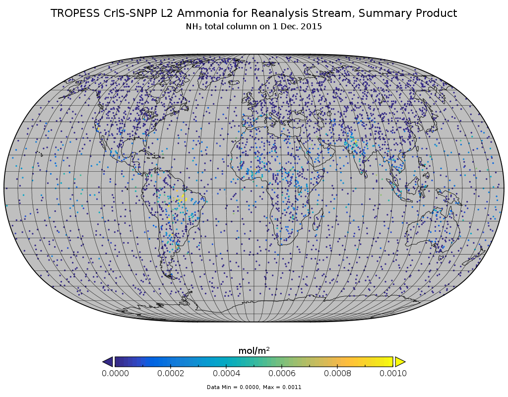
Federal
TROPESS CrIS-SNPP L2 Carbon Monoxide for West Coast Fires HiRes, Standard Product V1 (TRPSDL2COCRSWCFHI) at GES DISC
National Aeronautics and Space Administration —
The TROPESS CrIS-SNPP L2 Carbon Monoxide for West Coast Fires HiRes, Standard Product contains the vertical distribution of the retrieved atmospheric state of carbon... -
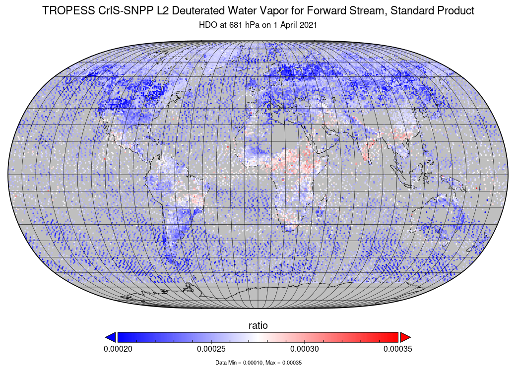
Federal
TROPESS CrIS-SNPP L2 Deuterated Water Vapor for Forward Stream, Standard Product V1 (TRPSDL2HDOCRSFS) at GES DISC
National Aeronautics and Space Administration —
The TROPESS CrIS-SNPP L2 Deuterated Water Vapor for Forward Stream, Standard Product contains the vertical distribution of the retrieved atmospheric state of semi-... -
Federal
TROPESS CrIS-SNPP L2 Peroxyacetyl Nitrate for Australian Fires, Standard Product V1 (TRPSDL2PANCRSAUS) at GES DISC
National Aeronautics and Space Administration —
The TROPESS CrIS-SNPP L2 Peroxyacetyl Nitrate for Australian Fires, Standard Product contains the vertical distribution of the retrieved atmospheric state of... -
Federal
TROPESS CrIS-SNPP L2 Ozone for Forward Stream, Summary Product V1 (TRPSYL2O3CRSFS) at GES DISC
National Aeronautics and Space Administration —
The TROPESS CrIS-SNPP L2 Ozone for Forward Stream, Summary Product contains the vertical distribution of the retrieved atmospheric state of ozone (O3), and formal... -
Federal
VIIRS/NPP BRDF/Albedo Valid Observation Band M5 Daily L3 Global 30ArcSec CMG V002
National Aeronautics and Space Administration —
The NASA/NOAA Suomi National Polar-orbiting Partnership (Suomi NPP) Visible Infrared Imaging Radiometer Suite (VIIRS) Bidirectional Reflectance Distribution Function... -
Federal
VIIRS/NPP Moderate Resolution Bands L1B 6-Min Swath 750 m NRT
National Aeronautics and Space Administration —
The VIIRS/NPP Moderate Resolution Bands L1B 6-Min Swath 750m Near Real Time (NRT) product, short-name VNP02MOD_NRT is among the VIIRS Level 1 and Level 2 swath... -
Federal
VIIRS/NPP BRDF/Albedo Parameter 3 VIS Daily L3 Global 30 ArcSec CMG V001
National Aeronautics and Space Administration —
The VNP43D30 Version 1 data product was decommissioned on July 31, 2025. Users are encouraged to use the VNP43D30 and VJ143D30 Version 2 data products.The NASA/NOAA... -
Federal
VIIRS/NPP BRDF/Albedo Uncertainty Daily L3 Global 30ArcSec CMG V001
National Aeronautics and Space Administration —
The VNP43D53 Version 1 data product was decommissioned on July 31, 2025. Users are encouraged to use the VNP43D53 and VJ143D53 Version 2 data products.The NASA/NOAA... -
Federal
VIIRS/NPP BRDF/Albedo BSA at Solar Noon ShortWave Daily L3 Global 30ArcSec CMG V001
National Aeronautics and Space Administration —
The VNP43D65 Version 1 data product was decommissioned on July 31, 2025. Users are encouraged to use the VNP43D65 and VJ143D65 Version 2 data products.The NASA/NOAA... -
Federal
VIIRS/NPP BRDF/Albedo NBAR at Solar Noon Band M8 Daily L3 Global 30ArcSec CMG V001
National Aeronautics and Space Administration —
The VNP43D86 Version 1 data product was decommissioned on July 31, 2025. Users are encouraged to use the VNP43D86 and VJ143D86 Version 2 data products.The NASA/NOAA... -
Federal
VIIRS/NPP BRDF/Albedo Parameter 1 Band M11 Daily L3 Global 30 ArcSec CMG V001
National Aeronautics and Space Administration —
The VNP43D25 Version 1 data product was decommissioned on July 31, 2025. Users are encouraged to use the VNP43D25 and VJ143D25 Version 2 data products.The NASA/NOAA... -
Federal
VIIRS/NPP BRDF/Albedo Parameter 1 Band M5 Daily L3 Global 30 ArcSec CMG V002
National Aeronautics and Space Administration —
The NASA/NOAA Suomi National Polar-orbiting Partnership (Suomi NPP) Visible Infrared Imaging Radiometer Suite (VIIRS) Bidirectional Reflectance Distribution Function... -
Federal
VIIRS/NPP BRDF/Albedo Parameter 1 VIS Daily L3 Global 30 ArcSec CMG V002
National Aeronautics and Space Administration —
The NASA/NOAA Suomi National Polar-orbiting Partnership (Suomi NPP) Visible Infrared Imaging Radiometer Suite (VIIRS) Bidirectional Reflectance Distribution Function... -
Federal
VIIRS/NPP BRDF/Albedo BSA at Solar Noon Band M4 Daily L3 Global 30ArcSec CMG V001
National Aeronautics and Space Administration —
The VNP43D57 Version 1 data product was decommissioned on July 31, 2025. Users are encouraged to use the VNP43D57 and VJ143D57 Version 2 data products.The NASA/NOAA... -
Federal
VIIRS/JPSS2 Day/Night Band 6-Min L1B Swath SDR 750m NRT
National Aeronautics and Space Administration —
The Near Real Time (NRT) VIIRS Level 1 and Level 2 swath (VJ202DNB_NRT) product is single NASA VIIRS panchromatic Day-Night band (DNB) calibrated radiance product.... -
Federal
LBA-ECO CD-10 H2O Profiles at km 67 Tower Site, Tapajos National Forest
National Aeronautics and Space Administration —
This data set reports vertical profiles of H2O vapor concentrations measured at the Para Western (Santarem) - km 67, Primary Forest Tower Site (Figure 1). This site... -
Federal
LBA-ECO CD-06 CO2 Exchange in River Systems Across the Amazon Basin: 2004-2007
National Aeronautics and Space Administration —
This data set provides measurements of carbon dioxide flux rates (FCO2), gas transfer velocity (k), and partial pressures (pCO2) at 75 sites on rivers and streams of...

Official websites use .gov
A
.gov website belongs to an official government
organization in the United States.
Secure .gov websites use HTTPS
A
lock (
) or https:// means you’ve safely connected to
the .gov website. Share sensitive information only on official,
secure websites.