
-
Federal
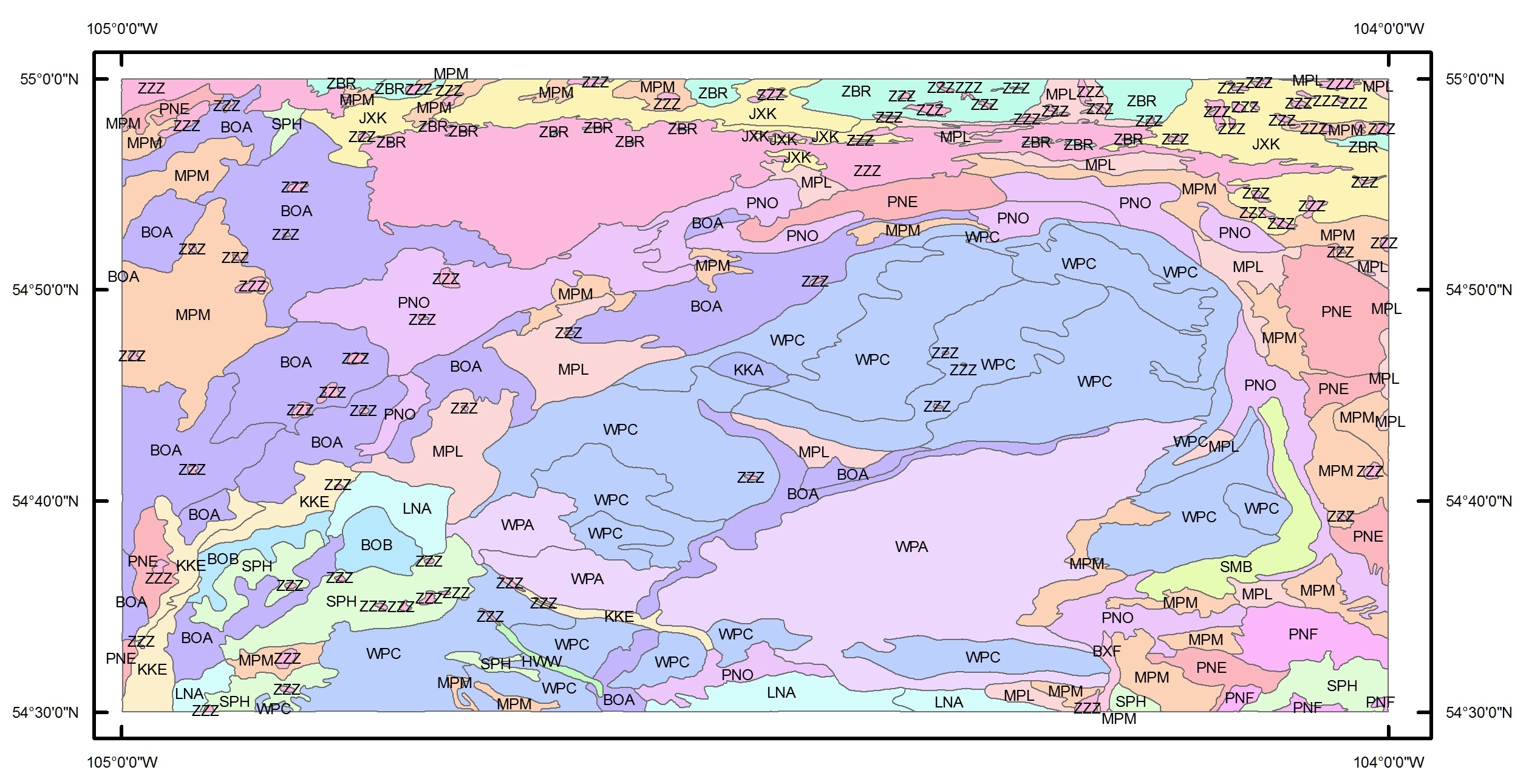
BOREAS Agriculture Canada Central Saskatchewan Vector Soils Data, R1
National Aeronautics and Space Administration —
This data set provides soil descriptions for forested areas in the BOREAS southern study area (SSA) in central Saskatchewan, Canada provided by Agriculture Canada.... -
Federal
BOREAS TE-18 Geosail Canopy Reflectance Model
National Aeronautics and Space Administration —
The SAIL (Scattering from Arbitrarily Inclined Leaves) model was combined with the Jasinski geometric model to simulate canopy spectral reflectance and absorption of... -
Federal
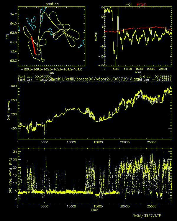
BOREAS Scanning Lidar Imager of Canopies by Echo Recovery (SLICER): Level-3 Data
National Aeronautics and Space Administration —
Scanning Lidar Imager of Canopies by Echo Recovery (SLICER) data were acquired in support of BOReal Ecosystem-Atmosphere Study (BOREAS) at all of the Tower Flux (TF)... -
Federal
BDSNP Module for Improved Soil NO Emission Estimates for CMAQ Model, Conterminous USA
National Aeronautics and Space Administration —
This model product provides: (1) the source code for the updated Berkeley-Dalhousie Soil Nitric Oxide (NO) Parameterization module (BDSNP, Version 1.0) as implemented... -
Federal
Arctic Vegetation Plots Legacy Project Barter Island and Point Barrow, Alaska, 1994
National Aeronautics and Space Administration —
This dataset provides vegetation cover and environmental plot and soil data collected at two U.S. Air Force sites at Barter Island (BI) and Point Barrow (B), on the... -
Federal
ABoVE: Ignitions, Burned Area, and Emissions of Fires in AK, YT, and NWT, 2001-2018
National Aeronautics and Space Administration —
This dataset provides estimates of daily burned area, carbon emissions, and uncertainty, and daily fire ignition locations for boreal fires in Alaska, U.S., and in... -
Federal
ABoVE: Synthesis of Burned and Unburned Forest Site Data, AK and Canada, 1983-2016
National Aeronautics and Space Administration —
This dataset is a synthesis of field plot characterization data, derived above-ground and below-ground combusted carbon, and acquired Fire Weather Index (FWI) System... -
Federal
A Global Database of Litterfall Mass and Litter Pool Carbon and Nutrients
National Aeronautics and Space Administration —
Measurement data of aboveground litterfall and littermass and litter carbon, nitrogen, and nutrient concentrations were extracted from 685 original literature sources... -
Federal
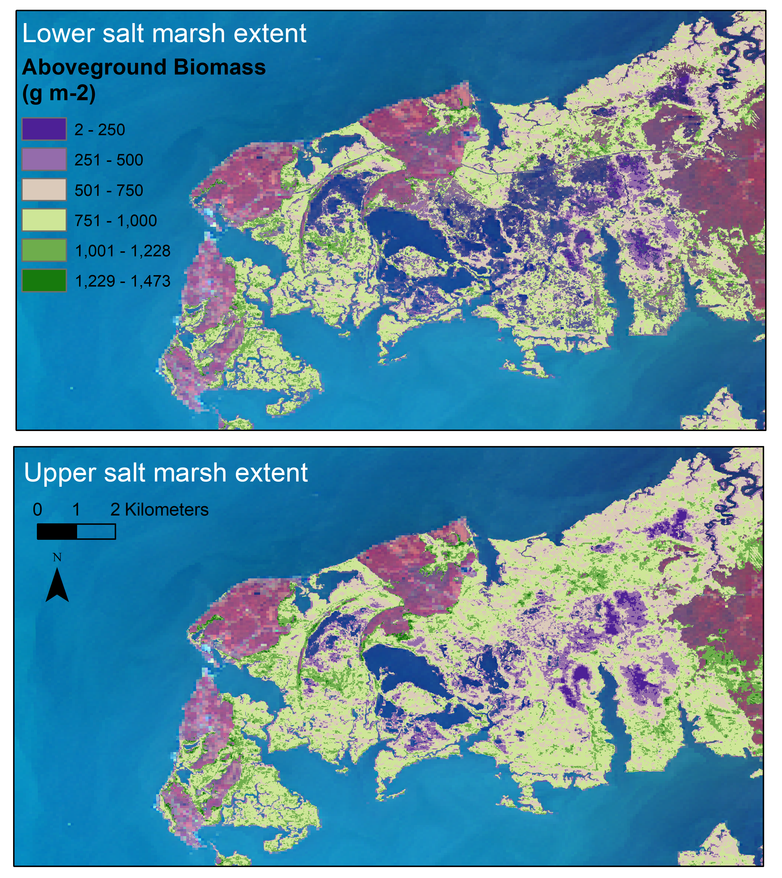
Aboveground Biomass Estimates for Salt Marsh for the Contiguous United States, 2020
National Aeronautics and Space Administration —
This dataset provides estimates of aboveground biomass (AGB) and salt marsh extent in the contiguous United States for 2020 and includes all coastal watersheds across... -
Federal
Tidal Wetland Soil Carbon Stocks for the Conterminous United States, 2006-2010
National Aeronautics and Space Administration —
This dataset provides modeled estimates of soil carbon stocks for tidal wetland areas of the Conterminous United States (CONUS) for the period 2006-2010. Wetland... -
Federal
TransCom 3: Seasonal CO2 Flux Estimates from Atmospheric Inversions (Level 2)
National Aeronautics and Space Administration —
This data set provides model outputs and seasonal mean CO2 fluxes from the Atmospheric Carbon Cycle Inversion Intercomparison (TransCom 3), Level 2 inversion... -
Federal
Vegetation Species Reference (FIFE)
National Aeronautics and Space Administration —
The Konza Natural Research Area is a tallgrass prairie in a biologically heterogeneous environment that is rich in native plant species. Species composition is... -
Federal
SORCE XPS Level 4 Solar Spectral Irradiance 0.1nm Res 24-Hour Means V012 (SOR4XPSD_HIGH) at GES DISC
National Aeronautics and Space Administration —
The SORCE XPS Level 4 Solar Spectral Irradiance 0.1nm Res 24-Hour Means product (SOR4XPSD_HIGH) contains modelled spectral extreme ultraviolet (XUV) irradiances based... -
Federal
SORCE XPS Level 4 Solar Spectral Irradiance 0.1nm Res 5-Minute V012 (SOR4XPS5) at GES DISC
National Aeronautics and Space Administration —
The SORCE XPS Level 4 Solar Spectral Irradiance 0.1nm Res 5-Minute product (SOR4XPS5) contains modelled spectral extreme ultraviolet (XUV) irradiances based on... -
Federal
SORCE XPS Level 4 Solar Spectral Irradiance 1.0nm Res 24-Hour Means V012 (SOR4XPSD_LOW) at GES DISC
National Aeronautics and Space Administration —
The SORCE XPS Level 4 Solar Spectral Irradiance 1.0nm Res 24-Hour Means product (SOR4XPSD_LOW) contains modelled spectral extreme ultraviolet (XUV) irradiances based... -
Federal
SiB3 Modeled Global 1-degree Hourly Biosphere-Atmosphere Carbon Flux, 1998-2006
National Aeronautics and Space Administration —
The Simple Biosphere Model, Version 3 (SiB3) was used to produce a global data set of hourly carbon fluxes between the atmosphere and the terrestrial biosphere for... -
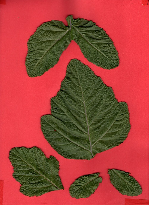
Federal
SHIFT: Photosynthetic and Leaf Traits, Santa Barbara County, 2022
National Aeronautics and Space Administration —
This dataset provides leaf images and measurements of leaf traits (area, wet weight, dry weight, leaf mass per area, leaf water content) and leaf pigments... -
Federal
Satellite Atmos. Correction Coef. (FIFE)
National Aeronautics and Space Administration —
The atmospheric effects on the transmitted and reflected solar radiation should be factored into the estimation of geophysical and biophysical parameters from... -
Federal
SAFARI 2000 MODIS MOD05_L2 Water Vapor Data, Binary Format, for Southern Africa
National Aeronautics and Space Administration —
The Moderate Resolution Imaging Spectroradiometer (MODIS) precipitable water product consists of vertical column water-vapor amounts in centimeters (cm) at 1-km... -
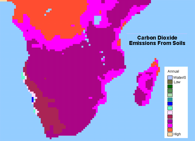
Federal
SAFARI 2000 Monthly and Annual CO2 Emissions from Soil, 0.5 Degree Grid
National Aeronautics and Space Administration —
The data set provides estimated monthly and annual soil CO2 emissions for southern Africa (the SAFARI 2000 project region). The calculated emissions are from the...

Official websites use .gov
A
.gov website belongs to an official government
organization in the United States.
Secure .gov websites use HTTPS
A
lock (
) or https:// means you’ve safely connected to
the .gov website. Share sensitive information only on official,
secure websites.