
-
Federal
SDG Indicator 9.1.1: Rural Access Index (RAI), 2023 Release
National Aeronautics and Space Administration —
The SDG Indicator 9.1.1: The Rural Access Index (RAI), 2023 Release data set, part of the SDGI collection, measures the proportion of the rural population who live... -
Federal
SDG Indicator 7.1.1: Access to Electricity, 2023 Release
National Aeronautics and Space Administration —
The SDG Indicator 7.1.1: Access to Electricity, 2023 Release data set, part of the Sustainable Development Goal Indicators (SDGI) collection, measures the proportion... -
Federal
Global Pesticide Grids (PEST-CHEMGRIDS), Version 1.01
National Aeronautics and Space Administration —
The Global Pesticide Grids (PEST-CHEMGRIDS), Version 1.01 data set contains 20 of the most-used pesticide active ingredients on 6 dominant crops and 4 aggregated crop... -
Federal
National Aggregates of Geospatial Data Collection: Population, Landscape, And Climate Estimates, Version 3 (PLACE III)
National Aeronautics and Space Administration —
The National Aggregates of Geospatial Data Collection: Population, Landscape, And Climate Estimates, Version 3 (PLACE III) data set contains estimates of national-... -
Federal
Identification of Spatial Fault Patterns in Semiconductor Wafers
National Aeronautics and Space Administration —
Abstract The semiconductor industry is constantly searching for new ways to increase the rate of both process development and yield learning. As more data is being... -
Federal
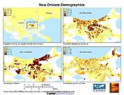
U.S. Population Grids (Summary File 3), 2000: New Orleans Metropolitan Statistical Area, Alpha Version
National Aeronautics and Space Administration —
The U.S. Population Grids (Summary File 3), 2000: New Orleans Metropolitan Statistical Area, Alpha Version data set contains an ARC/INFO Workspace with grids of... -
Federal
SBUV2/NOAA-18 Ozone (O3) Profile and Total Column Ozone 1 Month Zonal Mean L3 Global 5.0 degree Latitude Zones V1 (SBUV2N18L3zm) at GES DISC
National Aeronautics and Space Administration —
The Solar Backscattered Ultraviolet (SBUV) from NOAA-18 Level-3 monthly zonal mean (MZM) product (SBUV2N18L3zm) is derived from the Level-2 retrieved ozone profiles.... -
Federal
Archive of Census Related Products (ACRP): 1990 Census Block Statistics
National Aeronautics and Space Administration —
The 1990 Census Block Statistics portion of the Archive of Census Related Products (ACRP) contains population and housing data from the U.S. Census Bureau's 1990... -
Federal
U.S. Census Grids (Summary File 3), 2000: Metropolitan Statistical Areas
National Aeronautics and Space Administration —
The U.S. Census Grids (Summary File 3), 2000: Metropolitan Statistical Areas data set contains grids of demographic and socioeconomic data from the year 2000 U.S.... -
Federal
AllWISE Multiepoch Photometry Table
National Aeronautics and Space Administration —
The AllWISE program builds upon the work of the successful Wide-field Infrared Survey Explorer mission (WISE; Wright et al. 2010) by combining data from the WISE... -
Federal
2MASS All-Sky Survey Scan Information Table
National Aeronautics and Space Administration —
The 2MASS Scan Information Table provides basic data for each scan in the 2MASS All Sky Release. The table is organized according to the broad function and utility of... -
Federal
IMR90 radiation bystander time-course experiment 0.5Gy alpha particle
National Aeronautics and Space Administration —
The radiation bystander effect is an important component of the overall biological response of tissues and organisms to ionizing radiation. Little is known about the... -
Federal
CANDELS H-Band Selected Chandra Source Catalog
National Aeronautics and Space Administration —
Improving the capabilities of detecting faint X-ray sources is fundamental to increase the statistics on faint high-z AGN and star-forming galaxies. The authors... -
Federal
U.S. Population Grids (Summary File 1), 2000: New Orleans Metropolitan Statistical Area, Alpha Version
National Aeronautics and Space Administration —
U.S. Population Grids (Summary File 1), 2000: New Orleans Metropolitan Statistical Area, Alpha Version contains an ARC/INFO Workspace with grids of demographic data... -
Federal
Large Quasar Astrometric Catalog, 3rd Release
National Aeronautics and Space Administration —
Since the release of the original Large Quasar Astrometric Catalog (LQAC: Souchay et al. 2009, A&A, 494, 815), a large number of quasars have been discovered... -
Federal
Soil Organic Carbon Stock Estimates with Uncertainty across Latin America
National Aeronautics and Space Administration —
This dataset provides 5 x 5 km gridded estimates of soil organic carbon (SOC) across Latin America that were derived from existing point soil characterization data... -
Federal
ASTER Level 1 Precision Terrain Corrected Registered At-Sensor Radiance V031
National Aeronautics and Space Administration —
The Terra Advanced Spaceborne Thermal Emission and Reflection Radiometer (ASTER) Level 1 Precision Terrain Corrected Registered At-Sensor Radiance (AST_L1T) Version... -
Federal
An Integrated Approach to Battery Health Monitoring using Bayesian Regression, Classification and State Estimation
National Aeronautics and Space Administration —
The application of the Bayesian theory of managing uncertainty and complexity to regression and classification in the form of Relevance Vector Machine (RVM), and to... -
Federal
BOREAS RSS-10 TOMS Circumpolar One-Degree PAR Images
National Aeronautics and Space Administration —
The BOREAS RSS-10 team investigated the magnitude of daily, seasonal, and yearly variations of PAR from ground and satellite observations. This data set contains... -
Federal
AllWISE Reject Table
National Aeronautics and Space Administration —
The AllWISE program builds upon the work of the successful Wide-field Infrared Survey Explorer mission (WISE; Wright et al. 2010) by combining data from the WISE...

Official websites use .gov
A
.gov website belongs to an official government
organization in the United States.
Secure .gov websites use HTTPS
A
lock (
) or https:// means you’ve safely connected to
the .gov website. Share sensitive information only on official,
secure websites.