
-
Federal
Global Hyperspectral Imaging Spectral-library of Agricultural crops for Conterminous United States V001 18 recent views
National Aeronautics and Space Administration —
The Global Hyperspectral Imaging Spectral-library of Agricultural crops (GHISA) is a comprehensive compilation, collation, harmonization, and standardization of... -
Federal
Neutrally buoyant float data for the SPURS-1 N. Atlantic field campaign
National Aeronautics and Space Administration —
The SPURS (Salinity Processes in the Upper Ocean Regional Study) project is an oceanographic process study and associated field program that aim to elucidate key... -
Federal
GPM Ground Validation Goddard Profiling Algorithm (GPROF) 2014 IFloodS V3
National Aeronautics and Space Administration —
The GPM Ground Validation Goddard Profiling Algorithm (GPROF) 2014 IFloodS dataset consists of precipitation data derived from microwave radiometers and sounders... -
Federal
NACP Integrated Wildland and Cropland 30-m Fuel Characteristics Map, U.S.A., 2010
National Aeronautics and Space Administration —
The data set provides a 30-m comprehensive fuelbed characteristics map for both the wildland and cropland areas of the conterminous United States (CONUS) for 2010.... -
Federal
NASA MEASURES Precipitation Ensemble based on SSM/I DMSP F13 NASA PPS L1C V06 Tbs 1-orbit L2 Swath 12x12km V1 (PRECIP_SSMI_F13) at GES DISC
National Aeronautics and Space Administration —
The data presented in this level 2 orbital product are rain rate estimates expressed as mm/hour determined from brightness temperatures (Tbs) obtained from the... -
Federal
SCOAPE R/V Point Sur Data
National Aeronautics and Space Administration —
SCOAPE_RVPointSur_Data is the data collected from instruments onboard the University of Southern Mississippi’s Research Vessel (R/V) Point Sur during the Satellite... -
Federal
LISTOS Rutgers Ground Site Data
National Aeronautics and Space Administration —
LISTOS_Ground_Rutgers_Data is the Long Island Sound Tropospheric Ozone Study (LISTOS) Rutgers ground site data collected during the LISTOS field campaign. This... -
Federal
NASA MEASURES Precipitation Ensemble based on SSM/I DMSP F15 NASA PPS L1C V06 Tbs 1-orbit L2 Swath 12x12km V1 (PRECIP_SSMI_F15) at GES DISC
National Aeronautics and Space Administration —
The data presented in this level 2 orbital product are rain rate estimates expressed as mm/hour determined from brightness temperatures (Tbs) obtained from the... -
Federal
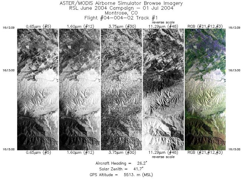
MASTER: Geological substrate mapping, Utah-Colorado, June, 2004
National Aeronautics and Space Administration —
This dataset includes Level 1B (L1B) data products from the MODIS/ASTER Airborne Simulator (MASTER) instrument. The spectral data were collected during two flights... -
Federal
ISLSCP II Global Sea Ice Concentration
National Aeronautics and Space Administration —
This International Satellite Land Surface Climatology Project (ISLSCP) Initiative II data set, ISLSCP II Global Sea Ice Concentration, is based on the Goddard Space... -
Federal
ECOSTRESS Evapotranspiration dis-ALEXI USDA Daily L3 Global 30m V001
National Aeronautics and Space Administration —
The ECOsystem Spaceborne Thermal Radiometer Experiment on Space Station (ECOSTRESS) mission measures the temperature of plants to better understand how much water... -
Federal
NASA MEASURES Precipitation Ensemble based on SSMIS DMSP F18 NASA PPS L1C V05 Tbs 1-orbit L2 Swath 12x12km V1 (PRECIP_SSMIS_F18) at GES DISC
National Aeronautics and Space Administration —
The data presented in this level 2 orbital product are rain rate estimates expressed as mm/hour determined from brightness temperatures (Tbs) obtained from the... -
Federal
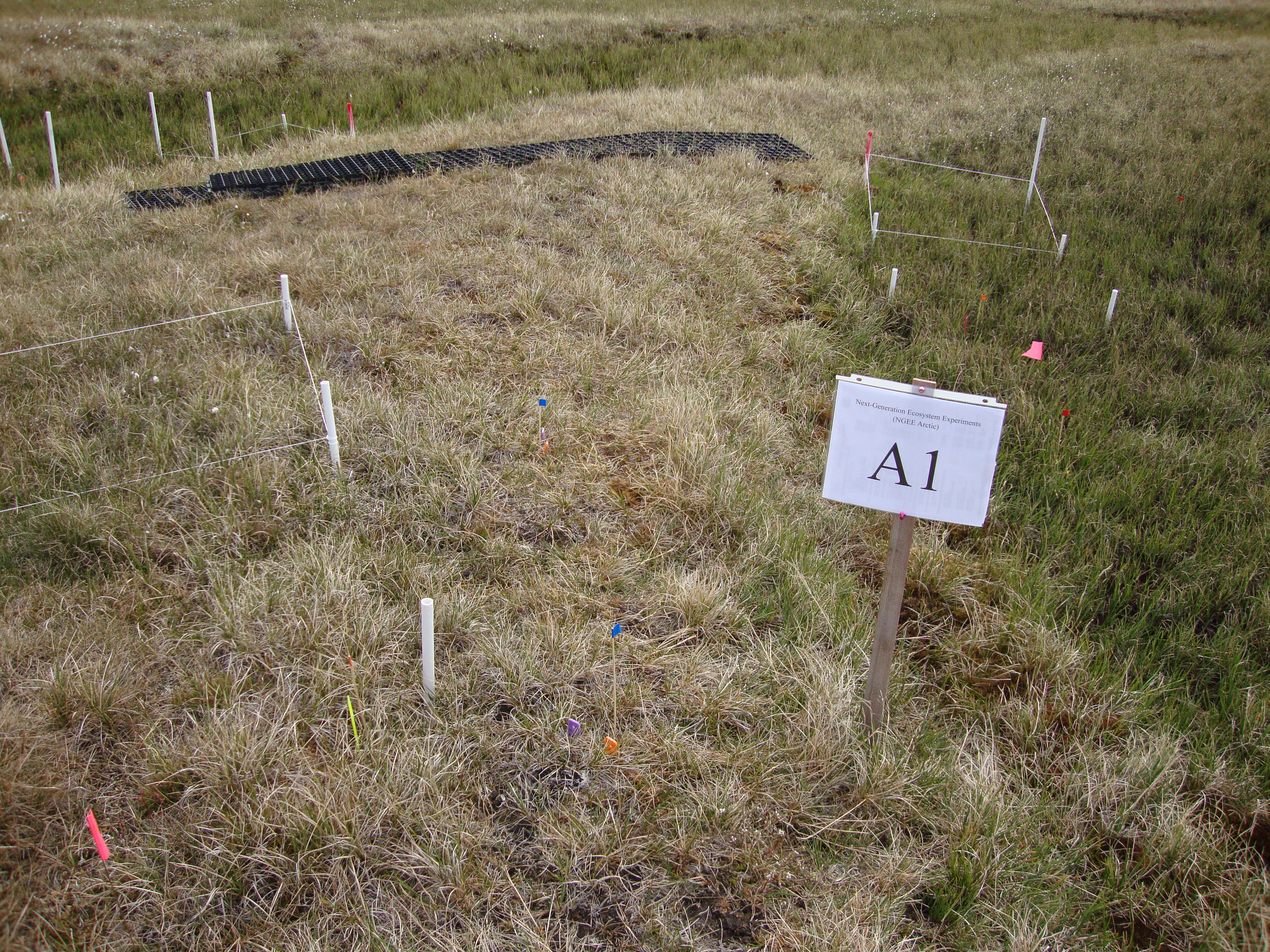
Arctic Vegetation Plots for NGEE-Arctic at Barrow, Alaska, 2012
National Aeronautics and Space Administration —
This data set provides vegetation cover and environmental plot data collected on the Barrow Environmental Observatory (BEO), Barrow, Alaska in 2012. Forty-eight 1 x 1... -
Federal
NASA MEASURES Precipitation Ensemble based on SSMIS DMSP F19 NASA PPS L1C V05 Tbs 1-orbit L2 Swath 12x12km V1 (PRECIP_SSMIS_F19) at GES DISC
National Aeronautics and Space Administration —
The data presented in this level 2 orbital product are rain rate estimates expressed as mm/hour determined from brightness temperatures (Tbs) obtained from the... -
Federal
NARSTO EPA Supersite (SS) Atlanta 1999 Air Chemistry, Particulate Matter (PM), and Meteorological Data
National Aeronautics and Space Administration —
The NARSTO_EPA_SS_ATLANTA_1999_CHEM_PM_MET_DATA is the North American Research Strategy for Tropospheric Ozone (NARSTO) Environmental Protection Agency (EPA)... -
Federal
Tidal Wetland Soil Carbon Stocks for the Conterminous United States, 2006-2010
National Aeronautics and Space Administration —
This dataset provides modeled estimates of soil carbon stocks for tidal wetland areas of the Conterminous United States (CONUS) for the period 2006-2010. Wetland... -
Federal
NARSTO EPA Supersite (SS) Atlanta 1999 University of Alabama-Huntsville (UAH) Mobile Integrated Profiling System (MIPS) Wind Data
National Aeronautics and Space Administration —
NARSTO_EPA_SS_ATLANTA_1999_UAH_MIPS_DATA is the North American Research Strategy for Tropospheric Ozone (NARSTO) Environmental Protection Agency (EPA) Supersite (SS)... -
Federal
Arctic Vegetation Plots Legacy Project Barter Island and Point Barrow, Alaska, 1994
National Aeronautics and Space Administration —
This dataset provides vegetation cover and environmental plot and soil data collected at two U.S. Air Force sites at Barter Island (BI) and Point Barrow (B), on the... -
Federal
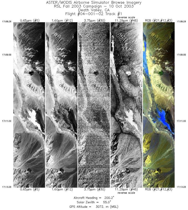
MASTER: Geological fault mapping, California-Nevada, October, 2003
National Aeronautics and Space Administration —
This dataset includes Level 1B (L1B) data products from the MODIS/ASTER Airborne Simulator (MASTER) instrument. The spectral data were collected during six flights...

Official websites use .gov
A
.gov website belongs to an official government
organization in the United States.
Secure .gov websites use HTTPS
A
lock (
) or https:// means you’ve safely connected to
the .gov website. Share sensitive information only on official,
secure websites.