

8 datasets found for "Runoff"
-
Federal
SMAP/SMOS L3 Radiometer 9 km EASE-Grid Soil Moisture V001
National Aeronautics and Space Administration —
The Soil Moisture Active Passive (SMAP, launched in 2015) and the Soil Moisture and Ocean Salinity (SMOS, launched in 2009) missions are each L-band satellites that... -
Federal
Daily Historical Water Balance Products for the CONUS
National Aeronautics and Space Administration —
This dataset provides daily historical Water Balance Model outputs from a Thornthwaite-type, single bucket model. Climate inputs to the model are from GridMet daily... -
Federal
High Mountain Asia PyGEM Glacier Projections with RCP Scenarios V001
National Aeronautics and Space Administration —
This data set comprises results from the Python Glacier Evolution Model (PyGEM) that include projections of glacier mass change, glacier runoff, and the various... -
Federal
Global PyGEM-OGGM Glacier Projections with RCP and SSP Scenarios V001
National Aeronautics and Space Administration —
This data set comprises results from a hybrid glacier evolution model that uses the mass balance module of the Python Glacier Evolution Model (PyGEM) and the glacier... -
Federal
SMOS-Based SMAP L2 Radiometer Half-Orbit 9 km EASE-Grid Soil Moisture V001
National Aeronautics and Space Administration —
The Soil Moisture Active Passive (SMAP, launched in 2015) and the Soil Moisture and Ocean Salinity (SMOS, launched in 2009) missions are each L-band satellites that... -
Federal
High Mountain Asia Rasterized PyGEM Glacier Projections with RCP Scenarios V001
National Aeronautics and Space Administration —
This data set comprises a rasterized (gridded) version of the of glacier point data from the Python Glacier Evolution Model (PyGEM) that include projections of... -
Federal
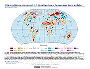
Water Security Indicator Model - Global Land Data Assimilation System (WSIM-GLDAS) Monthly Grids, Version 1
National Aeronautics and Space Administration —
The Water Security Indicator Model - Global Land Data Assimilation System (WSIM-GLDAS) Monthly Grids, Version 1 data set identifies and characterizes surpluses and... -
Federal
Monthly Historical Water Balance Products for the CONUS
National Aeronautics and Space Administration —
This dataset provides daily historical Water Balance Model outputs from a Thornthwaite-type, single bucket model. Climate inputs to the model are from GridMet daily...
8 datasets found for "Runoff"