
-
Federal
Global Reservoir and Dam Database, Version 1 (GRanDv1): Dams, Revision 01
National Aeronautics and Space Administration —
The Global Reservoir and Dam Database, Version 1, Revision 01 (v1.01) contains 6,862 records of reservoirs and their associated dams with a cumulative storage... -
Federal
Poverty Mapping Project: Poverty and Food Security Case Studies
National Aeronautics and Space Administration —
The Poverty Mapping Project: Poverty and Food Security Case Studies data set consists of small area estimates of poverty, inequality, food security and related... -
Federal
Geocoded Disasters (GDIS) Dataset
National Aeronautics and Space Administration —
The Geocoded Disasters (GDIS) Dataset is a geocoded extension of a selection of natural disasters from the Centre for Research on the Epidemiology of Disasters'... -
Federal
SDG Indicator 11.7.1: Urban Public Space, Availability and Access, 2023 Release
National Aeronautics and Space Administration —
The SDG Indicator 11.7.1: Urban Public Space, Availability and Access, 2023 Release, part of the SDGI collection, measures the average share of the built-up area of a... -
Federal
Global Reservoir and Dam Database, Version 1 (GRanDv1): Reservoirs, Revision 01
National Aeronautics and Space Administration —
Global Reservoir and Dam Database, Version 1, Revision 01 (v1.01) contains 6,862 records of reservoirs and their associated dams with a cumulative storage capacity of... -
Federal
Global Pesticide Grids (PEST-CHEMGRIDS), Version 1.01
National Aeronautics and Space Administration —
The Global Pesticide Grids (PEST-CHEMGRIDS), Version 1.01 data set contains 20 of the most-used pesticide active ingredients on 6 dominant crops and 4 aggregated crop... -
Federal
Daily and Annual PM2.5, O3, and NO2 Concentrations at ZIP Codes for the Contiguous U.S., 2000-2016, v1.0
National Aeronautics and Space Administration —
The Daily and Annual PM2.5, O3, and NO2 Concentrations at ZIP Codes for the Contiguous U.S., 2000-2016, v1.0 data set contains daily and annual concentration... -
Federal
SWOT Level 2 Lake Single-Pass Vector Prior Data Product, Version 2.0
National Aeronautics and Space Administration —
The SWOT Level 2 Lake Single-Pass Vector Prior Data Product from the Surface Water Ocean Topography (SWOT) mission provides water surface elevation, area, storage... -
Federal
CLASIC07 Soil Texture Data V001
National Aeronautics and Space Administration —
This data set contains soil texture data obtained for the Cloud and Land Surface Interaction Campaign 2007 (CLASIC07). The original data were extracted from a multi-... -
Federal
IPCC Fifth Assessment Report (AR5) Observed Climate Change Impacts Database, Version 2.01
National Aeronautics and Space Administration —
The Intergovernmental Panel on Climate Change Fifth Assessment Report (AR5) Observed Climate Change Impacts Database, Version 2.01 contains observed responses to... -
Federal
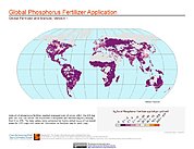
Global Fertilizer and Manure, Version 1: Phosphorus Fertilizer Application
National Aeronautics and Space Administration —
The Phosphorus Fertilizer Application data set of the Global Fertilizer and Manure, Version 1 Data Collection represents the amount of phosphorus fertilizer nutrients... -
Federal
Global Fertilizer and Manure, Version 1: Nitrogen Fertilizer Application
National Aeronautics and Space Administration —
The Nitrogen Fertilizer Application data set of the Global Fertilizer and Manure, Version 1 Data Collection represents the amount of nitrogen fertilizer nutrients... -
Federal
SWOT Level 2 Lake Single-Pass Vector Unassigned Data Product, Version 2.0
National Aeronautics and Space Administration —
The SWOT Level 2 Lake Single-Pass Vector Unassigned Data Product from the Surface Water Ocean Topography (SWOT) mission provides water surface elevation, area,... -
Federal
Multi-Resolution Land Characteristics
National Aeronautics and Space Administration —
The Multi-Resolution Land Characteristics (MRLC) project was established to provide multi-resolution land cover data of the conterminous United States from local to... -
Federal
VIIRS NOAA-20 (JPSS-1) 375m, I-Band Active Fire Product NRT (Vector Data)
National Aeronautics and Space Administration —
Near real-time (NRT) NOAA-20 (formally JPSS-1) Visible Infrared Imaging Radiometer Suite (VIIRS) Active Fire detection product is based on the instrument's 375 m... -
Federal
Millennium Ecosystem Assessment: MA Climate and Land Cover
National Aeronautics and Space Administration —
The Millennium Ecosystem Assessment: MA Climate and Land Cover provides data and information on global gridded climatological variables, global land cover maps, and... -
Federal
SWOT Level 2 Lake Single-Pass Vector Data Product, Version 2.0
National Aeronautics and Space Administration —
The SWOT Level 2 Lake Single-Pass Vector Data Product from the Surface Water Ocean Topography (SWOT) mission provides water surface elevation, area, storage change... -
Federal
Compendium of Environmental Sustainability Indicator Collections: 2006 National Footprint Accounts (NFA)
National Aeronautics and Space Administration —
The 2006 National Footprint Accounts (NFA) portion of the Compendium of Environmental Sustainability Indicator Collections, version 1.1 is a data set that measures... -
Federal
SMAPVEX08 Soil Texture Data V001
National Aeronautics and Space Administration —
This data set contains soil texture data that were extracted from a multi-layer soil characteristics database for the conterminous United States and generated for... -
Federal
Archive of Census Related Products (ACRP): 1990 Standard Extract Files
National Aeronautics and Space Administration —
The 1990 Standard Extract Files portion of the Archive of Census Related Products (ACRP) contains population and housing data derived from the U.S. Census Bureau's...

Official websites use .gov
A
.gov website belongs to an official government
organization in the United States.
Secure .gov websites use HTTPS
A
lock (
) or https:// means you’ve safely connected to
the .gov website. Share sensitive information only on official,
secure websites.