
-
Federal
30 Minute Rainfall Data (FIFE)
National Aeronautics and Space Administration —
30 minute rainfall data for the Konza Prairie -
Federal
BOREAS TE-06 1994 Soil and Air Temperatures in the NSA
National Aeronautics and Space Administration —
Contains soil temperature data collected by TE-06 during the BOREAS project. -
Federal
BOREAS RSS-14 GOES-7 Level-1a Visible, Infrared, and Water Vapor Images
National Aeronautics and Space Administration —
The level-1a BOREAS GOES-7 image data was collected by Remote Sensing Science Team-14 (RSS-14) personnel at Florida State University and processed to level-1a... -
Federal
BOREAS Level-2 MAS Surface Reflectance and Temperature Images in BSQ Format
National Aeronautics and Space Administration —
MAS images, along with other remotely sensed data, were collected to provide spatially extensive information over the primary study areas. This information includes... -
Federal
NACP Regional: Original Observation Data and Biosphere and Inverse Model Outputs
National Aeronautics and Space Administration —
This data set contains the originally-submitted observation measurement data, terrestrial biosphere model output data, and inverse model simulations that various... -
Federal
BOREAS TE-06 Multiband Vegetation Imager Data
National Aeronautics and Space Administration —
Describes the average data values derived from the multi-vegetation imager used by TE-06 during the BOREAS project.Describes the single point data values derived from... -
Federal
BIGFOOT Meteorological Data for North and South American Sites, 1991-2004
National Aeronautics and Space Administration —
The BigFoot Project has compiled daily meteorological measurements for nine EOS Land Validation Sites located from Alaska to Brazil from 1991 to 2004. Each site is... -
Federal
BOREAS RSS-17 Stem, Soil, and Air Temperature Data
National Aeronautics and Space Administration —
Contains the soil and stem temperature measurements collected by RSS17 at various flux sites: (1) Southern Study Area (SSA) at the Old Black Spruce (OBS), Old Jack... -
Federal
UARS Correlative UKMO Daily Gridded Stratospheric Assimilated Data V001 (UARZCUKM) at GES DISC
National Aeronautics and Space Administration —
The UARS Correlative assimilation data from the U.K. Meteorological Office (UKMO) consists of daily model runs at 12:00 GMT as a means of providing an independent... -
Federal
UARS Improved Stratospheric and Mesospheric Sounder (ISAMS) Level 3AL V010 (UARIS3AL) at GES DISC
National Aeronautics and Space Administration —
The Improved Stratospheric and Mesospheric Sounder (ISAMS) Level 3AL data product consists of daily, 4 degree increment latitude-ordered vertical profiles of... -
Federal
BOREAS RSS-20 POLDER Radiance Images from the NASA C-130
National Aeronautics and Space Administration —
A subset of images collected by the POLDER instrument mounted on the NASA/Ames C-130 aircraft over tower sites in the BOREAS study areas during the IFCs in 1994. -
Federal
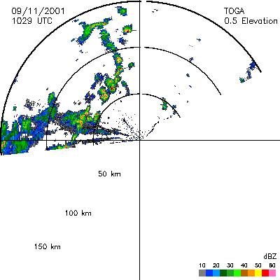
CAMEX-4 TOGA RADAR V1
National Aeronautics and Space Administration —
The TOGA radar dataset consists of browse and radar data collected from the TOGA radar during the CAMEX-4 experiment. TOGA is a C-band linear polarized doppler radar... -
Federal
Standing Crop & Nitrogen Content (FIFE)
National Aeronautics and Space Administration —
Biomass weight & nitrogen content for plants collected along transects & dried -
Federal
Eddy Corr. Surface Flux: GSFC (FIFE)
National Aeronautics and Space Administration —
Surface flux measurements by eddy correlation technique during FIFE -
Federal
Satellite Landsat TM Extr. Data (FIFE)
National Aeronautics and Space Administration —
Site reflectances extracted from Landsat TM imagery over FIFE study area -
Federal
Bowen Ratio Surface Flux: USGS (FIFE)
National Aeronautics and Space Administration —
Surface flux measurements by Bowen Ratio technique during FIFE -
Federal
Bowen Ratio Surface Flux: GSFC (FIFE)
National Aeronautics and Space Administration —
Surface flux measurements by Bowen Ratio technique during FIFE -
Federal
BOREAS TF-11 SSA-Fen 1995 Leaf Area Index Data
National Aeronautics and Space Administration —
Contains the TF-11 Leaf Area Index (LAI) data collected at the SSA Fen site. -
Federal
BOREAS TGB-09 Above-canopy NMHC at SSA-OBS, SSA-OJP and SSA-OA Sites
National Aeronautics and Space Administration —
Contains the mixing ratio and concentration of Non-Methane HydroCarbons (NMHC) taken by the TGB-09 group. -
Federal
BOREAS TE-08 Aspen Bark Chemistry Data
National Aeronautics and Space Administration —
Contains bark biochemical data collected by TE-08.

Official websites use .gov
A
.gov website belongs to an official government
organization in the United States.
Secure .gov websites use HTTPS
A
lock (
) or https:// means you’ve safely connected to
the .gov website. Share sensitive information only on official,
secure websites.