
-
Federal
GHRSST Level 3C North Atlantic Regional (NAR) subskin Sea Surface Temperature from Metop/AVHRR (GDS V2) produced by OSI SAF recent views
National Aeronautics and Space Administration —
A Group for High Resolution Sea Surface Temperature (GHRSST) dataset for the North Atlantic Region (NAR) derived from the Advanced Very High Resolution Radiometer... -
Federal
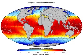
GHRSST Level 4 MW_OI Global Foundation Sea Surface Temperature analysis version 5.1 from REMSS recent views
National Aeronautics and Space Administration —
A Group for High Resolution Sea Surface Temperature (GHRSST) global Level 4 sea surface temperature analysis produced daily on a 0.25-degree grid at Remote Sensing... -
Federal
GHRSST L3C NOAA/ACSPO Himawari-09 AHI Pacific Ocean Region Sea Surface Temperature v2.90 dataset recent views
National Aeronautics and Space Administration —
The H09-AHI-L2P-ACSPO-v2.90 dataset contains the Subskin Sea Surface Temperature (SST) produced by the NOAA ACSPO system from the Advanced Himawari Imager (AHI;... -
Federal
GHRSST L2P NOAA/ACSPO Himawari-09 AHI Pacific Ocean Region Sea Surface Temperature v2.90 dataset recent views
National Aeronautics and Space Administration —
The H09-AHI-L2P-ACSPO-v2.90 dataset contains the Subskin Sea Surface Temperature (SST) produced by the NOAA ACSPO system from the Advanced Himawari Imager (AHI;... -
Federal
GHRSST Level 2P Atlantic Regional Skin Sea Surface Temperature from the Spinning Enhanced Visible and InfraRed Imager (SEVIRI) on the Meteosat Second Generation (MSG-3) satellite (GDS version 2) recent views
National Aeronautics and Space Administration —
The Meteosat Second Generation (MSG-3) satellites are spin stabilized geostationary satellites operated by the European Organization for the Exploitation of... -
Federal
GHRSST Level 2P Global Sea Surface Temperature v2.0 from the AVHRR on the MetOp-C satellite produced by NAVO recent views
National Aeronautics and Space Administration —
A global Group for High Resolution Sea Surface Temperature (GHRSST) Level 2P data set containing multi-channel Sea Surface Temperature (SST) retrievals derived in... -
Federal
GHRSST Level 2P Global Sea Surface Temperature v2.0 from the AVHRR on the MetOp-B satellite produced by NAVO recent views
National Aeronautics and Space Administration —
A global Group for High Resolution Sea Surface Temperature (GHRSST) Level 2P data set containing multi-channel Sea Surface Temperature (SST) retrievals derived in... -
Federal
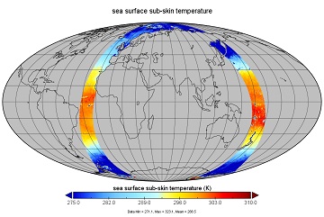
GHRSST Level 3U Global Subskin Sea Surface Temperature from the Advanced Scanning Microwave Radiometer - Earth Observing System (AMSR-E) on the NASA Aqua Satellite recent views
National Aeronautics and Space Administration —
The Advanced Microwave Scanning Radiometer (AMSR-E) was launched on 4 May 2002, aboard NASA's Aqua spacecraft. The National Space Development Agency of Japan (NASDA)... -
Federal
GHRSST Level 2P 1 m Depth Global Sea Surface Temperature from VIIRS on Suomi NPP (GDS2) V1 recent views
National Aeronautics and Space Administration —
A global Group for High Resolution Sea Surface Temperature (GHRSST) Level 2P dataset based on retrievals from the Visible Infrared Imaging Radiometer Suite (VIIRS).... -
Federal
GHRSST Level 2P Regional 1m Sea Surface Temperature from the Advanced Very High Resolution Radiometer (AVHRR) on the NOAA-19 satellite produced by NAVO recent views
National Aeronautics and Space Administration —
A regional Group for High Resolution Sea Surface Temperature (GHRSST) Level 2P dataset based on multi-channel sea surface temperature (SST) retrievals generated in... -
Federal
GHRSST Level 2P Global skin Sea Surface Temperature from the Infrared Atmospheric Sounding Interferometer (IASI) on the Metop-B satellite (GDS V2) produced by OSI SAF recent views
National Aeronautics and Space Administration —
A Group for High Resolution Sea Surface Temperature (GHRSST) Level 2P dataset based on multi-channel sea surface temperature (SST) retrievals generated in real-time... -
Federal
MODIS Terra Level 3 SST Thermal IR Daily 4km Daytime V2019.0 NGDA recent views
National Aeronautics and Space Administration —
Day and night spatially gridded (L3) global NASA skin sea surface temperature (SST) products from the Moderate-resolution Imaging Spectroradiometer (MODIS) onboard... -
Federal
QuikSCAT ESDR Level 2 Modeled Ocean Surface Auxiliary Fields Version 1.0 recent views
National Aeronautics and Space Administration —
This dataset contains the first provisional release of the MEaSUREs-funded Earth Science Data Record (ESDR) of ancillary data corresponding to the QuikSCAT Level 2... -
Federal
GHRSST Level 3C North Atlantic Regional (NAR) subskin Sea Surface Temperature from SNPP/VIIRS and Metop-A/AVHRR (GDS V2) produced by OSI SAF recent views
National Aeronautics and Space Administration —
A Group for High Resolution Sea Surface Temperature (GHRSST) dataset for the North Atlantic Region (NAR) derived from the Advanced Very High Resolution Radiometer... -
Federal
Aquarius Official Release Level 3 Ancillary Reynolds Sea Surface Temperature Standard Mapped Image Descending Seasonal Climatology Data V5.0 recent views
National Aeronautics and Space Administration —
Aquarius Level 3 ancillary sea surface temperature (SST) standard mapped image data are the ancillary SST data used in the Aquarius calibration for salinity... -
Federal
GHRSST Level 2P 1 m Depth Global Sea Surface Temperature version 3.0 from the Visible Infrared Imaging Radiometer Suite (VIIRS) on the Suomi NPP satellite (GDS2) recent views
National Aeronautics and Space Administration —
A global Group for High Resolution Sea Surface Temperature (GHRSST) Level 2P dataset based on retrievals from the Visible Infrared Imaging Radiometer Suite (VIIRS).... -
Federal
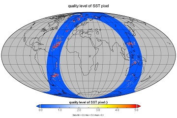
GHRSST Level 2P Global Near-Real-Time Subskin Sea Surface Temperature version 8.2 (v8.2) from the Advanced Microwave Scanning Radiometer 2 (AMSR2) on the GCOM-W satellite by REMSS recent views
National Aeronautics and Space Administration —
This product provides a near-real-time (NRT) Level-2 Sea Surface Temperature (SST) (identified by "rt" within the file name) for the Group for High Resolution Sea... -
Federal
SWOT 2019-2020 Prelaunch Oceanography Field Campaign NOAA Prawlers recent views
National Aeronautics and Space Administration —
This dataset provides the conductivity, temperature and depth (CTD) profiles from a Prawler profiler mooring deployed by the SWOT prelaunch field campaign. The... -
Federal
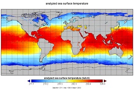
GHRSST Level 4 K10_SST Global 10 km Analyzed Sea Surface Temperature from Naval Oceanographic Office (NAVO) in GDS2.0 recent views
National Aeronautics and Space Administration —
This is a Group for High Resolution Sea Surface Temperature (GHRSST) Level 4 sea surface temperature (SST) analysis dataset produced daily on an operational basis by... -
Federal
GHRSST Level 2P 1 m Depth Global Sea Surface Temperature from VIIRS on Suomi NPP (GDS2) V2 recent views
National Aeronautics and Space Administration —
A global Group for High Resolution Sea Surface Temperature (GHRSST) Level 2P dataset based on retrievals from the Visible Infrared Imaging Radiometer Suite (VIIRS)....

Official websites use .gov
A
.gov website belongs to an official government
organization in the United States.
Secure .gov websites use HTTPS
A
lock (
) or https:// means you’ve safely connected to
the .gov website. Share sensitive information only on official,
secure websites.