
-
Federal
Aquarius Official Release Level 3 Sea Surface Salinity Smoothed Standard Mapped Image Descending Monthly Data V5.0 recent views
National Aeronautics and Space Administration —
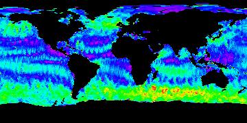
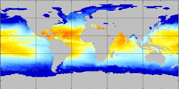
Aquarius Level 3 sea surface salinity (SSS) standard mapped image data contains gridded 1 degree spatial resolution SSS averaged over daily, 7 day, monthly, and... -
Federal
Aquarius Official Release Level 3 Rain-flagged Sea Surface Salinity Smoothed Standard Mapped Image Ascending Monthly Data V5.0 recent views
National Aeronautics and Space Administration —
Aquarius Level 3 sea surface salinity (SSS) standard mapped image data contains gridded 1 degree spatial resolution SSS averaged over daily, 7 day, monthly, and... -
Federal
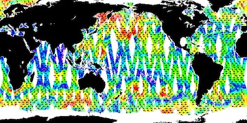
NSCAT Level 3 Daily Gridded Ocean Surface Wind Vector Browse Images (JPL) recent views
National Aeronautics and Space Administration —
This dataset provides browse images of the NASA Scatterometer (NSCAT) Level 3 daily gridded ocean wind vectors, which are provided at 0.5 degree spatial resolution... -
Federal
Aquarius Official Release Level 3 Sea Surface Salinity Standard Mapped Image Ascending Monthly Data V5.0 recent views
National Aeronautics and Space Administration —
Aquarius Level 3 sea surface salinity (SSS) standard mapped image data contains gridded 1 degree spatial resolution SSS averaged over daily, 7 day, monthly, and... -
Federal
Aquarius Official Release Level 3 Sea Surface Salinity Smoothed Standard Mapped Image Monthly Data V5.0 recent views
National Aeronautics and Space Administration —
Aquarius Level 3 sea surface salinity (SSS) standard mapped image data contains gridded 1 degree spatial resolution SSS averaged over daily, 7 day, monthly, and... -
Federal
Aquarius Official Release Level 3 Sea Surface Spiciness Standard Mapped Image Descending Monthly Data V5.0 recent views
National Aeronautics and Space Administration —
Aquarius Level 3 sea surface spiciness standard mapped image data contains gridded 1 degree spatial resolution spice data averaged over daily, 7 day, monthly, and... -
Federal
Aquarius Official Release Level 3 Sea Surface Density Standard Mapped Image Ascending Annual Data V5.0 recent views
National Aeronautics and Space Administration —
Aquarius Level 3 sea surface density standard mapped image data contains gridded 1 degree spatial resolution density data averaged over daily, 7 day, monthly, and... -
Federal
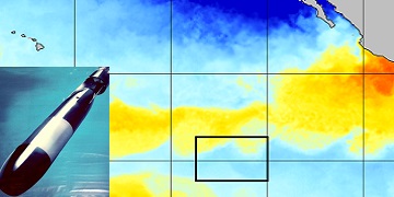
SPURS-2 research vessel Expendable Bathythermograph (XBT) profile data for E. Tropical Pacific R/V Revelle cruises recent views
National Aeronautics and Space Administration —
The SPURS (Salinity Processes in the Upper Ocean Regional Study) project is NASA-funded oceanographic process study and associated field program that aim to elucidate... -
Federal
Aquarius Official Release Level 3 Rain-flagged Sea Surface Salinity Standard Mapped Image Daily Data V5.0 recent views
National Aeronautics and Space Administration —
Aquarius Level 3 sea surface salinity (SSS) rain-flagged standard mapped image data contains gridded 1 degree spatial resolution SSS averaged over daily, 7 day,... -
Federal
Aquarius Official Release Level 3 Wind Speed Standard Mapped Image Ascending 28-Day Running Mean Data V5.0 recent views
National Aeronautics and Space Administration —
Aquarius Level 3 ocean surface wind speed standard mapped image data contains gridded 1 degree spatial resolution wind speed data averaged over daily, 7 day, monthly,... -
Federal
Aquarius Official Release Level 3 Sea Surface Density Standard Mapped Image Descending Seasonal Climatology Data V5.0 recent views
National Aeronautics and Space Administration —
Aquarius Level 3 sea surface density standard mapped image data contains gridded 1 degree spatial resolution density data averaged over daily, 7 day, monthly, and... -
Federal
Aquarius Official Release Level 3 Wind Speed Standard Mapped Image Ascending Seasonal Data V5.0 recent views
National Aeronautics and Space Administration —
Aquarius Level 3 ocean surface wind speed standard mapped image data contains gridded 1 degree spatial resolution wind speed data averaged over daily, 7 day, monthly,... -
Federal
Aquarius Official Release Level 3 Sea Surface Spiciness Standard Mapped Image Descending Daily Data V5.0 recent views
National Aeronautics and Space Administration —
Aquarius Level 3 sea surface spiciness standard mapped image data contains gridded 1 degree spatial resolution spice data averaged over daily, 7 day, monthly, and... -
Federal
Aquarius Official Release Level 3 Wind Speed Standard Mapped Image Mission Cumulative V5.0 recent views
National Aeronautics and Space Administration —
Aquarius Level 3 ocean surface wind speed standard mapped image data contains gridded 1 degree spatial resolution wind speed data averaged over daily, 7 day, monthly,... -
Federal
Aquarius Official Release Level 3 Sea Surface Spiciness Standard Mapped Image Descending 28-Day Running Mean Data V5.0 recent views
National Aeronautics and Space Administration —
Aquarius Level 3 sea surface spiciness standard mapped image data contains gridded 1 degree spatial resolution spice data averaged over daily, 7 day, monthly, and... -
Federal
Aquarius Official Release Level 3 Wind Speed Standard Mapped Image Descending Monthly Data V5.0 recent views
National Aeronautics and Space Administration —
Aquarius Level 3 ocean surface wind speed standard mapped image data contains gridded 1 degree spatial resolution wind speed data averaged over daily, 7 day, monthly,... -
Federal
Aquarius Official Release Level 3 Sea Surface Density Standard Mapped Image Seasonal Climatology Data V5.0 recent views
National Aeronautics and Space Administration —
Aquarius Level 3 sea surface density standard mapped image data contains gridded 1 degree spatial resolution derived density averaged over daily, 7 day, monthly, and... -
Federal
Aquarius Official Release Level 3 Wind Speed Standard Mapped Image Descending 7-Day Data V5.0 recent views
National Aeronautics and Space Administration —
Aquarius Level 3 ocean surface wind speed standard mapped image data contains gridded 1 degree spatial resolution wind speed data averaged over daily, 7 day, monthly,... -
Federal
Aquarius Official Release Level 3 Sea Surface Density Standard Mapped Image 7-Day Data V5.0 recent views
National Aeronautics and Space Administration —
Aquarius Level 3 sea surface density standard mapped image data contains gridded 1 degree spatial resolution derived density averaged over daily, 7 day, monthly, and... -
Federal
Aquarius Official Release Level 3 Wind Speed Standard Mapped Image Ascending Daily Data V5.0 recent views
National Aeronautics and Space Administration —
Aquarius Level 3 ocean surface wind speed standard mapped image data contains gridded 1 degree spatial resolution wind speed data averaged over daily, 7 day, monthly,...

Official websites use .gov
A
.gov website belongs to an official government
organization in the United States.
Secure .gov websites use HTTPS
A
lock (
) or https:// means you’ve safely connected to
the .gov website. Share sensitive information only on official,
secure websites.