
-
Federal
GLDAS Noah Land Surface Model L4 monthly 0.25 x 0.25 degree V2.0 (GLDAS_NOAH025_M) at GES DISC
National Aeronautics and Space Administration —
NASA Global Land Data Assimilation System Version 2 (GLDAS-2) has three components: GLDAS-2.0, GLDAS-2.1, and GLDAS-2.2. GLDAS-2.0 is forced entirely with the... -
Federal
GLDAS Catchment Land Surface Model L4 daily 0.25 x 0.25 degree V2.0 (GLDAS_CLSM025_D) at GES DISC
National Aeronautics and Space Administration —
NASA Global Land Data Assimilation System Version 2 (GLDAS-2) has three components: GLDAS-2.0, GLDAS-2.1, and GLDAS-2.2. GLDAS-2.0 is forced entirely with the... -
Federal
FLDAS Noah Land Surface Model L4 Global Monthly 0.1 x 0.1 degree (MERRA-2 and CHIRPS) V001 (FLDAS_NOAH01_C_GL_M) at GES DISC
National Aeronautics and Space Administration —
This dataset contains a series of land surface parameters simulated from the Noah 3.6.1 model in the Famine Early Warning Systems Network (FEWS NET) Land Data... -
Federal
GLDAS Noah Land Surface Model L4 monthly 0.25 x 0.25 degree V2.1 (GLDAS_NOAH025_M) at GES DISC
National Aeronautics and Space Administration —
NASA Global Land Data Assimilation System Version 2 (GLDAS-2) has three components: GLDAS-2.0, GLDAS-2.1, and GLDAS-2.2. GLDAS-2.0 is forced entirely with the... -
Federal
FLDAS Noah Land Surface Model L4 Global Monthly Anomaly 0.1 x 0.1 degree (MERRA-2 and CHIRPS) V001 (FLDAS_NOAH01_C_GL_MA) at GES DISC
National Aeronautics and Space Administration —
The monthly anomaly data set contains a series of land surface parameters simulated from the Noah 3.6.1 model in the Famine Early Warning Systems Network (FEWS NET)... -
Federal
FLDAS Noah Land Surface Model L4 Global Monthly 0.1 x 0.1 degree (GDAS and CHIRPS-PRELIM) V001 (FLDAS_NOAH01_CP_GL_M) at GES DISC
National Aeronautics and Space Administration —
This dataset contains a series of land surface parameters simulated from the Noah 3.6.1 model in the Famine Early Warning Systems Network (FEWS NET) Land Data... -
Federal
BOREAS Follow-On FLX-01 NSA-OBS Tower Flux, Meteorological, and Soil Temp. Data
National Aeronautics and Space Administration —
The BOREAS Follow-On FLX-01 team collected tower flux, surface meteorological, and soil temperature data at the BOREAS NSA-OBS site continuously from March 1994... -
Federal
GLDAS CLM Land Surface Model L4 3 hourly 1.0 x 1.0 degree Subsetted V001 (GLDAS_CLM10SUBP_3H) at GES DISC
National Aeronautics and Space Administration —
With the upgraded Land Surface Models (LSMs) and updated forcing data sets, the GLDAS version 2.1 (GLDAS-2.1) production stream serves as a replacement for GLDAS-001.... -
Federal
BOREAS TF-03 NSA-OBS Tower Flux, Meteorological, and Soil Temperature Data
National Aeronautics and Space Administration —
The flux and ancillary data collected at the NSA-OBS tower flux site by the TF-03 group. -
Federal
GLDAS Catchment Land Surface Model L4 daily 0.25 x 0.25 degree GRACE-DA1 V2.2 (GLDAS_CLSM025_DA1_D_EP) at GES DISC
National Aeronautics and Space Administration —
NASA Global Land Data Assimilation System Version 2 (GLDAS-2) has three components: GLDAS-2.0, GLDAS-2.1, and GLDAS-2.2. GLDAS-2.0 is forced entirely with the... -
Federal
BOREAS/SRC AMS Suite A Surface Meteorological and Radiation Data: 1996
National Aeronautics and Space Administration —
Contains the data collected in 1996 by the AMS suite A instrument set operated by SRC and provided to BORIS. -
Federal
BOREAS TGB-05 Biogenic Soil Emissions of NO and Nitrous Oxide
National Aeronautics and Space Administration —
Contains the TGB-05 NO and N2O flux data for sites in the Northern Study Area. -
Federal
ABoVE: Synthesis of Burned and Unburned Forest Site Data, AK and Canada, 1983-2016
National Aeronautics and Space Administration —
This dataset is a synthesis of field plot characterization data, derived above-ground and below-ground combusted carbon, and acquired Fire Weather Index (FWI) System... -
Federal
GLDAS Noah Land Surface Model L4 3 hourly 1.0 x 1.0 degree V2.1 (GLDAS_NOAH10_3H) at GES DISC
National Aeronautics and Space Administration —
NASA Global Land Data Assimilation System Version 2 (GLDAS-2) has three components: GLDAS-2.0, GLDAS-2.1, and GLDAS-2.2. GLDAS-2.0 is forced entirely with the... -
Federal
BOREAS TE-06 1994 Soil and Air Temperatures in the NSA
National Aeronautics and Space Administration —
Contains soil temperature data collected by TE-06 during the BOREAS project. -
Federal
WLDAS Noah-MP 3.6 Land Surface Model L4 Daily 0.01 degree x 0.01 degree Version D1.0 (WLDAS_NOAHMP001_DA1) at GES DISC
National Aeronautics and Space Administration —
The Western Land Data Assimilation System (WLDAS), developed at Goddard Space Flight Center (GSFC) and funded by the NASA Western Water Applications Office, provides... -
Federal
GLDAS Catchment Land Surface Model L4 monthly 1.0 x 1.0 degree V2.1 (GLDAS_CLSM10_M) at GES DISC
National Aeronautics and Space Administration —
NASA Global Land Data Assimilation System Version 2 (GLDAS-2) has three components: GLDAS-2.0, GLDAS-2.1, and GLDAS-2.2. GLDAS-2.0 is forced entirely with the... -
Federal
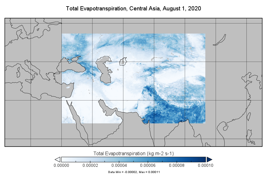
FLDAS2 Noah-MP GDAS Land Surface Model L4 Central Asia Daily 0.01 degree x 0.01 degree V001 (FLDAS_NOAHMP001_G_CA_D)
National Aeronautics and Space Administration —
This dataset contains a series of land surface parameters simulated from the Noah 3.6.1 model in the Famine Early Warning Systems Network (FEWS NET) Land Data... -
Federal
NLDAS Noah Land Surface Model L4 Monthly 0.125 x 0.125 degree V2.0 (NLDAS_NOAH0125_M) at GES DISC
National Aeronautics and Space Administration —
This data set contains fifty-two fields simulated from the Noah land-surface model (LSM) for Phase 2 of the North American Land Data Assimilation System (NLDAS-2).... -
Federal
Bowen Ratio Surface Flux: UNL (FIFE)
National Aeronautics and Space Administration —
Latent & sensible heat flux by Bowen Ratio & aerodynamic characterization of vegetation

Official websites use .gov
A
.gov website belongs to an official government
organization in the United States.
Secure .gov websites use HTTPS
A
lock (
) or https:// means you’ve safely connected to
the .gov website. Share sensitive information only on official,
secure websites.