
-
Federal
CYGNSS Level 1 Raw Intermediate Frequency Data Record recent views
National Aeronautics and Space Administration —
This Level 1 (L1) dataset contains the Raw Intermediate Frequency (IF) sensor data from the Delay Doppler Mapping Instrument aboard the CYGNSS satellite... -
Federal
SPURS-2 Passive Accoustic Listener (PAL) data from ARGO float deployments during the E. Tropical Pacific field campaign recent views
National Aeronautics and Space Administration —
The SPURS (Salinity Processes in the Upper Ocean Regional Study) project is a NASA-funded oceanographic process study and associated field program that aim to... -
Federal
JPL TELLUS GRACE-FO Level-3 Monthly Land Water-Equivalent-Thickness Surface Mass Anomaly Release 6.1 version 04 recent views
National Aeronautics and Space Administration —
The monthly land mass grids contain water mass anomalies given as equivalent water thickness derived from GRACE & GRACE-FO time-variable gravity observations... -
Federal
CSR TELLUS GRACE-FO Level-3 Monthly Ocean Bottom Pressure Anomaly Release 6.1 version 04 recent views
National Aeronautics and Space Administration —
The monthly ocean bottom pressure anomaly grids are given as equivalent water thickness changes derived from GRACE & GRACE-FO time-variable gravity observations... -
Federal
NSCAT Gridded Level 3 Enhanced Resolution Sigma-0 from BYU recent views
National Aeronautics and Space Administration —
This NASA Scatterometer (NSCAT) satellite Sigma-0 dataset is generated by the Scatterometer Climate Record Pathfinder (SCP) project at Brigham Young University (BYU)... -
Federal
GHRSST Level 3C North Atlantic Regional (NAR) subskin Sea Surface Temperature from Metop/AVHRR (GDS V2) produced by OSI SAF recent views
National Aeronautics and Space Administration —
A Group for High Resolution Sea Surface Temperature (GHRSST) dataset for the North Atlantic Region (NAR) derived from the Advanced Very High Resolution Radiometer... -
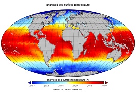
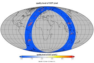
Federal
GHRSST Level 4 MW_OI Global Foundation Sea Surface Temperature analysis version 5.1 from REMSS recent views
National Aeronautics and Space Administration —
A Group for High Resolution Sea Surface Temperature (GHRSST) global Level 4 sea surface temperature analysis produced daily on a 0.25-degree grid at Remote Sensing... -
Federal
OSCAR third degree resolution ocean surface currents - yearly files recent views
National Aeronautics and Space Administration —
OSCAR (Ocean Surface Current Analysis Real-time) contains near-surface ocean current estimates, derived using quasi-linear and steady flow momentum equations. The... -
Federal
SWOT Simulated Level 2 North America Continent KaRIn High Rate Pixel Cloud Vector Attribute Product Version 1.0 recent views
National Aeronautics and Space Administration —
This dataset provides a simulated water surface elevation product that resembles the Ka-band Interferometer (KaRIn) measurements by the Surface Water and Ocean... -
Federal
Aquarius CAP Level 2 Sea Surface Salinity, Wind Speed & Direction Data V5.0 recent views
National Aeronautics and Space Administration —
The version 5.0 Aquarius CAP Level 2 product contains the fourth release of the AQUARIUS/SAC-D orbital/swath data based on the Combined Active Passive (CAP)... -
Federal
GFZ TELLUS GRACE-FO Level-3 Monthly Land Water-Equivalent-Thickness Surface Mass Anomaly Release 6.1 version 04 recent views
National Aeronautics and Space Administration —
The monthly land mass grids contain water mass anomalies given as equivalent water thickness derived from GRACE & GRACE-FO time-variable gravity observations... -
Federal
GHRSST L3C NOAA/ACSPO Himawari-09 AHI Pacific Ocean Region Sea Surface Temperature v2.90 dataset recent views
National Aeronautics and Space Administration —
The H09-AHI-L2P-ACSPO-v2.90 dataset contains the Subskin Sea Surface Temperature (SST) produced by the NOAA ACSPO system from the Advanced Himawari Imager (AHI;... -
Federal
S-MODE MASS Level 1 LWIR Version 1 recent views
National Aeronautics and Space Administration —
NOTICE: This dataset is currently undergoing maintenance to be repackaged as zip files of flight lines. The file count will decrease dramatically when new zip files... -
Federal
GRACE-FO Level-1B Release version 4.0 from JPL in ASCII recent views
National Aeronautics and Space Administration —
FOR EXPERT USE ONLY. The GRACE-FO Level-1B data provide all necessary inputs to derive monthly time variations in the Earth gravity field. Level-1B data are also used... -
Federal
GHRSST L2P NOAA/ACSPO Himawari-09 AHI Pacific Ocean Region Sea Surface Temperature v2.90 dataset recent views
National Aeronautics and Space Administration —
The H09-AHI-L2P-ACSPO-v2.90 dataset contains the Subskin Sea Surface Temperature (SST) produced by the NOAA ACSPO system from the Advanced Himawari Imager (AHI;... -
Federal
GHRSST Level 2P Atlantic Regional Skin Sea Surface Temperature from the Spinning Enhanced Visible and InfraRed Imager (SEVIRI) on the Meteosat Second Generation (MSG-3) satellite (GDS version 2) recent views
National Aeronautics and Space Administration —
The Meteosat Second Generation (MSG-3) satellites are spin stabilized geostationary satellites operated by the European Organization for the Exploitation of... -
Federal
CYGNSS Level 2 Climate Data Record Version 1.0 recent views
National Aeronautics and Space Administration —
This dataset contains the Version 1.0 CYGNSS Level 2 Climate Data Record which provides the time-tagged and geolocated average wind speed (m/s) and mean square slope... -
Federal
GHRSST Level 2P Global Sea Surface Temperature v2.0 from the AVHRR on the MetOp-C satellite produced by NAVO recent views
National Aeronautics and Space Administration —
A global Group for High Resolution Sea Surface Temperature (GHRSST) Level 2P data set containing multi-channel Sea Surface Temperature (SST) retrievals derived in... -
Federal
Sentinel-6A MF Jason-CS L2 P4 Altimeter Low Resolution (LR) STC Reduced Ocean Surface Topography recent views
National Aeronautics and Space Administration —
Provides low resolution (LR) short time critical (STC; 36-hour latency) measurements of sea surface height anomaly (SSHA), Significant Wave Height (SWH), and Wind... -
Federal
GHRSST Level 2P Global Sea Surface Temperature v2.0 from the AVHRR on the MetOp-B satellite produced by NAVO recent views
National Aeronautics and Space Administration —
A global Group for High Resolution Sea Surface Temperature (GHRSST) Level 2P data set containing multi-channel Sea Surface Temperature (SST) retrievals derived in...

Official websites use .gov
A
.gov website belongs to an official government
organization in the United States.
Secure .gov websites use HTTPS
A
lock (
) or https:// means you’ve safely connected to
the .gov website. Share sensitive information only on official,
secure websites.