

16 datasets found for "Satellite"
-
Federal
INGENIOUS - Great Basin Regional Dataset Compilation
Department of Energy —
This is the regional dataset compilation for the INnovative Geothermal Exploration through Novel Investigations Of Undiscovered Systems (INGENIOUS) project. The... -
Federal
Typical Solar Years (TSYs) and Typical Wind Years (TWYs) for the Assessment of PV System and Wind Turbine Performance
Department of Energy —
This dataset comprises Typical Solar Years (TSYs) and Typical Wind Years (TWYs) for the efficient assessment of PV system and wind turbine performance for over 2,000... -
Federal
Fallon FORGE: Geodetic Data
Department of Energy —
Fallon FORGE InSAR and geodetic GPS deformation data. InSAR shapefiles are packaged together as .MPK (ArcMap map package, compatible with other GIS platforms), and as... -
Federal
Remotely Sensed Thermal Anomalies in Western Colorado
Department of Energy —
This layer contains the areas identified as areas of anomalous surface temperature from Landsat satellite imagery in Western Colorado. Data was obtained for two... -
Federal
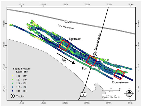
Triton Field Trials (TFiT) underwater noise - University of New Hampshire Living Bridge turbine Processed Data
Department of Energy —
In July 2021, a commercial-off-the-shelf hydrophone was deployed in a free-drifting configuration to measure underwater acoustic emissions and characterize a 25 kW-... -
Federal
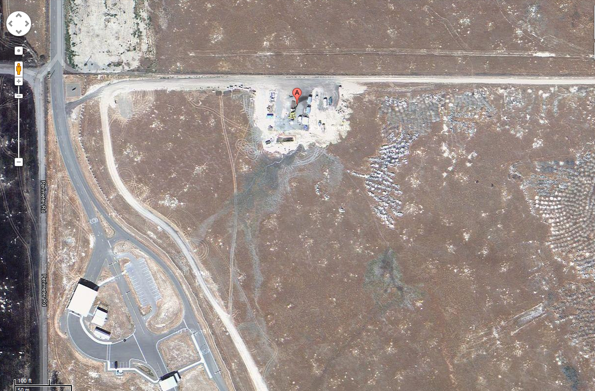
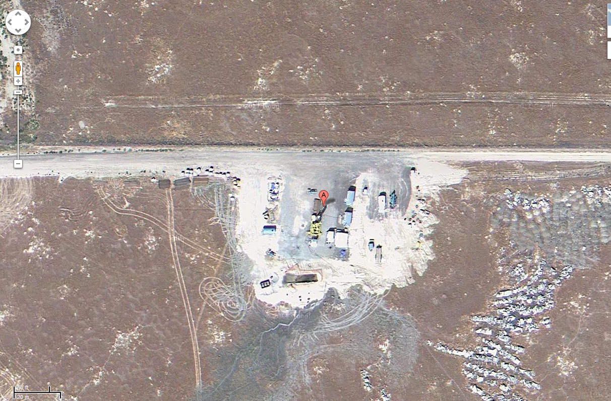
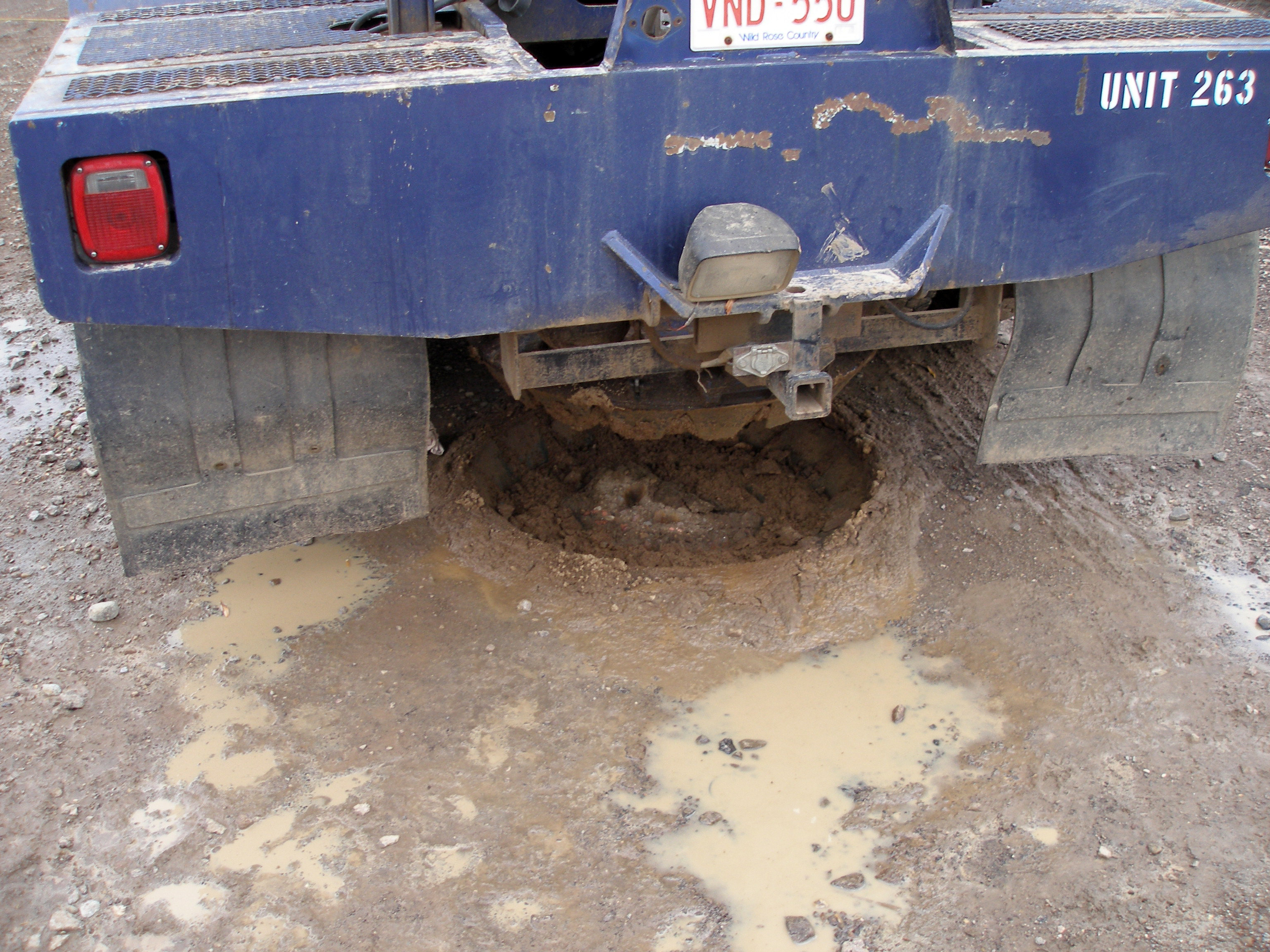
Project HOTSPOT: Mountain Home Well Core and Drill Site Photos
Department of Energy —
The Snake River Plain (SRP), Idaho, hosts potential geothermal resources due to elevated groundwater temperatures associated with the thermal anomaly Yellowstone-... -
Federal
Utah FORGE: InSAR Data 2019
Department of Energy —
This dataset contains Interferometric Synthetic Aperture Radar (InSAR) data used for ground deformation monitoring during Phase 2C of the Utah FORGE project. The... -
Federal
ASTER Thermal Anomalies in Western Colorado
Department of Energy —
This layer contains the areas identified as areas of anomalous surface temperature from ASTER satellite imagery. The temperature is calculated using the Emissivity... -
Federal
Topographic and Air-Photo Lineaments in Various Locations Related to Geothermal Exploration in Colorado
Department of Energy —
These line shapefiles trace apparent topographic and air-photo lineaments in various counties in Colorado. It was made in order to identify possible fault and... -
Federal
TEAMER: Raw data and three-year modeled velocity from the upper Kuskokwim River at McGrath, Alaska
Department of Energy —
This dataset from the upper Kuskokwim River at McGrath, Alaska is the result of a recent river resource and siting assessment conducted by the Alaska Center for... -
Federal
Utah FORGE: Phase 3 InSAR Study Results
Department of Energy —
Ground movement is evaluated through analysis of Interferometric Synthetic Aperture Radar (InSAR) interferograms. Results indicate there has been no detectable ground... -
Federal
Sentinel-1 Input Data for PSInSAR Analysis
Department of Energy —
Files used to perform the Persistent Scatterer InSAR analysis with SARPROZ. The data is sourced from ESAs Sentinel-1 project and covers Brady Hot Springs and Desert... -
Federal
Geothermal Target Areas in Colorado as Identified by Remote Sensing Techniques
Department of Energy —
This layer contains the areas identified as targets of potential geothermal activity. The Criteria used to identify the target areas include: hot/warm surface... -
Federal
Bhutan Solar Resources
Department of Energy —
GIS data for Bhutan's direct normal irradiance (DNI), global horizontal irradiance (GHI), and latitude tilt irradiance. Researchers from NREL and the Atmospheric...
16 datasets found for "Satellite"