

5 datasets found for "Relief"
-
Federal
Utility Outage Information
Department of Energy —
Data about power company service areas and their announcements about outages are critical for the effective coordination of resources after disasters, and also for... -
Federal
Location Map
Department of Energy —
Map file package containing shaded relief base with Hot Pot project area, major roads, railroads, and rivers. The inset map shows regional Paleozoic structural elements. -
Federal
Hot Pot Regional Geologic and Surface Feature Map
Department of Energy —
This archive contains an ArcGIS map package file that includes a relief base with the northern Nevada Hot Pot project area, generalized geology, selected mines, and... -
Federal
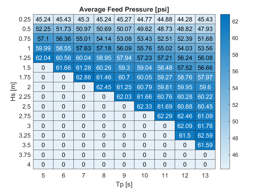
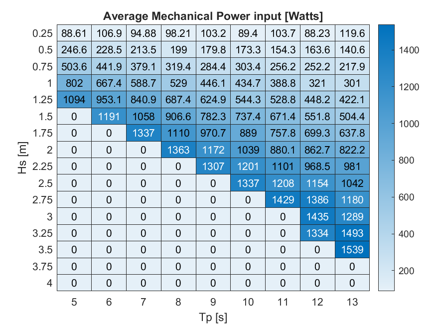
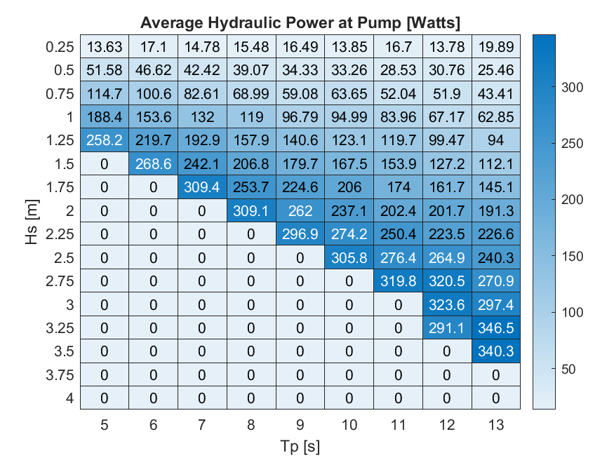
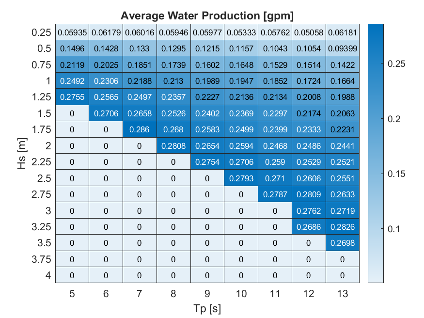
HERO WEC V1.0 - WEC-Sim Detailed Simulation Runs and Summary Data
Department of Energy —
Data sets from simulation runs include 144 wave cases that were run based on the WEC-Sim model (https://mhkdr.openei.org/submissions/483). The 144 wave cases...
5 datasets found for "Relief"