Search datasets
-
Homeland Infrastructure Foundation-Level Data (HIFLD) geospatial data sets containing information on Quaternary Fault Lines.
Search relevance: 112.36 | Views last month: 1 | Catalog Last Checked: September 10, 2026 at 05:46 PM -
This dataset represents structural faults (at the scale of original mapping) and descriptive data and shows the location and type of faults in the state of Oregon. Oregon Geologic Data Compilation - 2009
Search relevance: 80.58 | Views last month: 5 | Catalog Last Checked: September 10, 2026 at 06:42 PM -
This data set is a compilation of faults mapped by the United States Geological Survey (USGS) and published in USGS bulletin series 1028 (1956-1971). These bulletins are the last published...
Search relevance: 54.18 | Views last month: 4 | Catalog Last Checked: August 02, 2026 at 04:59 PM -
This project focused on defining geothermal play fairways and development of a detailed geothermal potential map of a large transect across the Great Basin region (96,000 km2), with the primary...
Search relevance: 46.11 | Views last month: 6 | Catalog Last Checked: October 15, 2026 at 11:01 PM -
This release is an update to the online "Quaternary fault and fold database" for Washington State. The online database was last updated for Washington in 2014 – this 2020 update includes newly...
Search relevance: 42.38 | Views last month: 4 | Catalog Last Checked: September 10, 2026 at 07:55 PM -
The NNW-striking Madison fault zone is approximately 95 km in length, lying at the confluence of the northeast Basin and Range province and the Yellowstone tectonic parabola. The fault zone...
Search relevance: 39.50 | Views last month: 6 | Catalog Last Checked: September 10, 2026 at 09:48 PM -
These data are the basis of the figures in the manuscript "A Wideband magnetoresistive sensor for monitoring dynamic fault slip in laboratory fault friction experiments". That report was the...
Search relevance: 39.33 | Views last month: 1 | Catalog Last Checked: September 10, 2026 at 08:33 PM -
This data release contains two datasets that depict fault rupture on the East Anatolian and Çardak faults resulting from the Mw7.8 and Mw7.5 earthquakes in Turkey (Türkiye). It contains two...
Search relevance: 37.01 | Views last month: 7 | Catalog Last Checked: September 10, 2026 at 10:16 PM -
Field observations of surface rupture extent and fault displacement are critical to improving our understanding of rupture processes in the 6 February 2023 earthquakes in the Kahramanmaraş region...
Search relevance: 36.82 | Views last month: 6 | Catalog Last Checked: September 10, 2026 at 09:51 PM -
PI: Steven G. Wesnousky, University of Nevada, Reno The requested survey area consisted of 1-km wide swaths centered along 335 km of fault centerlines. There were a total of 44 fault segments for...
Search relevance: 36.65 | Views last month: 0 | Catalog Last Checked: September 24, 2026 at 09:06 PM -
PI: Steven G. Wesnousky, University of Nevada, Reno The requested survey area consisted of 1-km wide swaths centered along 335 km of fault centerlines. There were a total of 44 fault segments for...
Search relevance: 36.37 | Views last month: 0 | Catalog Last Checked: September 10, 2026 at 06:15 PM -
NCALM Project. PI: Jacob Selander, University of California, Davis. The original Seed project requested survey area of 40 km2 was defined by two irregular polygons located along the Harper Lake...
Search relevance: 34.91 | Views last month: 1 | Catalog Last Checked: September 10, 2026 at 06:15 PM -
NCALM Project. PI: Jacob Selander, University of California, Davis. The original Seed project requested survey area of 40 km2 was defined by two irregular polygons located along the Harper Lake...
Search relevance: 34.35 | Views last month: 0 | Catalog Last Checked: September 24, 2026 at 09:07 PM -
The Willamette Lowland basin-fill aquifers (hereinafter referred to as the Willamette aquifer) is located in Oregon and in southern Washington. The aquifer is composed of unconsolidated deposits...
Search relevance: 33.22 | Views last month: 1 | Catalog Last Checked: September 10, 2026 at 09:04 PM -
This dataset contains offshore fault geometries for frontal thrust splay faults in the Cascadia Subduction Zone (CSZ) that were mapped and developed for use in 3D ground motion simulations (Dunham...
Search relevance: 33.18 | Views last month: 1 | Catalog Last Checked: September 10, 2026 at 10:20 PM -
We are conducting an inventory of structural settings of geothermal systems (>400 total) in the extensional to transtensional Great Basin region of the western USA. A system of NW-striking dextral...
Search relevance: 31.13 | Views last month: 3 | Catalog Last Checked: October 15, 2026 at 11:01 PM -
This data set is a series of polylines denoting fault lines mapped in USGS Publication MF-1790, "Geologic Map of the Late Cenozoic Deposits of the Sacramento Valley and Northern Sierran Foothills,...
Search relevance: 31.11 | Views last month: 2 | Catalog Last Checked: October 24, 2026 at 08:48 PM -
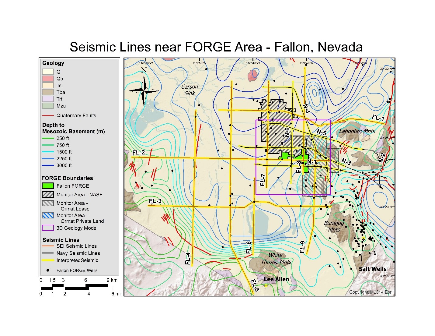
Newly reprocessed Naval Air Station Fallon (1994) seismic lines: pre-stack depth migrations, with interpretations to support the Fallon FORGE (Phase 2B) 3D Geologic model. Data along seven...
Search relevance: 29.91 | Views last month: 0 | Catalog Last Checked: October 15, 2026 at 11:02 PM -
We performed ring shear strength testing of three specimens from a glaciolacustrine silty clay unit involved in a large landslide that occurred March 22, 2014 near the town of Oso, Washington....
Search relevance: 29.12 | Views last month: 2 | Catalog Last Checked: September 10, 2026 at 09:35 PM