Search datasets
-
CA Geographic Boundaries Trending
This dataset contains shapefile boundaries for CA State, counties and places from the US Census Bureau's 2023 MAF/TIGER database. Current geography in the 2023 TIGER/Line Shapefiles generally...
Search relevance: 79.10 | Views last month: 136 | Catalog Last Checked: October 24, 2026 at 08:44 PM -
Link to a interactive map for CA Broadband
Search relevance: 74.82 | Views last month: 6 | Catalog Last Checked: October 24, 2026 at 08:44 PM -
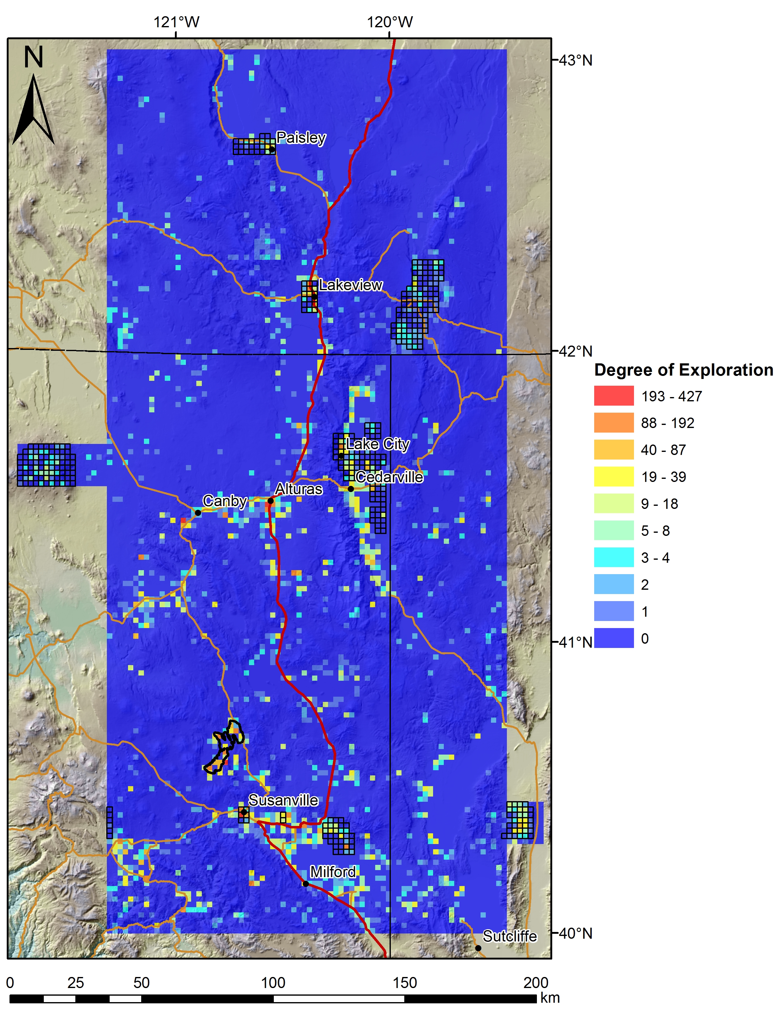
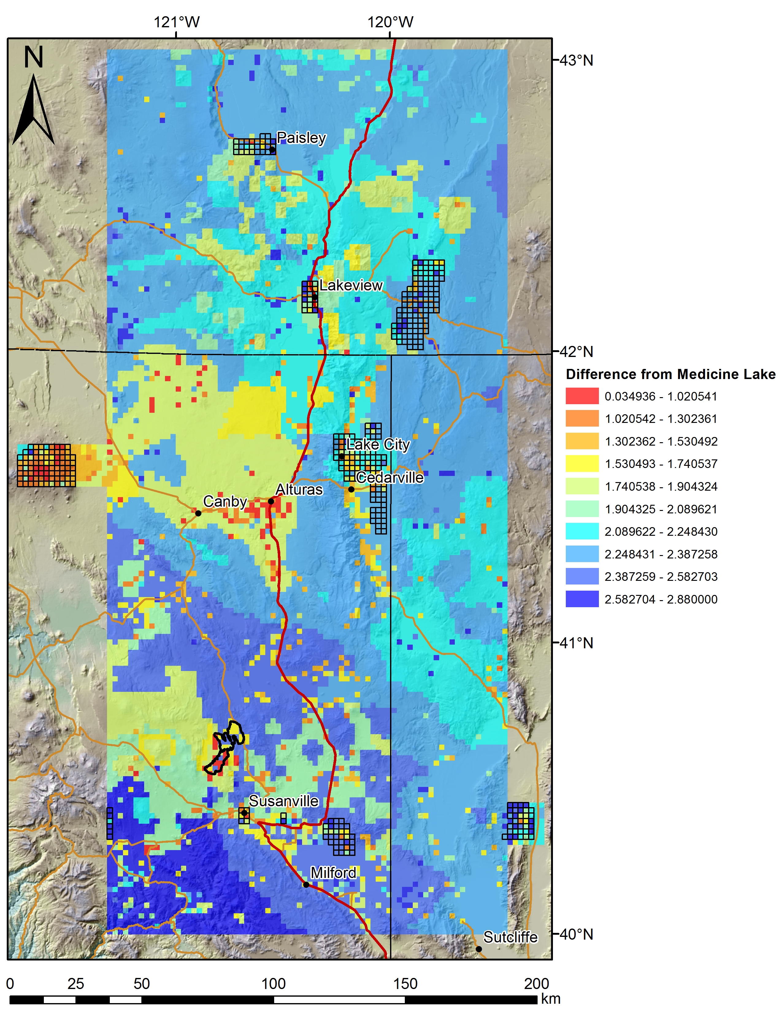
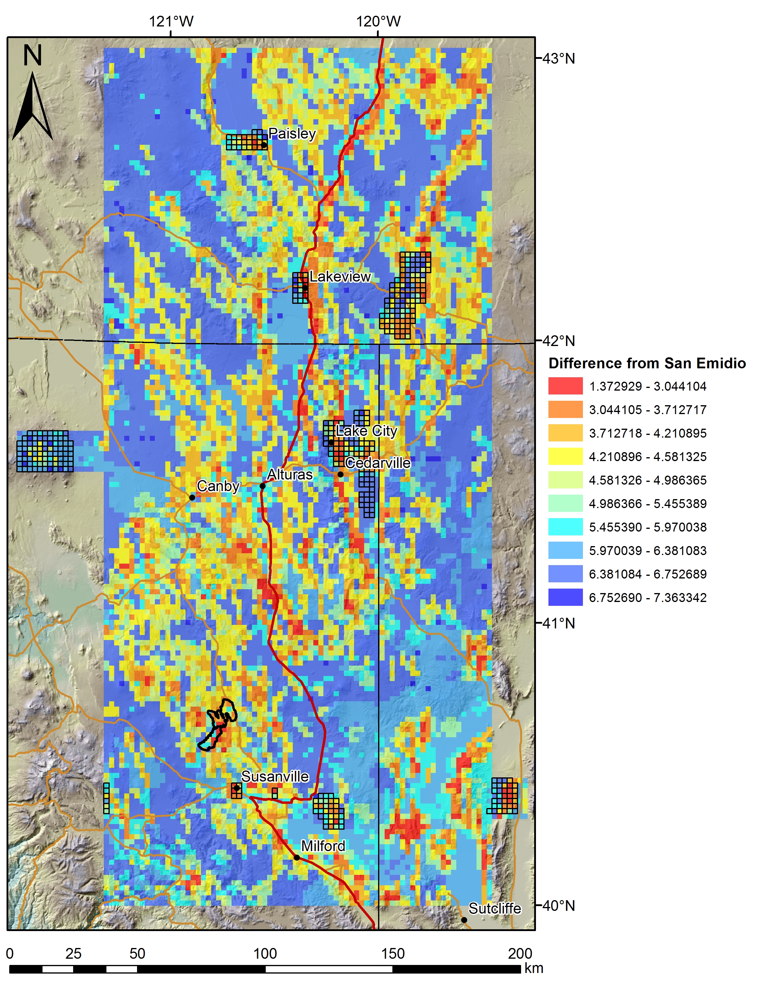
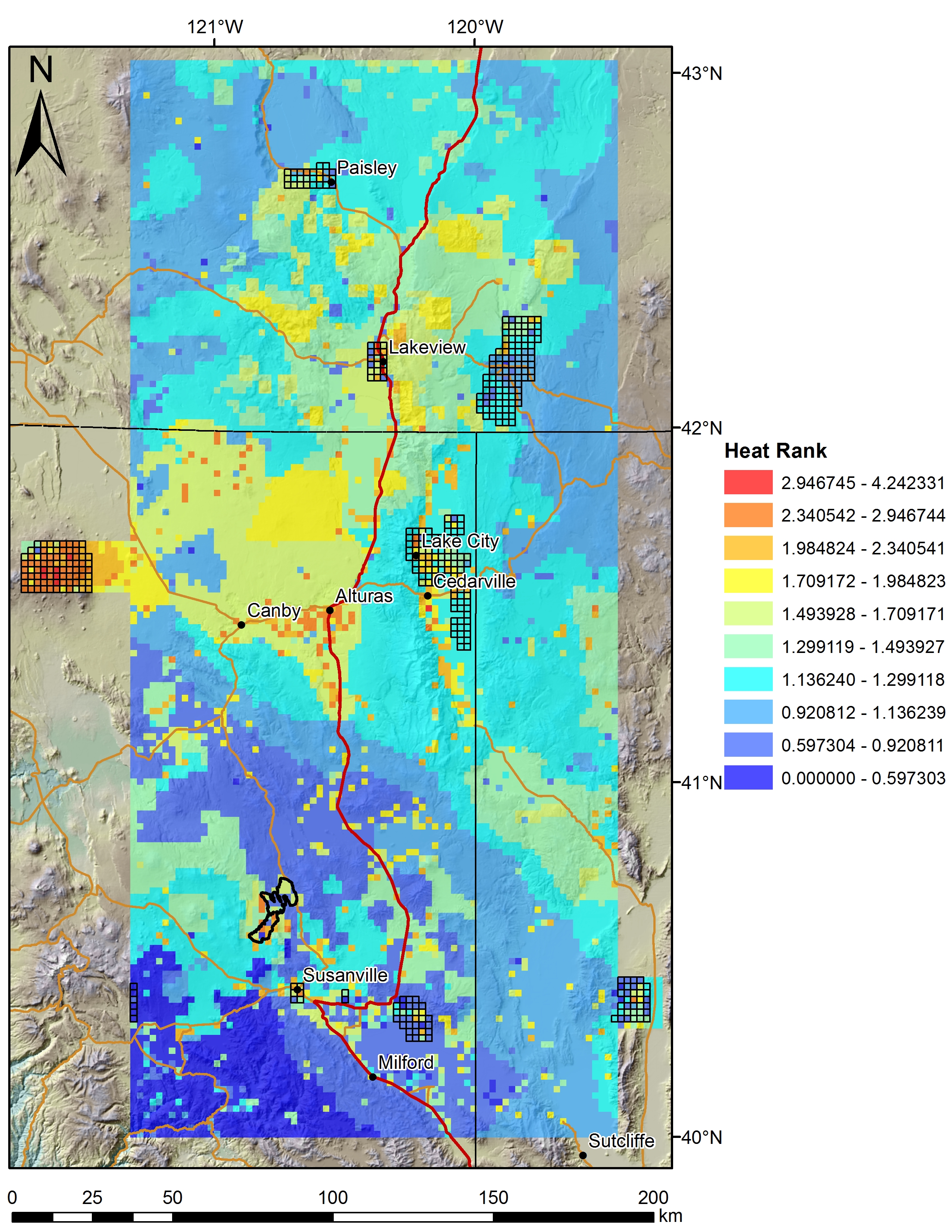
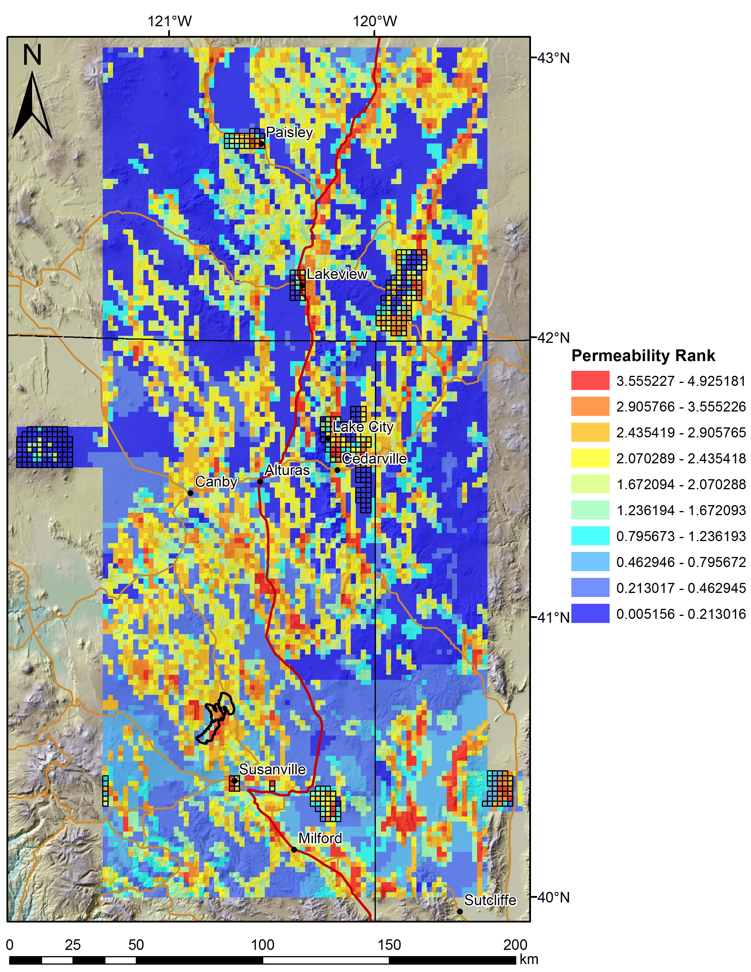
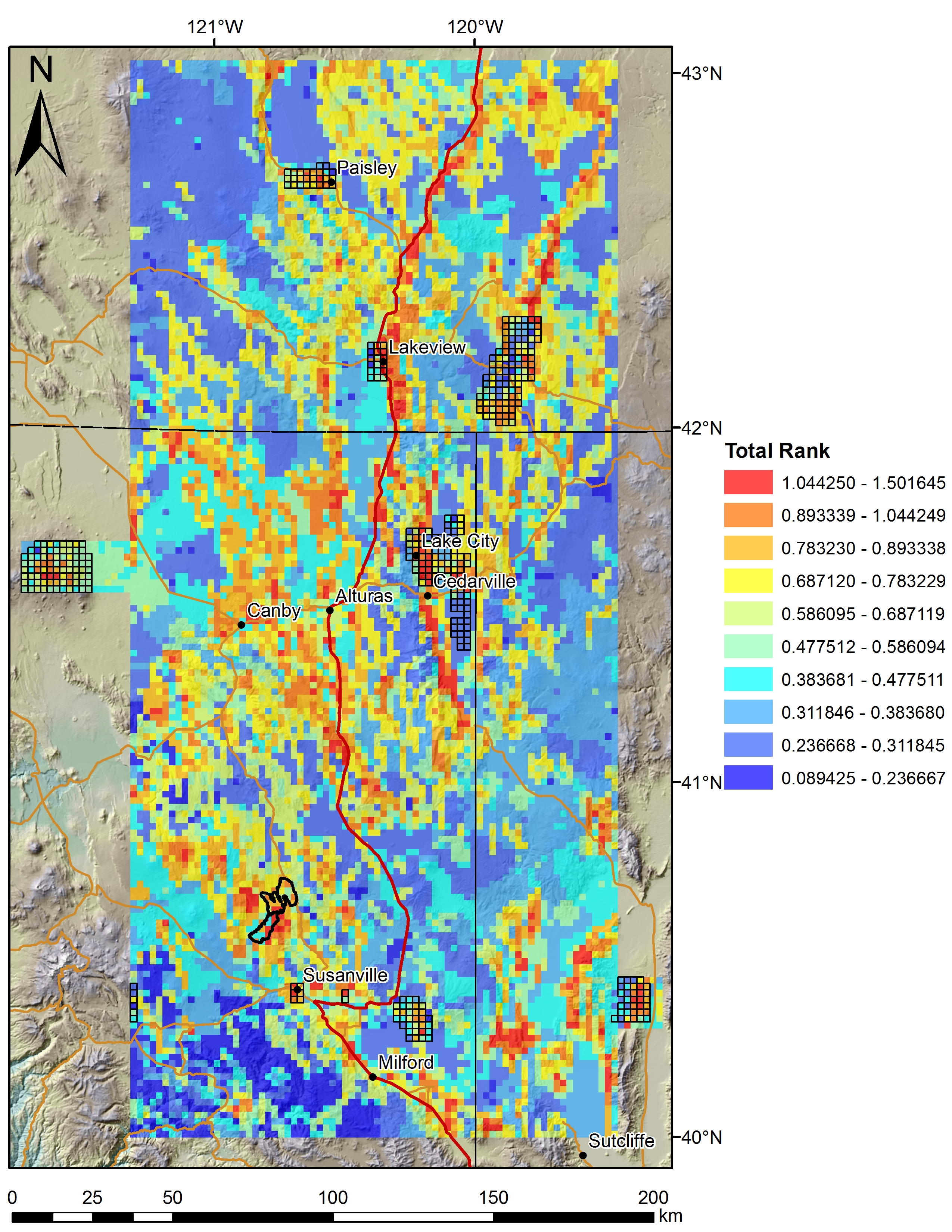
Various data sets displayed on a 2km grid for the Play Fairway Analysis CA-NV-OR area. Grids at 2km, updated from 5km.
Search relevance: 73.99 | Views last month: 3 | Catalog Last Checked: October 15, 2026 at 11:01 PM -
Data was collected in April 2019 for a repeat high resolution mapping of Antelope Valley, CA. Data was collected by NCALM for Dr. William Dietrich at the University of California. Approximately 24...
Search relevance: 70.65 | Views last month: 0 | Catalog Last Checked: September 10, 2026 at 06:15 PM -
Data was collected in April 2019 for a repeat high resolution mapping of Antelope Valley, CA. Data was collected by NCALM for Dr. William Dietrich at the University of California. Approximately 24...
Search relevance: 70.65 | Views last month: 0 | Catalog Last Checked: September 24, 2026 at 09:06 PM -
Tabular aqueous geochemistry data files for the Play Fairway Analysis CA-NV-OR area.
Search relevance: 68.73 | Views last month: 2 | Catalog Last Checked: October 15, 2026 at 11:01 PM -
These data were automated to provide an accurate high-resolution historical shoreline of Coast of CA, Vicinity of Tamalpais Mountain, CA suitable as a geographic information system (GIS) data...
Search relevance: 67.56 | Views last month: 1 | Catalog Last Checked: August 02, 2026 at 04:22 PM -
Timeseries data from '076 - Diablo Canyon, CA (46215)' (076-diablo-canyon-ca-46215)
Search relevance: 67.23 | Views last month: 1 | Catalog Last Checked: October 27, 2026 at 06:15 PM -
These data were automated to provide an accurate high-resolution historical shoreline of Bay Area of CA, Golden Gate Entrance, CA suitable as a geographic information system (GIS) data layer. ...
Search relevance: 66.61 | Views last month: 1 | Catalog Last Checked: August 02, 2026 at 04:22 PM -
Data was collected in March 2017 for high resolution mapping of Antelope Valley Ranch - 60 km west of Yuba City, CA. Data was collected by NCALM for William Dietrich at the University of...
Search relevance: 66.51 | Views last month: 0 | Catalog Last Checked: September 10, 2026 at 06:15 PM -
Timeseries data from 'NAWCWPNS POINT MUGU, CA, CA (KNTD)' (gov_noaa_awc_kntd)
Search relevance: 66.46 | Views last month: 1 | Catalog Last Checked: October 28, 2026 at 01:21 AM -
Data was collected in March 2017 for high resolution mapping of Antelope Valley Ranch - 60 km west of Yuba City, CA. Data was collected by NCALM for William Dietrich at the University of...
Search relevance: 66.35 | Views last month: 0 | Catalog Last Checked: September 24, 2026 at 09:06 PM -
These data were automated to provide an accurate high-resolution historical shoreline of Bay Area of CA, Redwood City to Belmont, CA suitable as a geographic information system (GIS) data layer....
Search relevance: 66.24 | Views last month: 2 | Catalog Last Checked: August 02, 2026 at 04:22 PM -
These data were automated to provide an accurate high-resolution historical shoreline of Bay Area of CA, Golden Gate Entrance, CA suitable as a geographic information system (GIS) data layer. ...
Search relevance: 66.24 | Views last month: 1 | Catalog Last Checked: August 02, 2026 at 04:22 PM -
The California System Performance Measures (CA SPMs) are a series of metrics developed by the California Interagency Council on Homelessness (Cal ICH), pursuant to Health and Safety Code §50220.7,...
Search relevance: 66.00 | Views last month: 3 | Catalog Last Checked: October 24, 2026 at 08:44 PM -
Timeseries data from '067 - San Nicolas Island, CA (46219)' (067-san-nicolas-island-ca-46219)
Search relevance: 65.61 | Views last month: 2 | Catalog Last Checked: October 27, 2026 at 06:15 PM -
Timeseries data from '203 - Santa Cruz Basin, CA (46251)' (203-santa-cruz-basin-ca-46251)
Search relevance: 65.36 | Views last month: 3 | Catalog Last Checked: October 27, 2026 at 06:15 PM -
Timeseries data from '222 - Santa Lucia Escarpment, CA (46259)' (222-santa-lucia-escarpment-ca-46)
Search relevance: 65.36 | Views last month: 2 | Catalog Last Checked: October 27, 2026 at 06:15 PM -
These data were automated to provide an accurate high-resolution historical shoreline of Bay Area of CA, Entrance to San Antonio Creek, CA suitable as a geographic information system (GIS) data...
Search relevance: 65.13 | Views last month: 1 | Catalog Last Checked: August 02, 2026 at 04:23 PM -
These data were automated to provide an accurate high-resolution historical shoreline of Bay Area of CA, Mouth of Petaloma Cr. to Vallejo, CA suitable as a geographic information system (GIS)...
Search relevance: 65.13 | Views last month: 0 | Catalog Last Checked: August 02, 2026 at 04:22 PM