
Search datasets
-
Groundwater-quality data and geophysical information for relatively deep wells (wells generally more than 300 feet deep) containing saline water (dissolved-solids concentrations greater than 2,000...
Search relevance: 1.00 | Views last month: 15 | Catalog Last Checked: May 05, 2026 at 07:53 PM -
The availability of groundwater-quality data along with geophysical information for relatively deep wells (wells generally more than 300 feet deep) containing saline water (dissolved-solids...
Search relevance: 1.00 | Views last month: 14 | Catalog Last Checked: May 05, 2026 at 09:29 PM -
*Back to [Basin Characterization Program webpage](https://data.cnra.ca.gov/dataset/dwr-basin-characterization "Basin Characterization Program webpage")* #Downloads: + ##[Full BCTools package...
Search relevance: 1.00 | Views last month: 4 | Catalog Last Checked: June 26, 2026 at 08:24 PM -
This digital geospatial data set consists of locations of coal, oil, gas and water wells shown as data points in the report, "Structure, Outcrop, and Subcrop of the Bedrock Aquifers Along the...
Search relevance: 1.00 | Views last month: 3 | Catalog Last Checked: July 13, 2026 at 06:59 PM -
Digital surfaces and thicknesses of selected hydrogeologic units of the Floridan aquifer system were developed to define an updated hydrogeologic framework as part of the U.S. Geological Survey...
Search relevance: 1.00 | Views last month: 1 | Catalog Last Checked: July 13, 2026 at 06:57 PM -
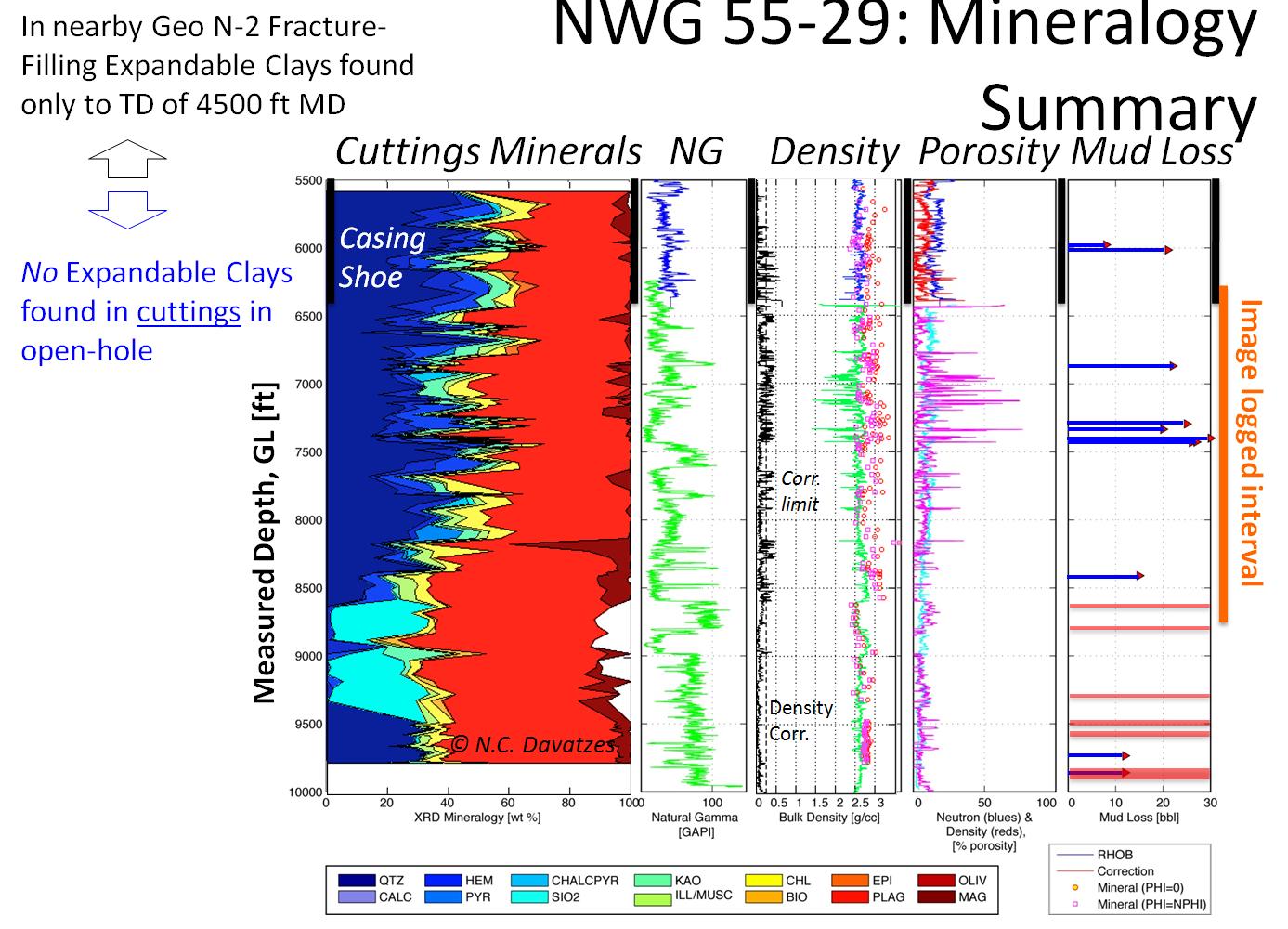
The Newberry Volcano EGS Demonstration in central Oregon, a 3 year project started in 2010, tests recent technological advances designed to reduce the cost of power generated by EGS in a hot, dry...
Search relevance: 1.00 | Views last month: 0 | Catalog Last Checked: March 23, 2026 at 09:38 PM -
DWR has a long history of studying and characterizing California’s groundwater aquifers as a part of [California’s Groundwater (Bulletin...
Search relevance: 1.00 | Views last month: 0 | Catalog Last Checked: June 26, 2026 at 08:24 PM
