
-
Federal
W00717: NOS Hydrographic Survey , External Source Data 2023, 2023-01-19
National Oceanic and Atmospheric Administration, Department of Commerce —
The National Oceanic and Atmospheric Administration (NOAA) has the statutory mandate to collect hydrographic data in support of nautical chart compilation for safe... -
Federal
2020 Cartographic Boundary File (KML), Current Census Tract for Louisiana, 1:500,000
U.S. Census Bureau, Department of Commerce —
The 2020 cartographic boundary KMLs are simplified representations of selected geographic areas from the U.S. Census Bureau's Master Address File / Topologically... -
State
High-resolution lidar data for infrastructure corridors, Tyonek Quadrangle, Alaska
State of Alaska —
In advance of design, permitting, and construction of a pipeline to deliver North Slope natural gas to out-of-state customers and Alaska communities, the Division of... -
Federal
HHS COVID-19 Small Area Estimations Survey - Primary Vaccine Series - Wave 10
U.S. Department of Health & Human Services —
The goal of the Monthly Outcome Survey (MOS) Small Area Estimations (SAE) is to generate estimates of the proportions of adults, by county and month, who were in the... -
Federal
Dissolved inorganic carbon, total alkalinity, water temperature and salinity from laboratory analyzed discrete water samples taken at the Central Gulf of Mexico Ocean Observing System buoy moored at 28.9N, 90.5W off Coastal Louisiana from 2017-07-14 to 2022-02-20 (NCEI Accession 0279824)
National Oceanic and Atmospheric Administration, Department of Commerce —
This NCEI Accession consists of Dissolved inorganic carbon, total alkalinity, water temperature and salinity from laboratory analyzed discrete water samples taken at... -
Federal
National Assessment of Hurricane-Induced Coastal Erosion Hazards: Southeast Atlantic Salvo to Duck, North Carolina Raw (non-interpolated) Beach Slope Point Data
Department of the Interior —
The National Assessment of Coastal Change Hazards project derives features of beach morphology from lidar elevation data for the purpose of understanding and... -
Federal
Two-dimensional hydrodynamic model outputs for the Missouri River at Searcys Bend near Huntsdale, Missouri for September 16, 2021
Department of the Interior —
This dataset consists of a point shapefile with depth, velocity magnitude, XY velocity vector components, and vector angles from outputs of a two-dimensional... -
Federal
Oceanographic Data, Logs, and Imagery collected during the Deepwater Atlantic Habitats II: Continued Atlantic Research and Exploration in Deepwater Ecosystems with Focus on Coral, Canyon and Seep Communities 2019 (DEEP SEARCH - RB1903) Expedition on NOAA Ship Ronald H. Brown in the North Pacific Ocean from 2019-04-09 to 2019-04-30 (NCEI Accession 0229074)
National Oceanic and Atmospheric Administration, Department of Commerce —
This dataset contains oceanographic data (ADCP, CTD, ROV, Jason, Lander, SCS, Vehicle, XBT), images, and documentation. The primary goals of this cruise were as... -
Federal
PH, temperature, salinity and other variables collected from discrete sample and profile observations using CTD, bottle and other instruments from SHUMPU MARU in the Philippine Sea from 1992-02-25 to 1992-02-29 (NCEI Accession 0115709)
National Oceanic and Atmospheric Administration, Department of Commerce —
This dataset includes chemical, discrete sample, physical and profile data collected from SHUMPU MARU in the Philippine Sea from 1992-02-25 to 1992-02-29. These data... -
Federal
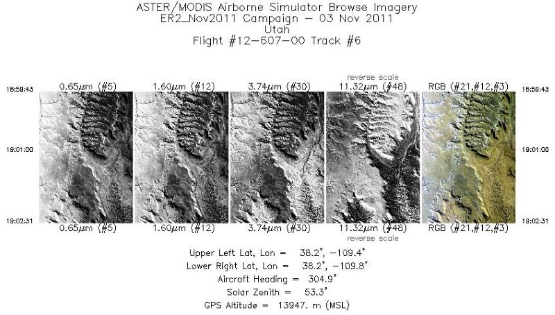
MASTER: Airborne Science, Southwest US, November, 2011
National Aeronautics and Space Administration —
This dataset includes Level 1B (L1B) data products from the MODIS/ASTER Airborne Simulator (MASTER) instrument. The spectral data were collected during seven flights... -
State
High-resolution lidar data for infrastructure corridors, Beechey Point Quadrangle, Alaska
State of Alaska —
In advance of design, permitting, and construction of a pipeline to deliver North Slope natural gas to out-of-state customers and Alaska communities, the Division of... -
Federal
R script to create boxplots of change factors by NOAA Atlas 14 station, or for all stations in an ArcHydro Enhanced Database (AHED) basin or county (create_boxplot.R)
Department of the Interior —
The South Florida Water Management District (SFWMD) and the U.S. Geological Survey have developed projected future change factors for precipitation depth-duration-... -
Federal
SMAPVEX19-22 Millbrook Lidar Derived Digital Surface Model V001
National Aeronautics and Space Administration —
These data consist of ground surface elevations derived from source lidar measurements collected in April and August 2022 in the vicinity of Millbrook, NY during the... -
Federal
Low resolution real-time physical trajectory profile data from glider usf-stella deployed by Gulf of Mexico Coastal Ocean Observing System (GCOOS) and TAMU - College Station; Geochemical and Environmental Research Group (TAMU GERG) in the Gulf of Mexico from 2022-02-01 to 2022-02-18 (NCEI Accession 0276672)
National Oceanic and Atmospheric Administration, Department of Commerce —
The purpose of this deployment is to collect water column variables to understand biological and physical processes to understand the dynamics and potential for the... -
Federal
2020 Cartographic Boundary File (KML), Current State Legislative District-Upper Chamber for New York, 1:500,000
U.S. Census Bureau, Department of Commerce —
The 2020 cartographic boundary KMLs are simplified representations of selected geographic areas from the U.S. Census Bureau's Master Address File / Topologically... -
State
High-resolution lidar data for infrastructure corridors, Gulkana Quadrangle, Alaska
State of Alaska —
In advance of design, permitting, and construction of a pipeline to deliver North Slope natural gas to out-of-state customers and Alaska communities, the Division of... -
Federal
East Maui, Hawaiʻi list of plants included for planning climate resilient recovery, 2021
Department of the Interior —
Multi-species recovery planning can be a challenging natural resource management task. In collaboration with state and federal agencies, and botanical and technical... -
Federal
Salinity_all_tropical: Modeling the effects of large-scale interior headland restoration on tidal hydrodynamics and salinity transport in an open coast, marine-dominant estuary: model input and results
Department of the Interior —
Using version 20.1_19 of the Discontinuous-Galerkin Shallow Water Equations Model (DG-SWEM) (Kubatko and others, 2006), astronomic tides and salinity transport were... -
State
Utility Renewable Generation by End Use and County: 2020
State of California —
Generation is from in-state renewable generators of at least 1 MW. Renewables include biomass, solar, wind, geothermal, and small hydro. Small hydro includes plants... -
Federal
Dissolved inorganic carbon, total alkalinity, pH, nutrients, and other variables collected from discrete profile observations in the southwest coast of Puerto Rico from 2009-01-16 to 2019-03-07 (NCEI Accession 0188506)
National Oceanic and Atmospheric Administration, Department of Commerce —
This time series dataset includes weekly and bi-weekly discrete seawater samples of pH and total alkalinity, dissolved inorganic carbon, phosphates and profile...

Official websites use .gov
A
.gov website belongs to an official government
organization in the United States.
Secure .gov websites use HTTPS
A
lock (
) or https:// means you’ve safely connected to
the .gov website. Share sensitive information only on official,
secure websites.