
-
SPURS-2 shipboard X-band radar backscatter images for the 2016 E. Tropical Pacific field campaign
The SPURS-2 X-band marine navigation radar image dataset was collected from the ship during both the 2016 and 2017 cruises. The dataset consists of screenshots of rain echoes... -
Sentinel-6A MF Jason-CS L2 P4 Altimeter High Resolution (HR) STC Reduced Ocean Surface Topography
Provides L2 high resolution (HR) short time critical (STC; 36-hour latency) altimetry from the Poseidon-4 SAR altimeter on the Sentinel-6A Michael Freilich spacecraft. It... -
Sentinel-6A MF Jason-CS L2 P4 Altimeter Low Resolution (LR) STC Reduced Ocean Surface Topography
Provides low resolution (LR) short time critical (STC; 36-hour latency) measurements of sea surface height anomaly (SSHA), Significant Wave Height (SWH), and Wind Speed. The STC... -
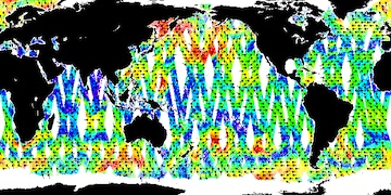
SMODE Shipboard Windcube LiDAR Observations Version 1
This dataset contains shipboard windcube data from the Sub-Mesoscale Ocean Dynamics Experiment (S-MODE) conducted approximately 300 km offshore of San Francisco during a pilot... -
Sentinel-6A MF Jason-CS L2 P4 Altimeter High Resolution (HR) NTC Reduced Ocean Surface Topography F08
Provides L2 high resolution (HR) non-time critical (NTC; 60-day latency) altimetry from the Poseidon-4 SAR altimeter on the Sentinel-6A Michael Freilich spacecraft. It contains... -
Sentinel-6A MF Jason-CS L2 P4 Altimeter High Resolution (HR) NTC Ocean Surface Topography F08
Provides L2 high resolution (HR) non-time critical (NTC; 60-day latency) altimetry from the Poseidon-4 SAR altimeter on the Sentinel-6A Michael Freilich spacecraft. It contains... -
Sentinel-6A MF Jason-CS L2 P4 Altimeter High Resolution (HR) NRT Reduced Ocean Surface Topography
Provides L2 high resolution (HR) near real time (NRT; 3-hour latency) altimetry from the Poseidon-4 SAR altimeter on the Sentinel-6A Michael Freilich spacecraft. It contains Sea... -
GHRSST Level 2P Global Sea Surface Skin Temperature from the Moderate Resolution Imaging Spectroradiometer (MODIS) on the NASA Terra satellite (GDS2)
NASA produces skin sea surface temperature (SST) products from the Infrared (IR) channels of the Moderate-resolution Imaging Spectroradiometer (MODIS) onboard the Terra... -
Cape Basin Pre-SWOT Level-4 Hourly MITgcm LLC4320 Native Grid 2km Oceanographic Dataset Version 1.0
This dataset provides a regional multivariate oceanographic state estimate from a global ocean numerical simulation with a focus on the Cape Basin region. The global ocean... -
Northeast Weddell Sea Pre-SWOT Level-4 Hourly MITgcm LLC4320 Native Grid 2km Oceanographic Dataset Version 1.0
This dataset provides a regional multivariate oceanographic state estimate from a global ocean numerical simulation with a focus on the Northeast Weddell Sea region. The global... -
Sentinel-6A MF Jason-CS L2 P4 Altimeter Low Resolution (LR) NRT Reduced Ocean Surface Topography
Provides low resolution (LR) near real time (NRT; 3-hour latency) measurements of sea surface height anomaly (SSHA), Significant Wave Height (SWH), and Wind Speed. The NRT... -
SWOT 2019-2020 Prelaunch Oceanography Field Campaign SIO Mooring WireWalker (WW)
This dataset provides the conductivity, temperature and depth (CTD) measurements from the CTD sensors on a WireWalker profiler on a full-depth mooring deployed by the SWOT... -
Sentinel-6A MF Jason-CS L2 P4 Altimeter Low Resolution (LR) STC Ocean Surface Topography
Provides low resolution (LR) short time critical (STC; 36-hour latency) measurements of sea surface height anomaly (SSHA), Significant Wave Height (SWH), and Wind Speed, along... -
GHRSST Level 3U Global Subskin Sea Surface Temperature from TMI onboard TRMM satellite
The Tropical Rainfall Measuring Mission (TRMM) Microwave Imager (TMI) is a well calibrated passive microwave radiometer, similar to the Special Sensor Microwave Imager (SSM/I),...

Official websites use .gov
A
.gov website belongs to an official government
organization in the United States.
Secure .gov websites use HTTPS
A
lock (
) or https:// means you’ve safely connected to
the .gov website. Share sensitive information only on official,
secure websites.