
-
ASTER Global Digital Elevation Model V002
The ASTGTM.002 dataset was decommissioned as of August 5, 2019. Users are encouraged to use the new improved ASTGTM.003 dataset.The ASTER Global Digital Elevation Model (ASTGTM)... -
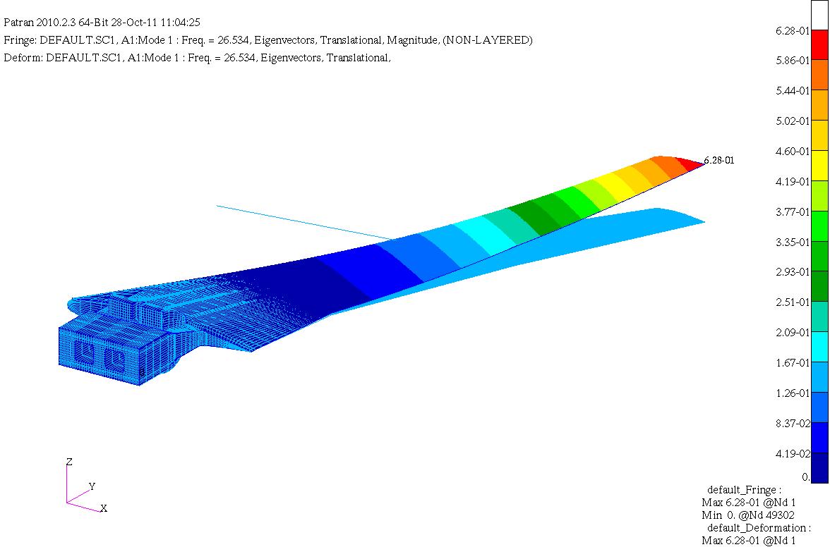
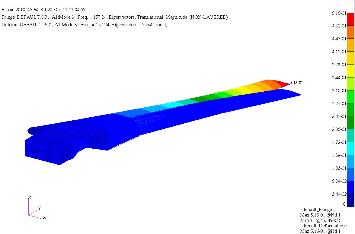
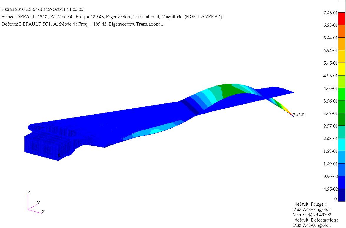
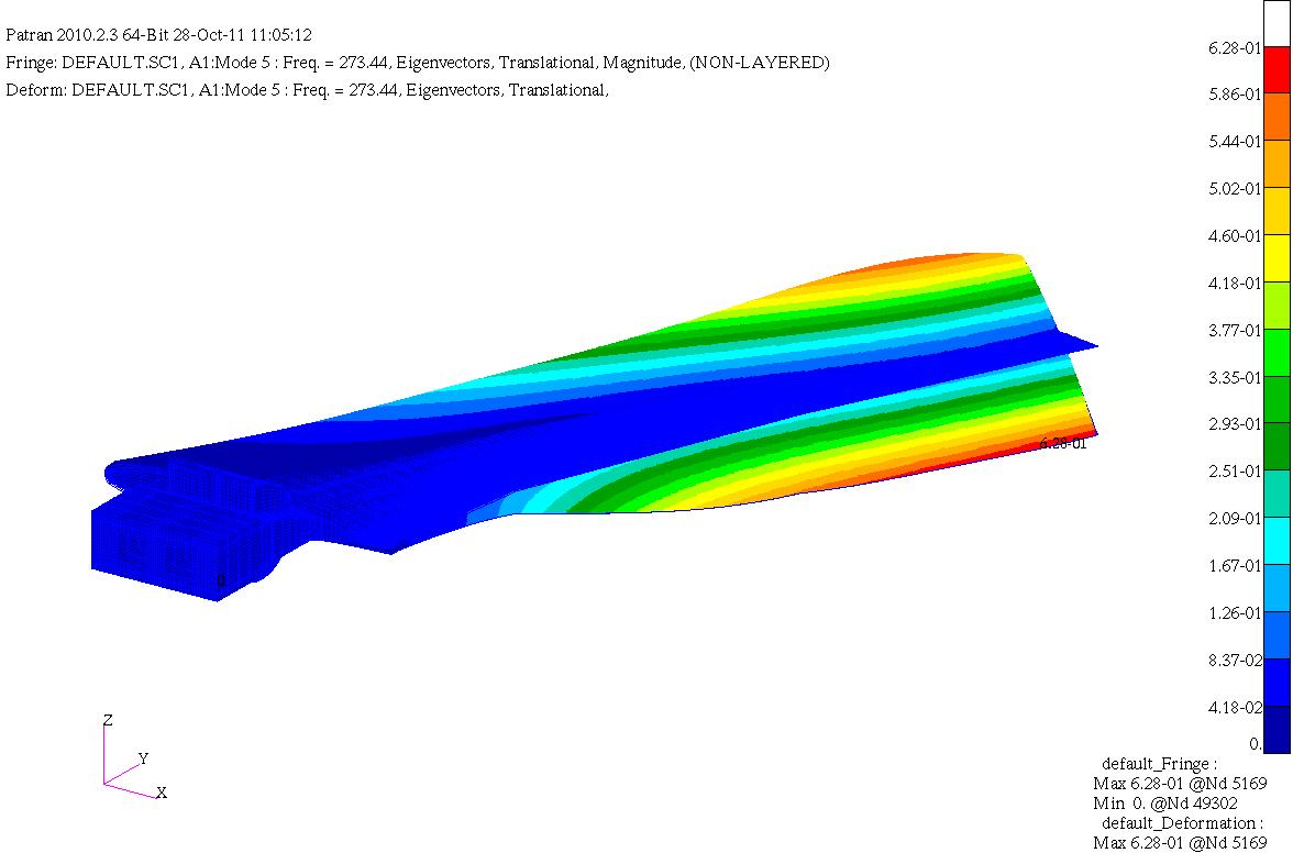
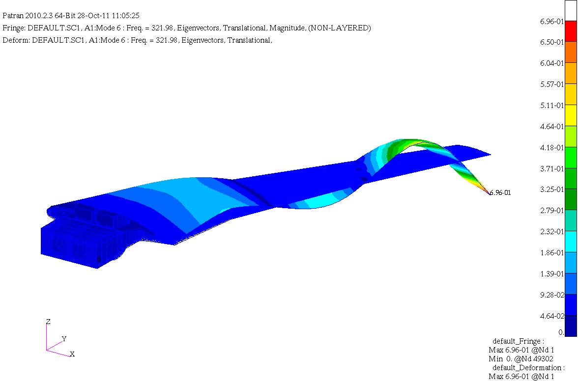
HIRENASD Comparisons of FEM modal frequencies and modeshapes
Below are frequency comparisons of different models with experiment Note Modeshapes aren't very descriptive for higher modes. There is coupling between them so this is just an... -
Distributed Anomaly Detection Using Satellite Data From Multiple Modalities
There has been a tremendous increase in the volume of Earth Science data over the last decade from modern satellites, in-situ sensors and different climate models. All these... -
Accelerated Aging in Electrolytic Capacitors for Prognostics
The focus of this work is the analysis of different degradation phenomena based on thermal overstress and electrical overstress accelerated aging systems and the use of... -
ECOSTRESS Evapotranspiration dis-ALEXI USDA Daily L3 Global 30m V001
The ECOsystem Spaceborne Thermal Radiometer Experiment on Space Station (ECOSTRESS) mission measures the temperature of plants to better understand how much water plants need... -
LBA-ECO LC-08 Soil, Vegetation, and Land Cover Maps for Brazil and South America
This data set provides (1) soil maps for Brazil that are digital versions of the MAPA DE SOLOS DO BRASIL (EMBRAPA, 1981) classified at three levels of detail, 19-class, 70-class... -
SWOT Level 2 Lake Single-Pass Vector Data Product, Version D
The SWOT Level 2 Lake Single-Pass Vector Product (SWOT_L2_HR_LakeSP_D) provides geolocated surface water measurements for lakes and unclassified water bodies, derived from high-... -
MULTI-TEMPORAL REMOTE SENSING IMAGE CLASSIFICATION - A MULTI-VIEW APPROACH
MULTI-TEMPORAL REMOTE SENSING IMAGE CLASSIFICATION - A MULTI-VIEW APPROACH VARUN CHANDOLA AND RANGA RAJU VATSAVAI Abstract. Multispectral remote sensing images have been widely... -
Modeling Li-ion Battery Capacity Depletion in a Particle Filtering Framework
This paper presents an empirical model to describe battery behavior during individual discharge cycles as well as over its cycle life. The basis for the form of the model has... -
Delta-X: Delft3D Sediment Model, Site 322, Terrebonne Basin, MRD, Louisiana, USA
This dataset contains the Delft3D model of the intensive site 322 in the Terrebonne Basin along the Mississippi River Delta (MRD) in coastal Louisiana. Simulations cover the... -
OCO-3 Level 2 geolocated XCO2 retrieval results and algorithm diagnostic information, Forward Processing V11 (OCO3_L2_Diagnostic) at GES DISC
Version 11 is the current version of the data set. Older versions will no longer be available and are superseded by Version 11. The Orbiting Carbon Observatory -3 (OCO-3) was... -
TROPICS05 L1B Orbital Geolocated Native-Resolution Brightness Temperatures V0.2
The "Time-Resolved Observations of Precipitation structure and storm Intensity with a Constellation of Smallsats" (TROPICS) mission has a goal of providing nearly all-weather... -
ASTER L2 Surface Radiance TIR V004
The Terra Advanced Spaceborne Thermal Emission and Reflection Radiometer (ASTER) Surface Radiance TIR (AST_09T) is generated using the five Thermal Infrared (TIR) bands... -
Entropy-based probabilistic fatigue damage prognosis and algorithmic performance comparison
In this paper, a maximum entropy-based general framework for probabilistic fatigue damage prognosis is investigated. The proposed methodology is based on an underlying physics-... -
Sparse Inverse Gaussian Process Regression with Application to Climate Network Discovery
Regression problems on massive data sets are ubiquitous in many application domains including the Internet, earth and space sciences, and finances. Gaussian Process regression... -
MetOp-C ASCAT Level 2 Ocean Surface Wind Vectors Optimized for Coastal Ocean
This dataset contains operational near-real-time Level 2 coastal ocean surface wind vector retrievals from the Advanced Scatterometer (ASCAT) on MetOp-C at 12.5 km sampling... -
Wind SMS Suite SupraThermal Ion Composition Spectrometer (SMS/STICS) Ion Angular Flux Maps (AFMs), Level 2 (L2), 30-minute Data in Solar Wind
The data include Wind STICS 30-minute Angular Flux Maps (AFMs) for selected ion species using triple coincidence (H+, He+, He2+, C5+, O+, O6+, and Fe10+) and double coincidence... -
S-MODE Saildrone Level 1 Observations
This dataset contains a suite of Saildrone in-situ measurements (including but not limited to temperature, salinity, currents, biochemistry, and meteorology) taken during the...

Official websites use .gov
A
.gov website belongs to an official government
organization in the United States.
Secure .gov websites use HTTPS
A
lock (
) or https:// means you’ve safely connected to
the .gov website. Share sensitive information only on official,
secure websites.