
-
Shuttle Radar Topography Mission DTED Level 1 (3-arc second) Data (DTED-1) recent views
The Shuttle Radar Topography Mission (SRTM) successfully collected Interferometric Synthetic Aperture Radar (IFSAR) data over 80 percent of the landmass of the Earth between 60... -
Shuttle Radar Topography Mission (SRTM) Version 2 recent views
NASA has released version 2 of the Shuttle Radar Topography Mission digital topographic data (also known as the "finished" version). Version 2 is the result of a substantial... -
Shuttle Radar Topography Mission 1-arc second Global recent views
The Shuttle Radar Topography Mission (SRTM) was flown aboard the space shuttle Endeavour February 11-22, 2000. The National Aeronautics and Space Administration (NASA) and the... -
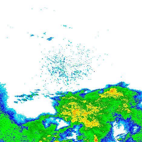
Shuttle Radar Topography Mission (SRTM) Images recent views
Culminating more than four years of processing data, NASA and the National Geospatial-Intelligence Agency (NGA) have completed Earth's most extensive global topographic map. The... -
CLPX-Airborne: Airborne Synthetic Aperture Radar (AIRSAR) Imagery, Version 1 recent views
Airborne Synthetic Aperture Radar (AIRSAR) is a side-looking imaging radar that is able to collect data irrespective of daylight or cloud cover. The AIRSAR instrument operated... -
SMAP_L1B_SIGMA_NAUGHT_LOW_RES_V003 recent views
SMAP Level 1B Sigma Naught Low Res Product Version 3 -
SMAP_L1B_SIGMA_NAUGHT_LOW_RES_QA_V002 recent views
SMAP Level 1B Sigma Naught Low Res Data Quality Info Version 2 -
GPM GROUND VALIDATION NASA MICRO RAIN RADAR (MRR) MC3E V1 recent views
The GPM Ground Validation NASA Micro Rain Radar (MRR) MC3E dataset was collected by a Micro Rain Radar (MRR), which is a vertically pointing Doppler radar which provides... -
GPM GROUND VALIDATION NEXRAD LEVEL II KARX IFLOODS V1 recent views
The GPM Ground Validation Next Generation Weather Radar (NEXRAD) Level II IFloodS datasets were collected from four sites (see Table 1) from March 29, 2013 to June 18, 2013 for... -
GPM Ground Validation KHTX NEXRAD IPHEx V1 recent views
The GPM Ground Validation KHTX NEXRAD IPHEx datasets contain data from the KHTX NEXt Generation Weather RADar system (NEXRAD) instrument in operation during the Integrated... -
SMEX03 QuikSCAT/SeaWinds Backscatter Data, Brazil, Version 1 recent views
This data set includes data collected over the Soil Moisture Experiment 2003 (SMEX03) areas of Alabama, Georgia, Oklahoma, USA , and Brazil. -
CYGNSS Level 1 Calibrated Raw IF Version 1.0 recent views
This dataset contains the first release, Version 1.0, of the CYGNSS Calibrated Raw Intermediate Frequency (IF) based L1 Product. This product includes several established signal... -
SMAP_L1C_SIGMA_NAUGHT_HIGH_RES_QA_V003 recent views
SMAP Level 1C Sigma Naught High Res Data Quality Info Version 3 -
TRMM Ground Validation Calibrated QC Radar Reflectivity Full Volume Scan L1C 1 hour V7 (TRMM_1C51) at GES DISC recent views
The purpose of the 1C51 algorithm is to remove non-meteorological radar echoes that adversely affect the quality of higher level products, such as clutter associated with... -
GPM Ground Validation CAX1 Radar ODIM format OLYMPEX V1 recent views
The GPM Ground Validation CAX1 Radar ODIM format OLYMPEX dataset consists of radar parameters, such as Radar reflectivity, Doppler velocity, Doppler width, Differential... -
NSCAT Gridded Level 3 Enhanced Resolution Sigma-0 from BYU recent views
This NASA Scatterometer (NSCAT) satellite Sigma-0 dataset is generated by the Scatterometer Climate Record Pathfinder (SCP) project at Brigham Young University (BYU) and is... -
GPM GROUND VALIDATION HIGH ALTITUDE IMAGING WIND AND RAIN AIRBORNE PROFILER (HIWRAP) MC3E V1 recent views
The GPM Ground Validation High Altitude Imaging Wind and Rain Airborne Profiler (HIWRAP) MC3E dataset was collected by the High-Altitude Imaging Wind and Rain Airborne Profiler...

Official websites use .gov
A
.gov website belongs to an official government
organization in the United States.
Secure .gov websites use HTTPS
A
lock (
) or https:// means you’ve safely connected to
the .gov website. Share sensitive information only on official,
secure websites.