
-
Federal
Interferometric Synthetic Aperture Radar (IFSAR) Alaska 10 recent views
National Aeronautics and Space Administration —
The U.S. Geological Survey (USGS) National Geospatial Program (NGP) developed the Alaska Mapping Initiative (AMI) to collaborate with the State and other Federal... -
Federal
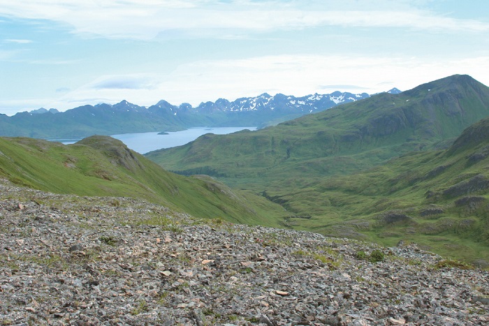
Global Multi-resolution Terrain Elevation Data 2010 (GMTED2010)
National Aeronautics and Space Administration —
The USGS and the NGA have collaborated on the development of a notably enhanced global elevation model named the GMTED2010 that replaces GTOPO30 as the elevation... -
Federal
GTOPO30 Hydro 1K
National Aeronautics and Space Administration —
HYDRO1k is a geographic database developed to provide comprehensive and consistent global coverage of topographically derived data sets, including streams, drainage... -
Federal
Spaceborne Imaging Radar-C Precision
National Aeronautics and Space Administration —
Spaceborne Imaging Radar-C/X-band Synthetic Aperture Radar (SIR-C/X-SAR) is a joint project of the National Aeronautics and Space Administration (NASA), the German... -
Federal
Arctic Vegetation Plots on Unalaska Island, Aleutian Islands, Alaska, 2007
National Aeronautics and Space Administration —
This data set provides environmental, soil, and vegetation data collected during August 2007 from 69 study plots at the Unalaska Island research site, and one plot on... -
Federal
Spaceborne Imaging Radar C-band (SIR-C)
National Aeronautics and Space Administration —
Spaceborne Imaging Radar-C (SIR-C) is part of an imaging radar system that was flown on board two Space Shuttle flights (9 - 20 April, 1994 and 30 September - 11... -
Federal
Global Forest Ecosystem Structure and Function Data For Carbon Balance Research
National Aeronautics and Space Administration —
A comprehensive global database has been assembled to quantify CO2 fluxes and pathways across different levels of integration (from photosynthesis up to net ecosystem... -
Federal
Burned and Unburned Field Site Data, Noatak, Seward, and North Slope, AK, 2016-2018
National Aeronautics and Space Administration —
This dataset includes field measurements from unburned and burned 10 m x 10 m and 1 m x 1 m plots in the Noatak, Seward, and North Slope regions of the Alaskan tundra... -
Federal
Arctic Vegetation Plots at Umiat, North Slope, Alaska, 1951
National Aeronautics and Space Administration —
This data set provides vegetation cover and plot data collected during the periods of July and August, 1951, from 51 stands (areas of homogeneous vegetation... -
Federal
SMEX03 AMSR-E Daily Gridded Soil Moisture and Brightness Temperatures, Alabama, Version 1
National Aeronautics and Space Administration —
Notice to Data Users: The documentation for this data set was provided solely by the Principal Investigator(s) and was not further developed, thoroughly reviewed, or... -
Federal
ABoVE: Synthesis of Burned and Unburned Forest Site Data, AK and Canada, 1983-2016
National Aeronautics and Space Administration —
This dataset is a synthesis of field plot characterization data, derived above-ground and below-ground combusted carbon, and acquired Fire Weather Index (FWI) System... -
Federal
GPM Ground Validation Duke Soil Moisture IPHEx V1
National Aeronautics and Space Administration —
The GPM Ground Validation Duke Soil Moisture dataset consists of a collection of various data obtained during the Integrated Precipitation and Hydrology Experiment... -
Federal
Arctic Circumpolar Distribution and Soil Carbon of Thermokarst Landscapes, 2015
National Aeronautics and Space Administration —
This data set provides the distribution of thermokarst landscapes in the boreal and tundra ecoregions within the northern circumpolar permafrost zones. This dataset... -
Federal
Arctic Vegetation Plots in Northern NWT and YT, Canada, 1965-1966
National Aeronautics and Space Administration —
This dataset provides vegetation, soil, and plot characteristics for 154 study plots located at three sites across the Richardson Mountains, Northwest Territories... -
Federal
Heat Capacity Mapping Mission (HCMM)
National Aeronautics and Space Administration —
The mission was the first of a series of NASA Applications Explorer Missions and is also known as AEM-A. Day/night coverage over a given area occurred at intervals... -
Federal
Active Layer Monitoring, Arctic and Subarctic Canada, Version 6
National Aeronautics and Space Administration —
This project involves measuring regional and site variability in maximum annual active layer development and vertical surface movement over permafrost, and monitoring... -
Federal
HDDS_Baseline_Adhoc
National Aeronautics and Space Administration —
The U.S. Geological Survey (USGS) Emergency Operations, in support of the Department of Homeland Security, provides imagery and resources for use in disaster... -
Federal
Stocks of Surface Soil Organic Carbon Fractions, Great Plains Region, USA, 2007-2010
National Aeronautics and Space Administration —
This dataset provides estimates of total organic soil carbon (SOC), pyrogenic (PyC), particulate (POC), and other organic soil carbon (OOC) fractions in 473 surface... -
Federal
Land Surface Atmospheric Boundary Interaction Product L3 V1(LANDMET) at GES DISC
National Aeronautics and Space Administration —
This product is a multi-variate data compilation that reconciles the variation scales of these multiple measurements from varies resources, merges and maps them into...

Official websites use .gov
A
.gov website belongs to an official government
organization in the United States.
Secure .gov websites use HTTPS
A
lock (
) or https:// means you’ve safely connected to
the .gov website. Share sensitive information only on official,
secure websites.