
-
Federal
Spaceborne Imaging Radar-C Precision
National Aeronautics and Space Administration —
Spaceborne Imaging Radar-C/X-band Synthetic Aperture Radar (SIR-C/X-SAR) is a joint project of the National Aeronautics and Space Administration (NASA), the German... -
Federal
MSS 1-5 (1972-1987)
National Aeronautics and Space Administration —
The USGS Earth Resources Observation and Science (EROS) Center archive holds data collected by the Landsat suite of satellites, beginning with Landsat 1 in 1972. All... -
Federal
Aerial Photo Single Frames
National Aeronautics and Space Administration —
The Aerial Photography Single Frame Records collection is a large and diverse group of imagery acquired by Federal organizations from 1937 to the present. Over 6.4... -
Federal
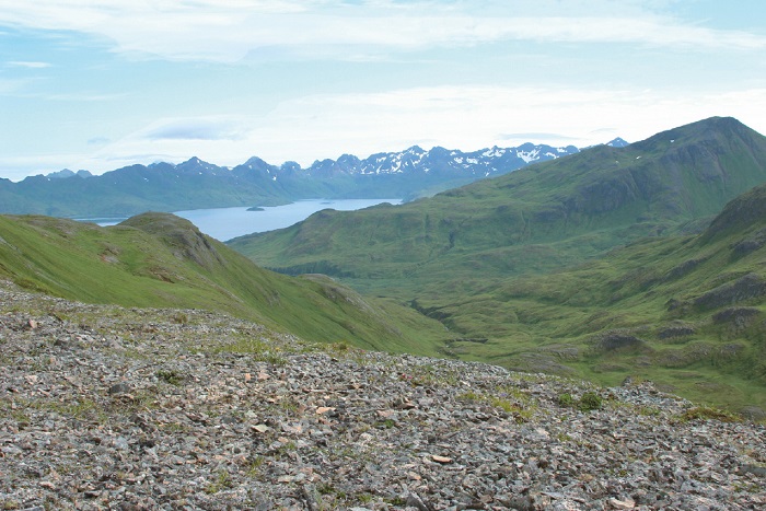
Arctic Vegetation Plots on Unalaska Island, Aleutian Islands, Alaska, 2007
National Aeronautics and Space Administration —
This data set provides environmental, soil, and vegetation data collected during August 2007 from 69 study plots at the Unalaska Island research site, and one plot on... -
Federal
Spaceborne Imaging Radar C-band (SIR-C)
National Aeronautics and Space Administration —
Spaceborne Imaging Radar-C (SIR-C) is part of an imaging radar system that was flown on board two Space Shuttle flights (9 - 20 April, 1994 and 30 September - 11... -
Federal
NASADEM Merged DEM Global 1 arc second V001
National Aeronautics and Space Administration —
The Land Processes Distributed Active Archive Center (LP DAAC) is responsible for the archive and distribution of the NASA Making Earth System Data Records for Use in... -
Federal
IceBridge HiCARS 2 L2 Geolocated Ice Thickness V001
National Aeronautics and Space Administration —
This data set contains ice thickness, surface and bed elevation, and echo strength measurements taken over Antarctica using the Hi-Capability Airborne Radar Sounder... -
Federal
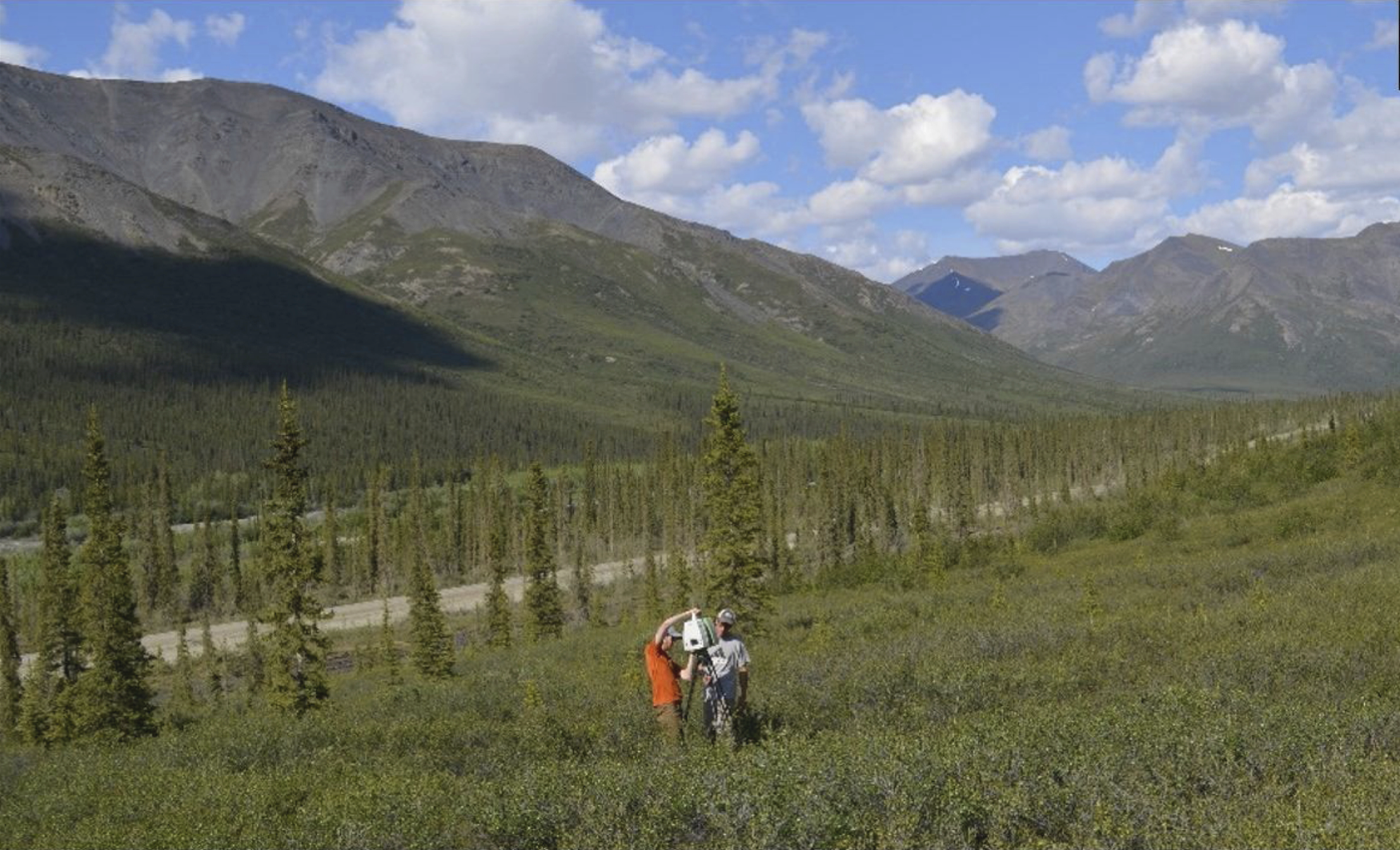
ABoVE: Terrestrial Lidar Scanning Forest-Tundra Ecotone, Brooks Range, Alaska, 2016
National Aeronautics and Space Administration —
This dataset provides terrestrial lidar scanning (TLS) point cloud data collected at 10 research plots along the forest-tundra ecotone (FTE) in the Brooks Range of... -
Federal
SMAPVEX19-22 Massachusetts Lidar Derived Digital Elevation Model V001
National Aeronautics and Space Administration —
These digital elevation model (DEM) data consist of ground surface elevations derived from source lidar measurements collected in April and August 2022 in the... -
Federal
BOREAS Scanning Lidar Imager of Canopies by Echo Recovery (SLICER): Level-3 Data
National Aeronautics and Space Administration —
Scanning Lidar Imager of Canopies by Echo Recovery (SLICER) data were acquired in support of BOReal Ecosystem-Atmosphere Study (BOREAS) at all of the Tower Flux (TF)... -
Federal
IceBridge HiCARS 1 L2 Geolocated Ice Thickness V001
National Aeronautics and Space Administration —
This data set contains ice thickness, surface and bed elevation, and echo strength measurements taken over Antarctica using the Hi-Capability Airborne Radar Sounder... -
Federal
Burned and Unburned Field Site Data, Noatak, Seward, and North Slope, AK, 2016-2018
National Aeronautics and Space Administration —
This dataset includes field measurements from unburned and burned 10 m x 10 m and 1 m x 1 m plots in the Noatak, Seward, and North Slope regions of the Alaskan tundra... -
Federal
Arctic Vegetation Plots at Umiat, North Slope, Alaska, 1951
National Aeronautics and Space Administration —
This data set provides vegetation cover and plot data collected during the periods of July and August, 1951, from 51 stands (areas of homogeneous vegetation... -
Federal
NASA Shuttle Radar Topography Mission Global 3 arc second V003
National Aeronautics and Space Administration —
The Land Processes Distributed Active Archive Center (LP DAAC) is responsible for the archive and distribution of NASA Making Earth System Data Records for Use in... -
Federal
SENTINEL-1B_DUAL_POL_GRD_MEDIUM_RES
National Aeronautics and Space Administration —
Sentinel-1B Dual-pol ground projected medium resolution images -
Federal
SMEX03 AMSR-E Daily Gridded Soil Moisture and Brightness Temperatures, Alabama, Version 1
National Aeronautics and Space Administration —
Notice to Data Users: The documentation for this data set was provided solely by the Principal Investigator(s) and was not further developed, thoroughly reviewed, or... -
Federal
ABoVE: Synthesis of Burned and Unburned Forest Site Data, AK and Canada, 1983-2016
National Aeronautics and Space Administration —
This dataset is a synthesis of field plot characterization data, derived above-ground and below-ground combusted carbon, and acquired Fire Weather Index (FWI) System... -
Federal
Delta-X: UAVSAR L1 Single Look Complex (SLC) Stack Products, MRD, Louisiana, 2021
National Aeronautics and Space Administration —
This dataset contains UAVSAR Level 1 (L1) Single Look Complex (SLC) stack products for Delta-X flight lines acquired during 2021-03-27 to 2021-04-18 (spring) and... -
Federal
GPM Ground Validation Duke Soil Moisture IPHEx V1
National Aeronautics and Space Administration —
The GPM Ground Validation Duke Soil Moisture dataset consists of a collection of various data obtained during the Integrated Precipitation and Hydrology Experiment...

Official websites use .gov
A
.gov website belongs to an official government
organization in the United States.
Secure .gov websites use HTTPS
A
lock (
) or https:// means you’ve safely connected to
the .gov website. Share sensitive information only on official,
secure websites.