
-
Federal
CORONA Satellite Photography 46 recent views
National Aeronautics and Space Administration —
On February 24, 1995, President Clinton signed an Executive Order, directing the declassification of intelligence imagery acquired by the first generation of United... -
Federal
Shuttle Radar Topography Mission DTED Level 1 (3-arc second) Data (DTED-1) 44 recent views
National Aeronautics and Space Administration —
The Shuttle Radar Topography Mission (SRTM) successfully collected Interferometric Synthetic Aperture Radar (IFSAR) data over 80 percent of the landmass of the Earth... -
Federal
Landsat 8 25 recent views
National Aeronautics and Space Administration —
The Operational Land Imager (OLI) and Thermal Infrared Sensor (TIRS) are onboard the Landsat 8 satellite, have acquired images of the Earth since February 2013. The... -
Federal
NCEP/CPC L3 Half Hourly 4km Global (60S - 60N) Merged IR V1 (GPM_MERGIR) at GES DISC 23 recent views
National Aeronautics and Space Administration —
These data originate from NOAA/NCEP. The NOAA Climate Prediction Center/NCEP/NWS is making the data available originally in binary format, in a weekly rotating... -
Federal
Shuttle Radar Topography Mission (SRTM) Images 15 recent views
National Aeronautics and Space Administration —
Culminating more than four years of processing data, NASA and the National Geospatial-Intelligence Agency (NGA) have completed Earth's most extensive global... -
Federal
CALIPSO Lidar Level 2 Cloud Profile, V4-20 11 recent views
National Aeronautics and Space Administration —
CAL_LID_L2_05kmCPro-Standard-V4-20 is the Cloud-Aerosol Lidar and Infrared Pathfinder Satellite Observations (CALIPSO) Lidar Level 2 Cloud Profile, Version 4-20 data... -
Federal
USGS Digital Orthophoto Quadrangles
National Aeronautics and Space Administration —
A Digital Orthophoto Quadrangle (DOQ) is a computer-generated image of an aerial photograph in which the image displacement caused by terrain relief and camera tilt... -
Federal
Shuttle Radar Topography Mission 1-arc second Global
National Aeronautics and Space Administration —
The Shuttle Radar Topography Mission (SRTM) was flown aboard the space shuttle Endeavour February 11-22, 2000. The National Aeronautics and Space Administration... -
Federal
CORONA Satellite Photographs from the U.S. Geological Survey
National Aeronautics and Space Administration —
The first generation of U.S. photo intelligence satellites collected more than 860,000 images of the Earth’s surface between 1960 and 1972. The classified military... -
Federal
Shuttle Radar Topography Mission (SRTM) Version 2
National Aeronautics and Space Administration —
NASA has released version 2 of the Shuttle Radar Topography Mission digital topographic data (also known as the "finished" version). Version 2 is the result of a... -
Federal
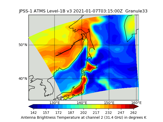
JPSS-1 ATMS Level 1B Brightness Temperature V3 (SNDRJ1ATMSL1B) at GES DISC
National Aeronautics and Space Administration —
The Advanced Technology Microwave Sounder (ATMS) Level 1B data files contain brightness temperature measurements along with ancillary spacecraft, instrument, and... -
Federal
LiDAR Surveys over Selected Forest Research Sites, Brazilian Amazon, 2008-2018
National Aeronautics and Space Administration —
This dataset provides the complete catalog of point cloud data collected during LiDAR surveys over selected forest research sites across the Amazon rainforest in... -
Federal
BOREAS RSS-16 Level-3b DC-8 AIRSAR SY Images
National Aeronautics and Space Administration —
Satellite and aircraft SAR data used in conjunction with various ground measurements to determine the moisture regime of the boreal forest. The NASA JPL AIRSAR is a... -
Federal
MISR Level 1B2 Terrain Data V003
National Aeronautics and Space Administration —
Multi-angle Imaging SpectroRadiometer (MISR) is an instrument designed to view Earth with cameras pointed in 9 different directions. As the instrument flies overhead,... -
Federal
CLPX-Airborne: Airborne Synthetic Aperture Radar (AIRSAR) Imagery, Version 1
National Aeronautics and Space Administration —
Airborne Synthetic Aperture Radar (AIRSAR) is a side-looking imaging radar that is able to collect data irrespective of daylight or cloud cover. The AIRSAR instrument... -
Federal
NASA Landsat Data Collection
National Aeronautics and Space Administration —
The NASA Landsat Data Collection (NLDC) is a compilation of Landsat multispectral scanner (MSS) scenes and Landsat thematic mapper (TM) scenes. This compilation of... -
Federal
CALIPSO Lidar Level 2 5 km Aerosol Layer Data, V4-20
National Aeronautics and Space Administration —
CAL_LID_L2_05kmALay-Standard-V4-20 is the Cloud-Aerosol Lidar and Infrared Pathfinder Satellite Observation (CALIPSO) Lidar Level 2 5 km Aerosol Layer Data, Version... -
Federal
SLSTR/Sentinel-3B L1 Full Resolution Top of Atmosphere Radiances and Brightness Temperature
National Aeronautics and Space Administration —
The SLSTR/Sentinel-3B L1 Full Resolution Top of Atmosphere Radiances and Brightness Temperature product with shortname S3B_SL_1_RBT, is generated from the data... -
Federal
VIIRS/NPP Moderate Resolution Terrain-Corrected Geolocation L1 6-Min Swath 750 m
National Aeronautics and Space Administration —
The VIIRS/NPP Moderate Resolution Terrain-Corrected Geolocation 6-Min L1 Swath 750 m product, short-name VNP03MOD, contains the derived line-of-sight (LOS) vectors... -
Federal
SMEX02 AMSR-E Level 3 Daily Gridded Brightness Temperatures, Iowa, Version 1
National Aeronautics and Space Administration —
This data set contains Advanced Microwave Scanning Radiometer - Earth Observing System (AMSR-E) level 3 daily gridded brightness temperatures, spatially subsetted to...

Official websites use .gov
A
.gov website belongs to an official government
organization in the United States.
Secure .gov websites use HTTPS
A
lock (
) or https:// means you’ve safely connected to
the .gov website. Share sensitive information only on official,
secure websites.