
-
Federal
Biscayne Bay Dolphin Photo ID System
National Oceanic and Atmospheric Administration, Department of Commerce —
It has been shown through a variety of photo-identification studies that populations of bottlenose dolphin inhabit the various embayments along the coast of Florida.... -
Federal
Houston Ship Channel 1993-1994
National Oceanic and Atmospheric Administration, Department of Commerce —
Between May 5, 1993 and September 19, 1994, we collected quantitative 1-m2 area drop samples and measured a variety of habitat attributes using field surveys and... -
Federal
Kemp's Ridley Head Start Recapture
National Oceanic and Atmospheric Administration, Department of Commerce —
Anatomical field measurements of stranded sea turtles and necropsy information when available. -
Federal
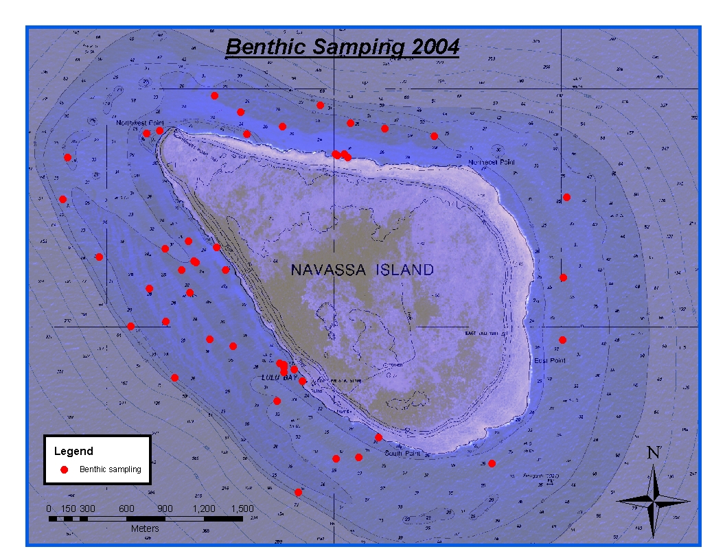
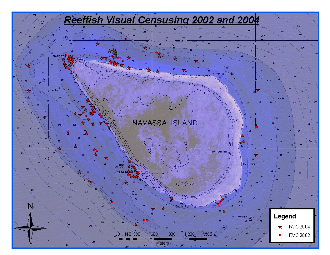
CRCP-Navassa reef assessment
National Oceanic and Atmospheric Administration, Department of Commerce —
Episodic cruises ( every 2 years) were conducted to perform assessments of Navassa Island coral reef resources including reeffish visual census, benthic reef... -
Federal
Corpus Christi-East Matagorda Bay 1986
National Oceanic and Atmospheric Administration, Department of Commerce —
Patterns of habitat utilization were compared among transplanted and natural Spartina alterniflora marshes in the Halls Lake area of Chocolate Bay in the Galveston... -
Federal
Sabine National Wildlife Refuge 1999
National Oceanic and Atmospheric Administration, Department of Commerce —
Terracing uses existing bottom sediments to form terraces or ridges at marsh elevation and the intertidal zone is planted with marsh vegetation. This study examined... -
Federal
Juvenile Smalltooth Sawfish Abundance Survey (longterm effort, catch, and environmental data)
National Oceanic and Atmospheric Administration, Department of Commerce —
: Research on the U.S. Distinct Population Segment of smalltooth sawfish (Pristis pectinata) life history, abundance, habitat use, movements, and migration is... -
Federal
Northern Gulf Institute NE Gulf reef and reef fish study
National Oceanic and Atmospheric Administration, Department of Commerce —
This data set contains ROV digital video data stored on DVDs and raw CTD data -
Federal
Acoustical Environment of Three Stations at Rileys Hump
National Oceanic and Atmospheric Administration, Department of Commerce —
Passive acoustic recorders were deployed to record acoustic signals over the time span of two years, and the data analyzed for the existence of known spawning sounds... -
Federal
Caernarvon 2001
National Oceanic and Atmospheric Administration, Department of Commerce —
Sampled marshes and ponds along two transects within the intermediate and brackish marsh zones of Breton Sound, Louisiana, from May 7-11, 2001. Sampling followed... -
Federal
COE (BUG) Houston-Galveston 1991
National Oceanic and Atmospheric Administration, Department of Commerce —
Compared species composition, numbers, and biomass per unit area among salt marsh (Spartina alterniflora) and open water habitats in the Galveston Bay corridor to... -
Federal
Sportsmans Road/Gangs Bayou 1995
National Oceanic and Atmospheric Administration, Department of Commerce —
Measured fine-scale distributions of nekton on the vegetated marsh surface using drop samplers and utilized these patterns to estimate population size. Natant decapod... -
Federal
Pelican Spit 1988-1997
National Oceanic and Atmospheric Administration, Department of Commerce —
Densities of nekton were measured in three created salt marshes to examine habitat development rate. All three marshes were created from dredged material from the... -
Federal
Grand Isle 1988
National Oceanic and Atmospheric Administration, Department of Commerce —
During July and October 1988, a total of 42 samples were collected in salt marsh habitats of the Caminada Bay system near Grand Isle, Louisiana to evaluate the use of... -
Federal
Mangrove study examining seasonal and spatial variation in fish taxonomic composition and diversity in North Atlantic Ocean from 1998-08-17 to 2021-09-09 (NCEI Accession 0159580)
National Oceanic and Atmospheric Administration, Department of Commerce —
Southern Biscayne Bay's shoreline fish community been monitored visually twice a year since 1998 to compare fish use of mangrove prop root habitats along the mainland... -
Federal
Meta-analysis of estuarine nurseries
National Oceanic and Atmospheric Administration, Department of Commerce —
Densities of juvenile fishery species and other animals (all generally 100 mm total length) were summarized for shallow estuarine areas along coastal Texas and... -
Federal
Terracing at Pierce Marsh in Galveston Bay 2001-2002
National Oceanic and Atmospheric Administration, Department of Commerce —
Marsh terracing is used to restore coastal wetlands by converting shallow nonvegetated bottom to intertidal marsh. Terraces are constructed from excavated bottom...

Official websites use .gov
A
.gov website belongs to an official government
organization in the United States.
Secure .gov websites use HTTPS
A
lock (
) or https:// means you’ve safely connected to
the .gov website. Share sensitive information only on official,
secure websites.