
-
Federal
GPM GROUND VALIDATION FLIGHT SUMMARIES AND FLIGHT TRACKS IMAGERY MC3E V1
National Aeronautics and Space Administration —
The GPM Ground Validation Flight Summaries and Flight Tracks Imagery MC3E dataset for the Midlatitude Continental Convective Clouds Experiment (MC3E) provides... -
Federal
GRIP DC-8 METEOROLOGICAL MEASUREMENT SYSTEM (MMS) V1
National Aeronautics and Space Administration —
The GRIP DC-8 Meteorological measurement System (MMS) dataset was collected by the Meteorological Measurement System (MMS), which provides high-resolution, accurate... -
Federal
NAMMA LANGLEY AEROSOL RESEARCH GROUP EXPERIMENT NAVIGATION DATA V1
National Aeronautics and Space Administration —
The NAMMA Langley Aerosol Research Group Experiment Navigation Data is the DC-8 NAV data (ICATS) extracted into columns with time correction. These data files were... -
Federal
Sentinel-5P TROPOMI Radiance product band 4 (UVIS detector) L1B 5.5km x 3.5km V1 (S5P_L1B_RA_BD4_HiR) at GES DISC
National Aeronautics and Space Administration —
Starting from August 6th in 2019, Sentinel-5P TROPOMI along-track high spatial resolution (~5.5km at nadir) has been implemented. For data before August 6th of 2019,... -
Federal
GPM GROUND VALIDATION CARE SATELLITE OVERPASS IMAGES GCPEX V1
National Aeronautics and Space Administration —
The GPM Ground Validation CARE Satellite Overpass GCPEx Images are the satellite overpass images for the GPM Cold-season Precipitation Experiment (GCPEx), which... -
Federal
IceBridge IMU L0 Raw Inertial Measurement Unit Data, Version 1
National Aeronautics and Space Administration —
This data set contains Inertial Measurement Unit (IMU) readings, including latitude, longitude, altitude, velocity, pitch, roll, and true heading, taken over... -
Federal
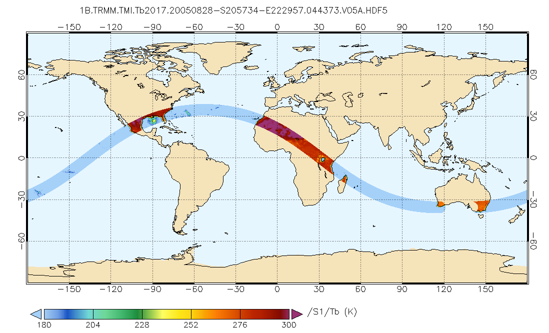
GPM TMI on TRMM Brightness Temperatures L1B 1.5 hours 13 km V07 (GPM_1BTMI) at GES DISC
National Aeronautics and Space Administration —
This is the new (GPM-formated) TRMM product. It replaces the old TRMM_1B11 Version 07 is the current version of the data set. Previous versions have been superseded... -
Federal
ACES Aircraft and Mechanical Data V1
National Aeronautics and Space Administration —
The ACES Aircraft and Mechanical Data consist of aircraft (e.g. pitch, roll, yaw) and mechanical (e.g. aircraft engine speed, tail commands, fuel levels) data... -
Federal
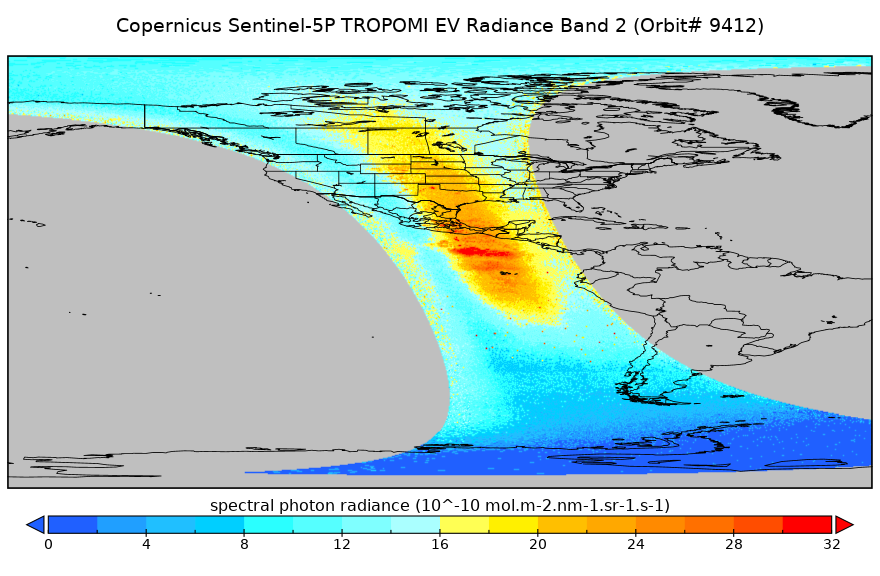
Sentinel-5P TROPOMI Radiance product band 2 (UV detector) L1B 5.5km x 3.5km V2 (S5P_L1B_RA_BD2_HiR) at GES DISC
National Aeronautics and Space Administration —
Starting from August 6th in 2019, Sentinel-5P TROPOMI along-track high spatial resolution (~5.5km at nadir) has been implemented. For data before August 6th of 2019,... -
Federal
SMAP_L1B_SIGMA_NAUGHT_LOW_RES_METADATA_V001
National Aeronautics and Space Administration —
SMAP Level 1B Sigma Naught Low Res Product Metadata -
Federal
IceBridge Mission Flight Reports, Version 1
National Aeronautics and Space Administration —
This data set contains flight reports from NASA Operation IceBridge Greenland, Arctic, Antarctic, and Alaska missions. Flight reports contain information on region,... -
Federal
SMAP_L1C_SIGMA_NAUGHT_HIGH_RES_V003
National Aeronautics and Space Administration —
SMAP Level 1C Sigma Naught High Res Product Version 3 -
Federal
ATom: Flight Dynamics and Environmental Parameters of the NASA DC-8 Aircraft
National Aeronautics and Space Administration —
This dataset contains flight dynamics and environmental parameters (often referred to as housekeeping) specific to the DC-8 aircraft as collected from an assortment... -
Federal
SMAP_L1A_RADAR_QA_V001
National Aeronautics and Space Administration —
SMAP Level 1A Radar Data Quality Information -
Federal
IceBridge NSERC L1B Geolocated Meteorologic and Surface Temperature Data, Version 1
National Aeronautics and Space Administration —
This data set is a collection of airborne, in-flight meteorological and in-cabin measurements, as well as thermal emission measurements of near-nadir surface skin... -
Federal
Sentinel-5P TROPOMI Radiance product band 8 (SWIR detector) L1B 5.5km x 7km V1 (S5P_L1B_RA_BD8_HiR) at GES DISC
National Aeronautics and Space Administration —
Starting from August 6th in 2019, Sentinel-5P TROPOMI along-track high spatial resolution (~5.5km at nadir) has been implemented. For data before August 6th of 2019,... -
Federal
TRMM Attitude and TMI Packets and Header Record L1A V7 (TRMM_1A11) at GES DISC
National Aeronautics and Space Administration —
The Level-1A Product file, "1A11", is a concatenation of Header record, Spacecraft Attitude packets, TMI Housekeeping packets, TMI Science Data packets, QACs and an...

Official websites use .gov
A
.gov website belongs to an official government
organization in the United States.
Secure .gov websites use HTTPS
A
lock (
) or https:// means you’ve safely connected to
the .gov website. Share sensitive information only on official,
secure websites.