
-
Federal
MERRA-2 tavg1_2d_slv_Nx: 2d,1-Hourly,Time-Averaged,Single-Level,Assimilation,Single-Level Diagnostics 0.625 x 0.5 degree V5.12.4 (M2T1NXSLV) at GES DISC 13 recent views
National Aeronautics and Space Administration —
M2T1NXSLV (or tavg1_2d_slv_Nx) is an hourly time-averaged 2-dimensional data collection in Modern-Era Retrospective analysis for Research and Applications version 2... -
Federal
Ocean Surface Current Analyses Real-time (OSCAR) Surface Currents - Final 0.25 Degree (Version 2.0)
National Aeronautics and Space Administration —
Ocean Surface Current Analyses Real-time (OSCAR) is a global surface current database and NASA funded research project. OSCAR ocean mixed layer velocities are... -
Federal
MERRA-2 tavgM_2d_slv_Nx: 2d,Monthly mean,Time-Averaged,Single-Level,Assimilation,Single-Level Diagnostics 0.625 x 0.5 degree V5.12.4 (M2TMNXSLV) at GES DISC
National Aeronautics and Space Administration —
M2TMNXSLV (or tavgM_2d_slv_Nx) is a time-averaged 2-dimensional monthly mean data collection in Modern-Era Retrospective analysis for Research and Applications... -
Federal
ISLSCP II Global Sea Ice Concentration
National Aeronautics and Space Administration —
This International Satellite Land Surface Climatology Project (ISLSCP) Initiative II data set, ISLSCP II Global Sea Ice Concentration, is based on the Goddard Space... -
Federal
Sounder SIPS: Suomi NPP CrIMSS Level 3 Comprehensive Quality Control Gridded Monthly CHART Normal Spectral Resolution V1
National Aeronautics and Space Administration —
The objective of this limited edition data collection is to examine products generated by the Climate Heritage AIRS Retrieval Technique (CHART) algorithm to analyze... -
Federal
AIRS/Aqua L3 8-day Standard Physical Retrieval (AIRS+AMSU+HSB) 1 degree x 1 degree V006 (AIRH3ST8) at GES DISC
National Aeronautics and Space Administration —
The Atmospheric Infrared Sounder (AIRS) is a grating spectrometer (R = 1200) aboard the second Earth Observing System (EOS) polar-orbiting platform, EOS Aqua. In... -
Federal
Sounder SIPS: Suomi NPP CrIS Level-1B NSR Calibration Subset: Random full spectra V2 (SNDRSNIL1BCALSUBRNDN) at GES DISC
National Aeronautics and Space Administration —
The CrIS/ATMS instruments used for this product are on board the Suomi National Polar-orbiting Partnership (SNPP) platform and use the Normal Spectral Resolution... -
Federal
Sounder SIPS: JPSS-1 ATMS Level 3 RAMSES2 Standard Gridded Daily V3 at GES DISC
National Aeronautics and Space Administration —
This level 3 daily product is generated from the RAMSES (Retrieval Algorithm for Microwave Sounders in Earth Science) II algorithm.The RAMSES II algorithm is a... -
Federal
MERRA-2 tavg1_2d_flx_Nx: 2d,1-Hourly,Time-Averaged,Single-Level,Assimilation,Surface Flux Diagnostics 0.625 x 0.5 degree V5.12.4 (M2T1NXFLX) at GES DISC
National Aeronautics and Space Administration —
M2T1NXFLX (or tavg1_2d_flx_Nx) is an hourly time-averaged 2-dimensional data collection in Modern-Era Retrospective analysis for Research and Applications version 2... -
Federal
AIRS/Aqua L2 Support Retrieval (AIRS-only) V006 (AIRS2SUP) at GES DISC
National Aeronautics and Space Administration —
The Atmospheric Infrared Sounder (AIRS) is a grating spectrometer (R = 1200) aboard the second Earth Observing System (EOS) polar-orbiting platform, EOS Aqua. In... -
Federal
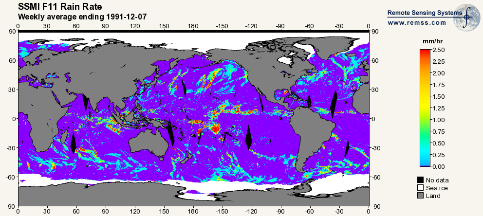
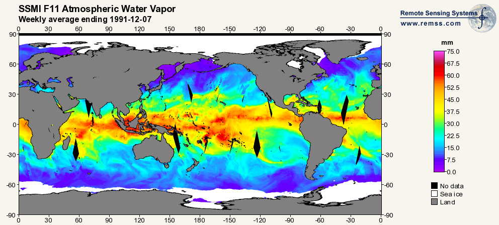
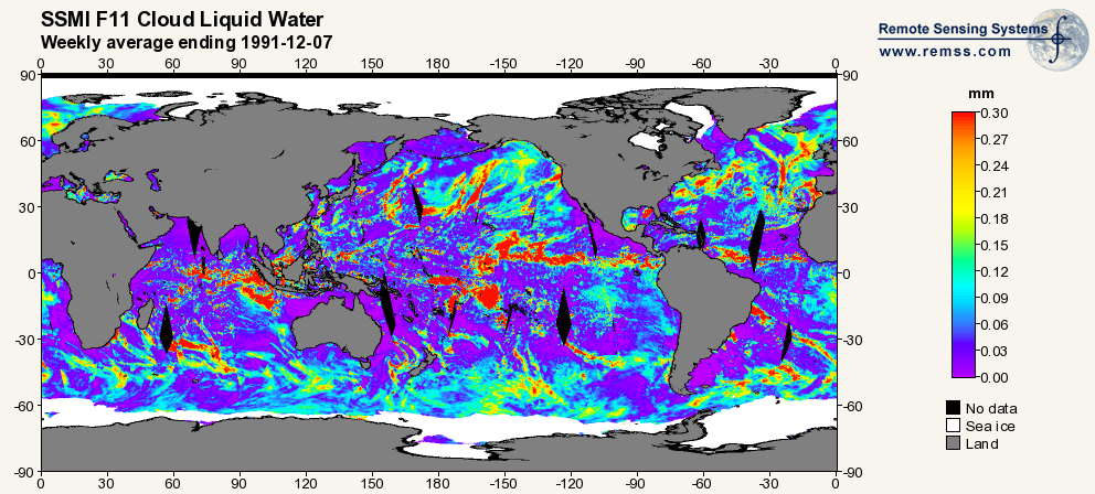
RSS SSM/I OCEAN PRODUCT GRIDS WEEKLY AVERAGE FROM DMSP F11 NETCDF V7
National Aeronautics and Space Administration —
The RSS SSM/I Ocean Product Grids Weekly Average from DMSP F11 netCDF dataset is part of the collection of Special Sensor Microwave/Imager (SSM/I) and Special Sensor... -
Federal
TOVS GLA DAILY GRIDS from NOAA-10 V01 (TOVSADNG) at GES DISC
National Aeronautics and Space Administration —
This dataset (TOVSADNG) contains the TIROS Operational Vertical Sounder (TOVS) level 3 geophysical parameters derived using data from NOAA-10 and the physical... -
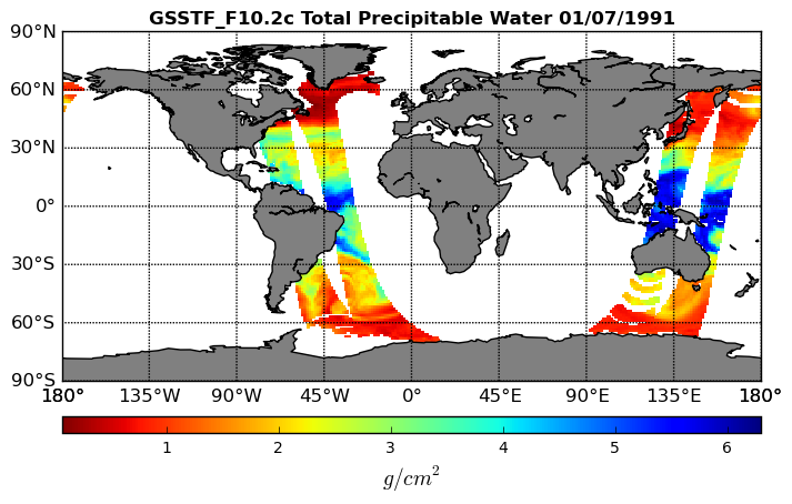
Federal
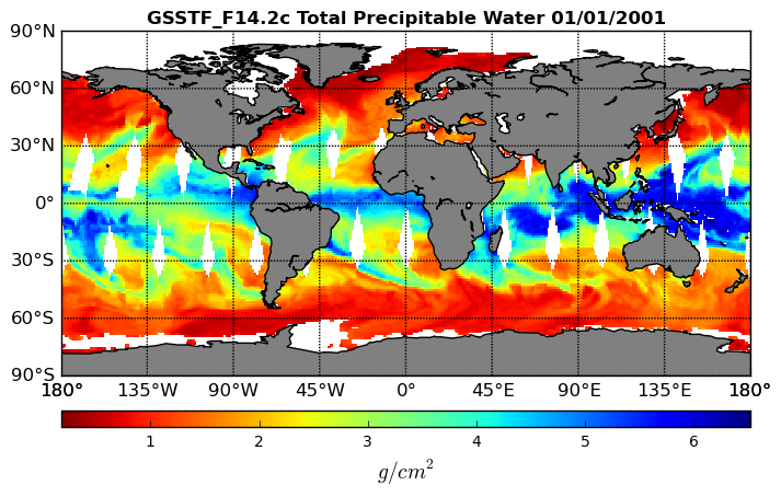
Goddard Satellite-Based Surface Turbulent Fluxes, 0.25 x 0.25 deg, Daily Grid F14 V3 (GSSTF_F14) at GES DISC
National Aeronautics and Space Administration —
These data are part of the Goddard Satellite-based Surface Turbulent Fluxes Version 3 (GSSTF3) Dataset recently produced through a MEaSURES funded project led by Dr.... -
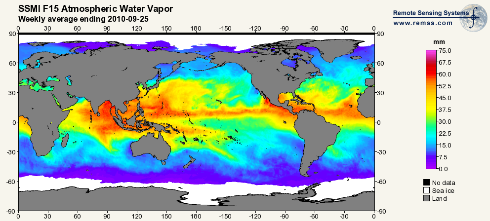
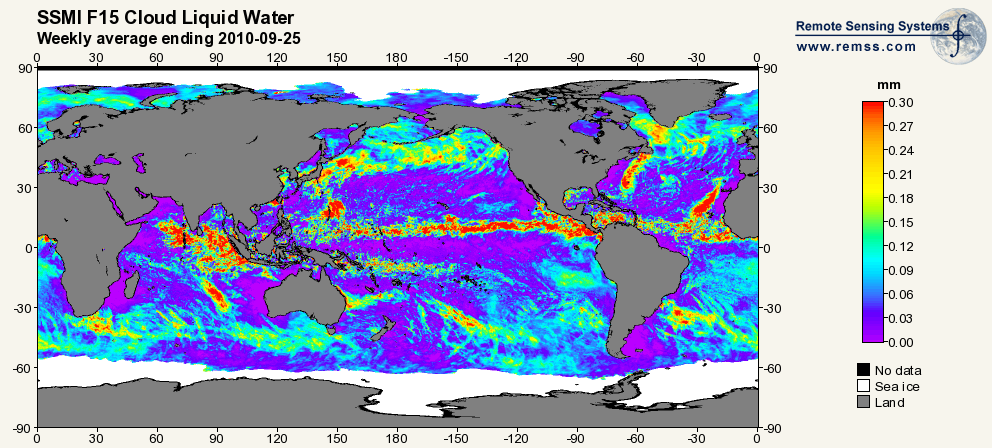
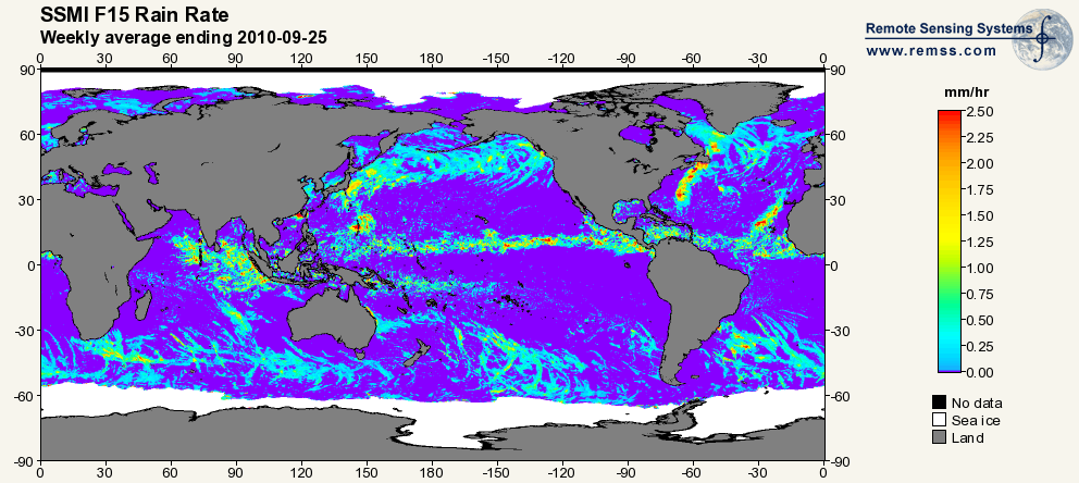
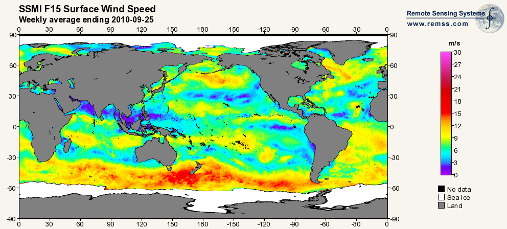
Federal
RSS SSM/I OCEAN PRODUCT GRIDS WEEKLY AVERAGE FROM DMSP F15 NETCDF V7
National Aeronautics and Space Administration —
The RSS SSM/I Ocean Product Grids Weekly Average from DMSP F15 netCDF dataset is part of the collection of Special Sensor Microwave/Imager (SSM/I) and Special Sensor... -
Federal
CMS: Simulated Physical-Biogeochemical Data, SABGOM Model, Gulf of Mexico, 2005-2010
National Aeronautics and Space Administration —
This dataset contains monthly mean ocean surface physical and biogeochemical data for the Gulf of Mexico simulated by the South Atlantic Bight and Gulf of Mexico... -
Federal
Gross Primary Production Maps of Tidal Wetlands across Conterminous USA, 2000-2019 NGDA
National Aeronautics and Space Administration —
This dataset provides mapped tidal wetland gross primary production (GPP) estimates (g C/m2/day) derived from multiple wetland types at 250-m resolution across the... -
Federal
Sounder SIPS: Suomi NPP ATMS Level 3 RAMSES2 Standard Gridded Daily V3 at GES DISC
National Aeronautics and Space Administration —
This level 3 daily product is generated from the RAMSES (Retrieval Algorithm for Microwave Sounders in Earth Science) II algorithm.The RAMSES II algorithm is a... -
Federal
Aqua/AIRS L3 Monthly Standard Physical Retrieval (AIRS+AMSU) 1 degree x 1 degree V7.0 at GES DISC
National Aeronautics and Space Administration —
The Atmospheric Infrared Sounder (AIRS) is a grating spectrometer (R = 1200) aboard the second Earth Observing System (EOS) polar-orbiting platform, EOS Aqua. In... -
Federal
CMS: Mangrove Canopy Height Estimates from Remote Imagery, Zambezi Delta, Mozambique
National Aeronautics and Space Administration —
This data set provides high resolution canopy height estimates for mangrove forests in the Zambezi Delta, Mozambique, Africa. The estimates were derived from three... -
Federal
Goddard Satellite-Based Surface Turbulent Fluxes, 0.25 x 0.25 deg, Daily Grid F10 V3 (GSSTF_F10) at GES DISC
National Aeronautics and Space Administration —
These data are part of the Goddard Satellite-based Surface Turbulent Fluxes Version 3 (GSSTF3) Dataset recently produced through a MEaSURES funded project led by Dr....

Official websites use .gov
A
.gov website belongs to an official government
organization in the United States.
Secure .gov websites use HTTPS
A
lock (
) or https:// means you’ve safely connected to
the .gov website. Share sensitive information only on official,
secure websites.