

9 datasets found
-
Federal
SMMR/Nimbus-7 Color Images V001 (SMMRN7IM) at GES DISC
National Aeronautics and Space Administration —
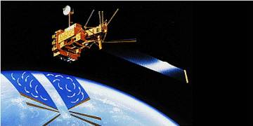
SMMRN7IM is the Nimbus-7 Scanning Multichannel Microwave Radiometer (SMMR) Color Image data product scanned from 17" x 15" color prints and saved as JPEG-2000 files.... -
Federal
NSCAT High-Resolution MGDR, Sigma-0 and Ocean Wind Vectors (Dunbar)
National Aeronautics and Space Administration —
The NASA Scatterometer (NSCAT) Level 2.5 high-resolution merged ocean wind vectors and sigma-0 in 25 km wind vector cell (WVC) swaths contain daily data from... -
Federal
NOAA CYGNSS Level 2 Science Wind Speed 25-km Product Version 1.1
National Aeronautics and Space Administration —
This dataset contains the Version 1.1 NOAA CYGNSS Level 2 Science Wind Speed Product Version 1.1 which provides the time-tagged and geolocated average wind speed... -
Federal
QuikSCAT Level 1C Averaged Sigma-0 and Winds from Non-spinning Antenna Version 2.0
National Aeronautics and Space Administration —
This dataset is Version 2 of the geo-located and averaged Level 1B Sigma-0 measurements and wind retrievals from the SeaWinds on QuikSCAT platform, initiated in the... -
Federal
CYGNSS Level 2 Science Data Record Version 2.1
National Aeronautics and Space Administration —
This dataset contains the Version 2.1 CYGNSS Level 2 Science Data Record which provides the time-tagged and geolocated average wind speed (m/s) and mean square slope... -
Federal
HURRICANE AND SEVERE STORM SENTINEL (HS3) HURRICANE IMAGING RADIOMETER (HIRAD) V1
National Aeronautics and Space Administration —
The Hurricane and Severe Storm Sentinel (HS3) Hurricane Imaging Radiometer (HIRAD) was collected by the Hurricane Imaging Radiometer (HIRAD), which was a multi-band... -
Federal
NOAA CYGNSS Level 2 Science Wind Speed 25-km Product Version 1.2
National Aeronautics and Space Administration —
This dataset contains the Version 1.2 NOAA CYGNSS Level 2 Science Wind Speed Product Version 1.2 which provides the time-tagged and geolocated average wind speed... -
Federal
CYGNSS Level 2 Science Data Record Version 3.0
National Aeronautics and Space Administration —
This dataset contains the Version 3.0 CYGNSS Level 2 Science Data Record which provides the time-tagged and geolocated average wind speed (m/s) and mean square slope... -
Federal
RSS WindSat L1C Calibrated TB Version 8
National Aeronautics and Space Administration —
The dataset contains the Level 1C WindSat Top of the Atmosphere (TOA) TB processed by RSS. The WindSat radiances are turned into TOA TB after correction for hot and...
9 datasets found