
-
Federal
Penobscot Bay Optical Survey
National Aeronautics and Space Administration —
Measurements made in the Penobscot Bay between 2007 and 2008. -
Federal
Optical Water quality measurements made in the Florida Panhandle estuaries
National Aeronautics and Space Administration —
Measurements made in the Florida Panhandle estuaries in partnership with USF and FWC-FWRI. -
Federal
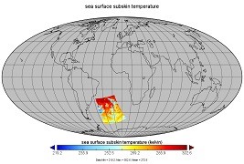
Aquarius Official Release Level 3 Ancillary Reynolds Sea Surface Temperature Standard Mapped Image Descending 7-Day Data V5.0
National Aeronautics and Space Administration —
Aquarius Level 3 ancillary sea surface temperature (SST) standard mapped image data are the ancillary SST data used in the Aquarius calibration for salinity... -
Federal
Aerosol Characterization Experiment (ACE) - Asia
National Aeronautics and Space Administration —
Measurements taken during the Aerosol Characterization Experiment (ACE) off the coast of Asia in the East China Sea, Sea of Japan, and Pacific Ocean. -
Federal
GHRSST NOAA/STAR GOES-17 ABI L3C America Region SST v2.71 dataset in GDS2
National Aeronautics and Space Administration —
The ACSPO G17/ABI L3C (Level 3 Collated) product is a gridded version of the ACSPO G17/ABI L2P product available at... -
Federal
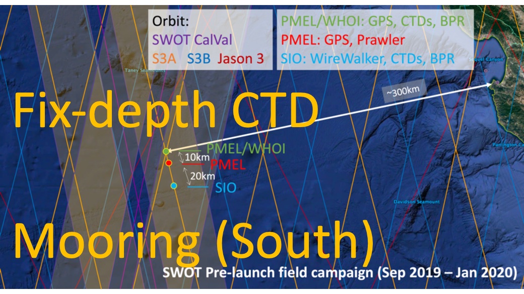
SWOT 2019-2020 Prelaunch Oceanography Field Campaign SIO Moored Fixed-Depth CTDs
National Aeronautics and Space Administration —
This dataset provides the conductivity, temperature and depth (CTD) measurements from the fixed-depth CTD sensors mounted on a full-depth mooring deployed by the SWOT... -
Federal
Mid-Atlantic coastal region and Monterey Bay measurements
National Aeronautics and Space Administration —
Measurements made near the mid-Atlantic coastal region and Monterey Bay in 2005 and 2006. -
Federal
GHRSST Level 2P NOAA STAR SST v2.80 from VIIRS on S-NPP Satellite
National Aeronautics and Space Administration —
The Joint Polar Satellite System (JPSS), starting with S-NPP launched on 28 October 2011, is the new generation of the US Polar Operational Environmental Satellites... -
Federal
Tokyo Bay measurements from 1982-1984
National Aeronautics and Space Administration —
Measurements taken in the Tokyo Bay between 1982 and 1984. -
Federal
Geochemistry, Phytoplankton, and Color of the Ocean (GePCO) program
National Aeronautics and Space Administration —
Measurements taken during 2001 under the Geochemistry, Phytoplankton, and Color of the Ocean (GePCO) program. -
Federal
Measurements made by the NOAA R/V Ron H. Brown
National Aeronautics and Space Administration —
Measurements made by the NOAA research vessel, the Ron H. Brown between 2000 and 2002. -
Federal
SMMR/Nimbus-7 Color Images V001 (SMMRN7IM) at GES DISC
National Aeronautics and Space Administration —
SMMRN7IM is the Nimbus-7 Scanning Multichannel Microwave Radiometer (SMMR) Color Image data product scanned from 17" x 15" color prints and saved as JPEG-2000 files.... -
Federal
Sounder SIPS: Suomi NPP CrIMSS Level 3 Comprehensive Quality Control Gridded Monthly CHART Normal Spectral Resolution V1
National Aeronautics and Space Administration —
The objective of this limited edition data collection is to examine products generated by the Climate Heritage AIRS Retrieval Technique (CHART) algorithm to analyze... -
Federal
AIRS/Aqua L3 8-day Standard Physical Retrieval (AIRS+AMSU+HSB) 1 degree x 1 degree V006 (AIRH3ST8) at GES DISC
National Aeronautics and Space Administration —
The Atmospheric Infrared Sounder (AIRS) is a grating spectrometer (R = 1200) aboard the second Earth Observing System (EOS) polar-orbiting platform, EOS Aqua. In... -
Federal
Trichonesia cruise
National Aeronautics and Space Administration —
Measurements from Indonesia made during 1998. -
Federal
Observations from the Western Gulf of Maine
National Aeronautics and Space Administration —
Observations from the Western Gulf of Maine -
Federal
Turkish Seas pigment measurements
National Aeronautics and Space Administration —
Chlorophyll-a and pigment measurements made in the seas surrounding Turkey between 1997 and 1999. -
Federal
Monsoonal Arabian Sea measurements to validate OceanSat-2
National Aeronautics and Space Administration —
Measurements made in the monsoonal Arabian Sea in 2009 to validate the Indian Satellite, OceanSat-2. -
Federal
MODIS Aqua Level 3 SST MID-IR Annual 4km Nighttime V2019.0 NGDA
National Aeronautics and Space Administration —
Day and night spatially gridded (L3) global NASA skin sea surface temperature (SST) products from the Moderate-resolution Imaging Spectroradiometer (MODIS) onboard... -
Federal
GHRSST NOAA/STAR Metop-A AVHRR FRAC ACSPO v2.80 1km L2P Dataset (GDS v2)
National Aeronautics and Space Administration —
The MetOp First Generation (FG) is a European multi-satellite program jointly established by ESA and EUMETSAT, comprising three satellites, MetOp-A, -B and -C. The...

Official websites use .gov
A
.gov website belongs to an official government
organization in the United States.
Secure .gov websites use HTTPS
A
lock (
) or https:// means you’ve safely connected to
the .gov website. Share sensitive information only on official,
secure websites.