

9 datasets found
-
Federal
CLPX-Model: Land Data Assimilation System (LDAS) Data, Version 1
National Aeronautics and Space Administration —
The LDAS data set contains 43 model and observation-based fields produced by the LDAS uncoupled modeling system at the NASA Goddard Space Flight Center using the... -
Federal
Land Surface Atmospheric Boundary Interaction Product L3 V1(LANDMET) at GES DISC
National Aeronautics and Space Administration —
This product is a multi-variate data compilation that reconciles the variation scales of these multiple measurements from varies resources, merges and maps them into... -
Federal
SMEX04 San Miguel Watershed Soil Moisture Data: Sonora, Version 1
National Aeronautics and Space Administration —
Notice to Data Users: The documentation for this data set was provided solely by the Principal Investigator(s) and was not further developed, thoroughly reviewed, or... -
Federal
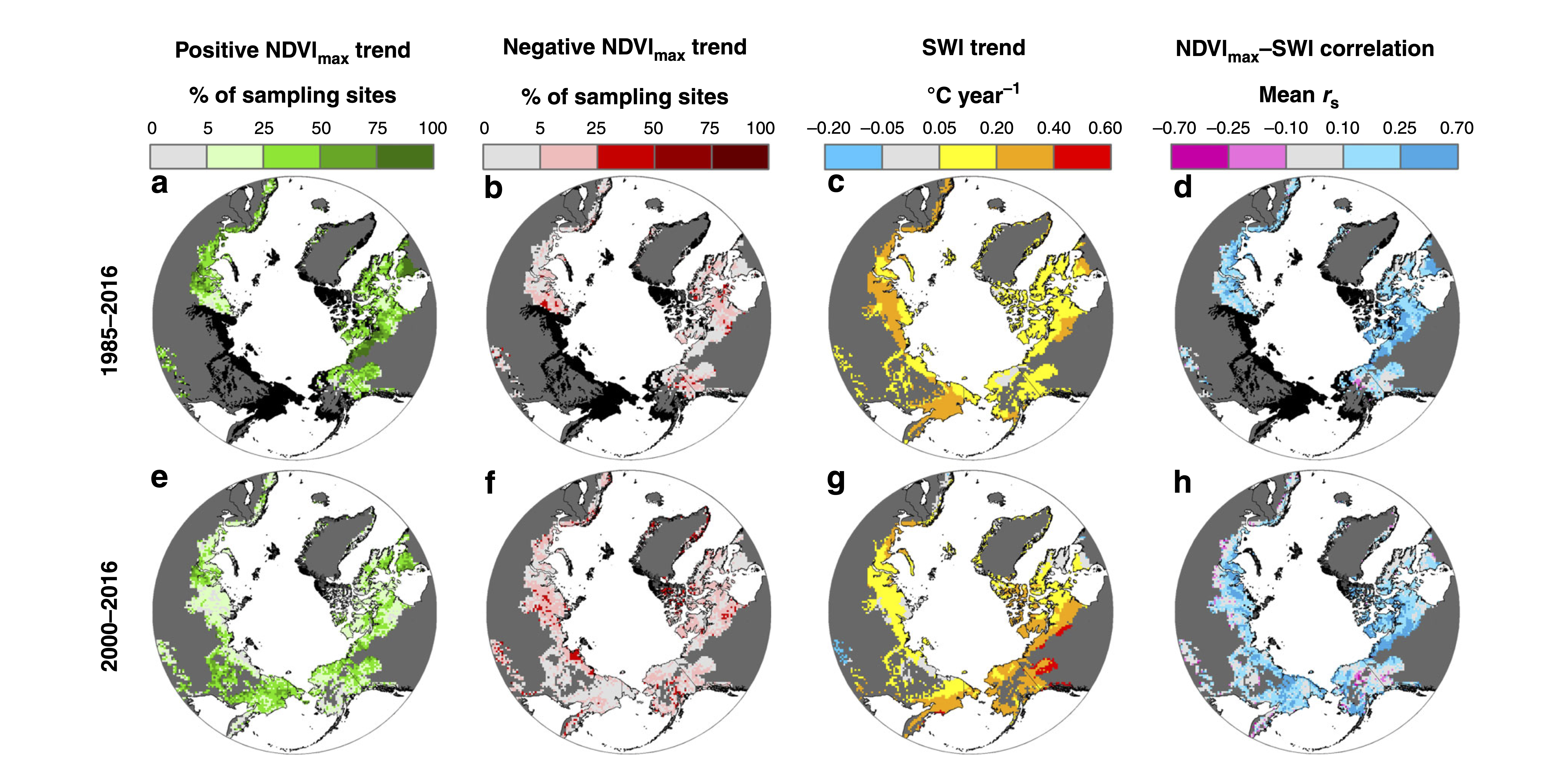
ABoVE: Landsat Tundra Greenness and Summer Air Temperatures, Arctic Tundra, 1985-2016
National Aeronautics and Space Administration —
This dataset provides annual tundra greenness and summer air temperatures at a resolution of 50 km over the pan-Arctic tundra biome above 31.5 degrees over the time... -
Federal
FLUXNET Research Network Site Characteristics, Investigators, and Bibliography, 2016
National Aeronautics and Space Administration —
FLUXNET is a global network of micrometeorological tower sites that use eddy covariance methods to measure the exchanges of carbon dioxide, water vapor, and energy... -
Federal
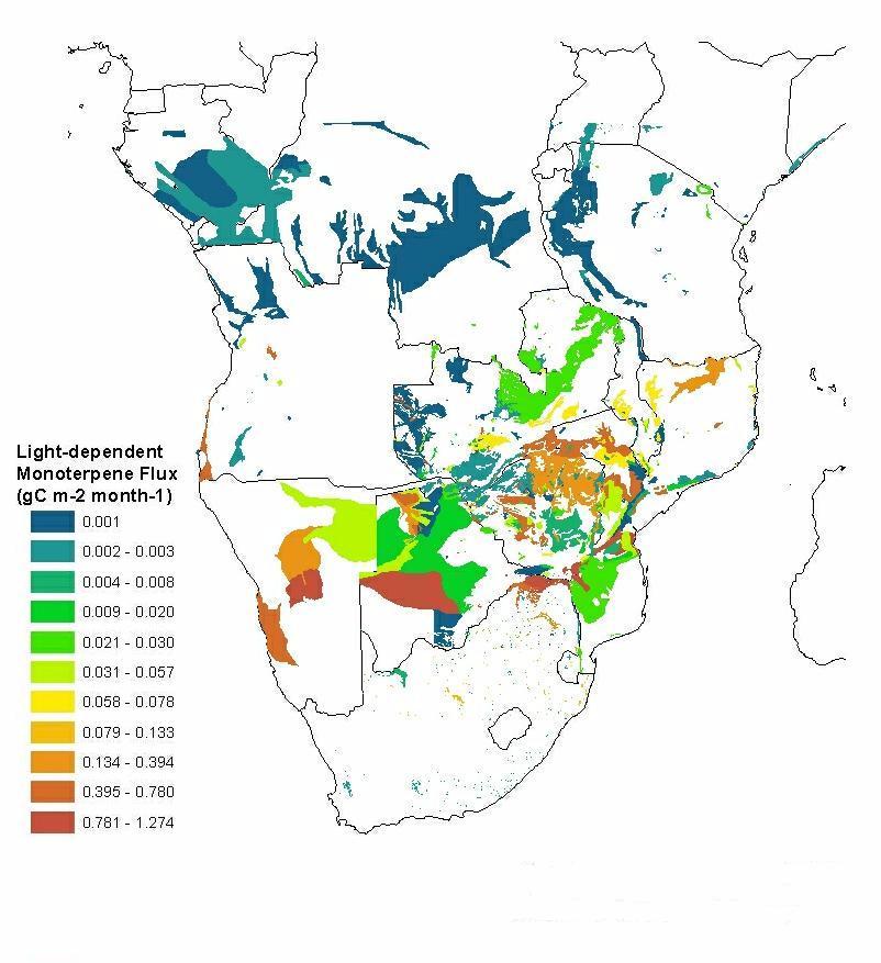
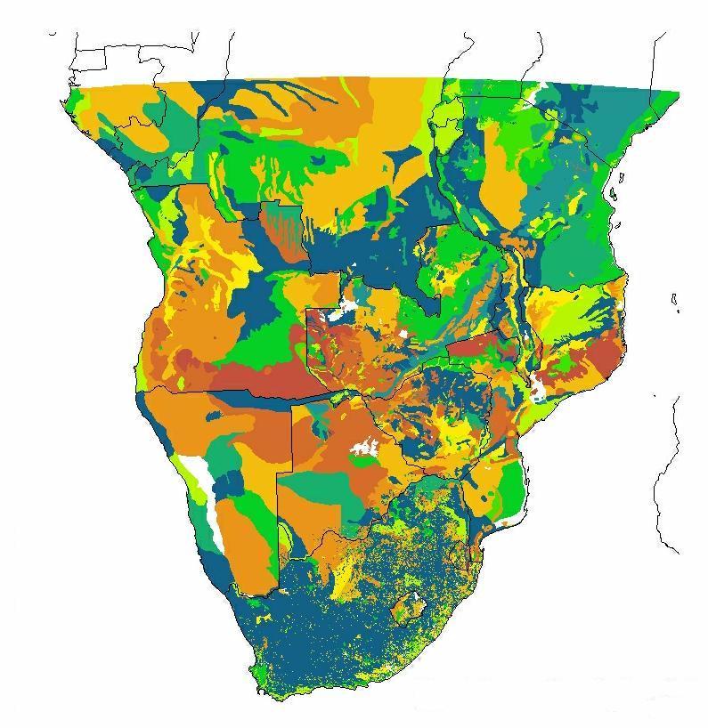
SAFARI 2000 Estimated BVOC Emissions for Southern African Land Cover Types NGDA
National Aeronautics and Space Administration —
Improved vegetation distribution and emission data for Africa south of the equator were developed for the Southern African Regional Science Initiative (SAFARI 2000)... -
Federal
SAFARI 2000 MODIS Water and Heat Fluxes, Maun, Botswana, Dry Season 2001 NGDA
National Aeronautics and Space Administration —
A physically-based model, Energy: Surface Towards Atmosphere (ESTA), was used to model and map the energy and water balances of a heterogeneous land surface in a... -
Federal
NACP MsTMIP: Global and North American Driver Data for Multi-Model Intercomparison
National Aeronautics and Space Administration —
This data set provides environmental data that have been standardized and aggregated for use as input to carbon cycle models at global (0.5-degree resolution) and... -
Federal
BOREAS TGB-12 Soil Carbon Data: NSA
National Aeronautics and Space Administration —
Contains the soil carbon data collected by TGB-12 in the northern study area.
9 datasets found