
-
Federal
TIGER/Line Shapefile, 2021, County, Burlington County, NJ, All Roads
U.S. Census Bureau, Department of Commerce —
The TIGER/Line shapefiles and related database files (.dbf) are an extract of selected geographic and cartographic information from the U.S. Census Bureau's Master... -
Federal
Basin Characteristics Data for the StreamStats Application in the Mystic River Basin, Massachusetts
Department of the Interior —
The U.S. Geological Survey’s StreamStats program is a publicly-accessible web application (https://streamstats.usgs.gov) that can be used to delineate drainage areas,... -
Federal
Digital Elevation Model and Derivative Datasets to Support the Integration of Stormwater Drainage into the StreamStats Application for the Mystic River Watershed, Massachusetts
Department of the Interior —
The U.S. Geological Survey’s StreamStats program is a publicly-accessible web application (https://streamstats.usgs.gov) that can be used to delineate drainage areas,... -
Federal
TIGER/Line Shapefile, 2020, County, Burlington County, NJ, Topological Faces (Polygons With All Geocodes)
U.S. Census Bureau, Department of Commerce —
The TIGER/Line shapefiles and related database files (.dbf) are an extract of selected geographic and cartographic information from the U.S. Census Bureau's Master... -
Federal
TIGER/Line Shapefile, 2023, County, Burlington County, NJ, Address Range-Feature
U.S. Census Bureau, Department of Commerce —
The TIGER/Line shapefiles and related database files (.dbf) are an extract of selected geographic and cartographic information from the U.S. Census Bureau's Master... -
Federal
TIGER/Line Shapefile, 2023, County, Burlington County, NJ, Area Hydrography
U.S. Census Bureau, Department of Commerce —
The TIGER/Line shapefiles and related database files (.dbf) are an extract of selected geographic and cartographic information from the U.S. Census Bureau's Master... -
Federal
TIGER/Line Shapefile, Current, County, Burlington County, NJ, All Roads
U.S. Census Bureau, Department of Commerce —
This resource is a member of a series. The TIGER/Line shapefiles and related database files (.dbf) are an extract of selected geographic and cartographic information... -
Federal
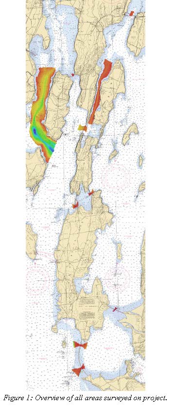
D00267: NOS Hydrographic Survey , 2018-05-29
National Oceanic and Atmospheric Administration, Department of Commerce —
The National Oceanic and Atmospheric Administration (NOAA) has the statutory mandate to collect hydrographic data in support of nautical chart compilation for safe... -
Federal
TIGER/Line Shapefile, 2022, County, Burlington County, NJ, Area Hydrography
U.S. Census Bureau, Department of Commerce —
The TIGER/Line shapefiles and related database files (.dbf) are an extract of selected geographic and cartographic information from the U.S. Census Bureau's Master... -
Federal
TIGER/Line Shapefile, 2022, County, Burlington County, NJ, All Lines
U.S. Census Bureau, Department of Commerce —
The TIGER/Line shapefiles and related database files (.dbf) are an extract of selected geographic and cartographic information from the U.S. Census Bureau's Master... -
Federal
TIGER/Line Shapefile, 2022, County, Burlington County, NJ, Linear Hydrography
U.S. Census Bureau, Department of Commerce —
The TIGER/Line shapefiles and related database files (.dbf) are an extract of selected geographic and cartographic information from the U.S. Census Bureau's Master... -
Federal
TIGER/Line Shapefile, 2022, County, Burlington County, NJ, Topological Faces (Polygons With All Geocodes)
U.S. Census Bureau, Department of Commerce —
The TIGER/Line shapefiles and related database files (.dbf) are an extract of selected geographic and cartographic information from the U.S. Census Bureau's Master... -
Federal
TIGER/Line Shapefile, 2022, County, Burlington County, NJ, Feature Names Relationship File
U.S. Census Bureau, Department of Commerce —
The TIGER/Line shapefiles and related database files (.dbf) are an extract of selected geographic and cartographic information from the U.S. Census Bureau's Master... -
Federal
TIGER/Line Shapefile, 2023, County, Burlington County, NJ, Topological Faces (Polygons With All Geocodes)
U.S. Census Bureau, Department of Commerce —
The TIGER/Line shapefiles and related database files (.dbf) are an extract of selected geographic and cartographic information from the U.S. Census Bureau's Master... -
Federal
TIGER/Line Shapefile, 2023, County, Burlington County, NJ, Feature Names Relationship File
U.S. Census Bureau, Department of Commerce —
The TIGER/Line shapefiles and related database files (.dbf) are an extract of selected geographic and cartographic information from the U.S. Census Bureau's Master... -
Federal
TIGER/Line Shapefile, 2023, County, Burlington County, NJ, Topological Faces-Area Hydrography Relationship File
U.S. Census Bureau, Department of Commerce —
The TIGER/Line shapefiles and related database files (.dbf) are an extract of selected geographic and cartographic information from the U.S. Census Bureau's Master... -
Federal
TIGER/Line Shapefile, 2022, County, Burlington County, NJ, Address Range-Feature Name Relationship File
U.S. Census Bureau, Department of Commerce —
The TIGER/Line shapefiles and related database files (.dbf) are an extract of selected geographic and cartographic information from the U.S. Census Bureau's Master... -
Federal
TIGER/Line Shapefile, 2023, County, Burlington County, NJ, Linear Hydrography
U.S. Census Bureau, Department of Commerce —
The TIGER/Line shapefiles and related database files (.dbf) are an extract of selected geographic and cartographic information from the U.S. Census Bureau's Master... -
Federal
TIGER/Line Shapefile, 2022, County, Burlington County, NJ, Topological Faces-Area Hydrography Relationship File
U.S. Census Bureau, Department of Commerce —
The TIGER/Line shapefiles and related database files (.dbf) are an extract of selected geographic and cartographic information from the U.S. Census Bureau's Master... -
Federal
TIGER/Line Shapefile, 2023, County, Burlington County, NJ, All Lines
U.S. Census Bureau, Department of Commerce —
The TIGER/Line shapefiles and related database files (.dbf) are an extract of selected geographic and cartographic information from the U.S. Census Bureau's Master...

Official websites use .gov
A
.gov website belongs to an official government
organization in the United States.
Secure .gov websites use HTTPS
A
lock (
) or https:// means you’ve safely connected to
the .gov website. Share sensitive information only on official,
secure websites.