

7 datasets found
-
Federal
OMI/Aura Surface UV Irradiance 1-orbit L2 Swath 13x24 km V003 (OMUVB) at GES DISC
National Aeronautics and Space Administration —
The Aura Ozone Monitoring Instrument (OMI) Version 003 Surface UV Irradiance Product (OMUVB) is now available from the NASA Goddard Earth Sciences Data and... -
Federal
GPM Ground Validation Environment Canada (EC) Weather Station XET C3VP V1
National Aeronautics and Space Administration —
The GPM Ground Validation Environment Canada (EC) Weather Station XET C3VP dataset consists of surface meteorological data collected at the Environment Canada (EC)... -
Federal
SASSIE Arctic Field Campaign Shipboard Meteorology Data Fall 2022
National Aeronautics and Space Administration —
The Salinity and Stratification at the Sea Ice Edge (SASSIE) project is a NASA experiment that aims to understand how salinity anomalies in the upper ocean generated... -
Federal
New York State Mesonet IMPACTS V1
National Aeronautics and Space Administration —
The New York State Mesonet IMPACTS dataset is a browse-only dataset and consists of temperature, wind, wind direction, mean sea level pressure, precipitation, and... -
Federal
SeaFlux Data Products V1
National Aeronautics and Space Administration —
The SeaFlux Data Products dataset consists of estimates of ocean surface latent and sensible heat fluxes, 2m and 10m wind speed, 2m and 10m air temperature, 2m and... -
Federal
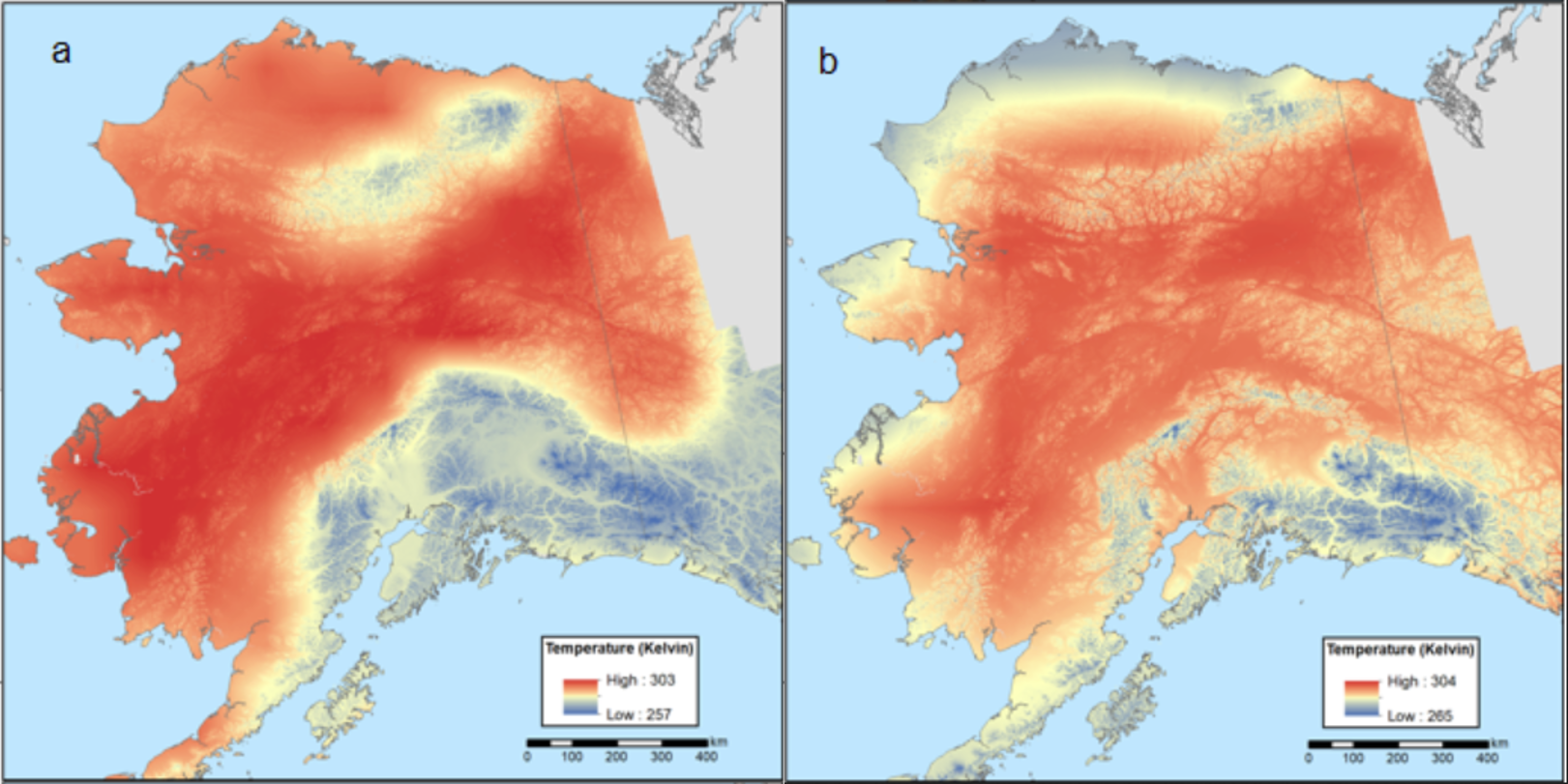
Climate Normals for Last Glacial Maximum and Modern (1975-2005), Alaska
National Aeronautics and Space Administration —
This dataset provides two 30-year climate normal data products for conditions during the last glacial maximum (LGM; ~18,000 years ago) and a modern time period... -
Federal
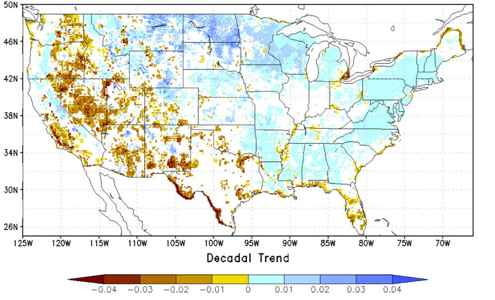
NCA-LDAS Noah-3.3 Land Surface Model L4 Trends 0.125 x 0.125 degree V2.0 (NCALDAS_NOAH0125_Trends) at GES DISC
National Aeronautics and Space Administration —
The National Climate Assessment - Land Data Assimilation System, or NCA-LDAS, is a terrestrial water reanalysis in support of the United States Global Change Research...
7 datasets found