

6 datasets found
-
Federal
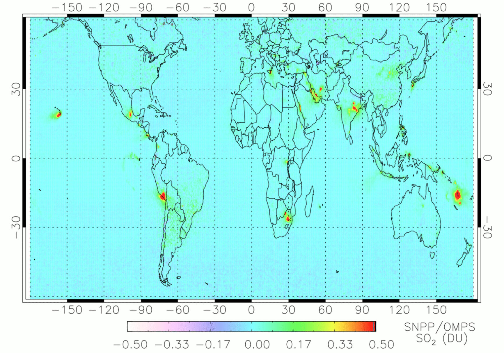
OMPS/NPP PCA SO2 Total Column 1-Orbit L2 Swath 50x50km V2 (OMPS_NPP_NMSO2_PCA_L2) at GES DISC
National Aeronautics and Space Administration —
The OMPS_NPP_NMSO2_PCA_L2 product is part of the MEaSUREs (Making Earth Science Data Records for Use in Research Environments) suite of products. It is retrieved from... -
Federal
Export and Leaching of Carbon and Nitrogen from Mississippi River Basin, 1901-2099
National Aeronautics and Space Administration —
This dataset provides estimates for export and leaching of dissolved inorganic carbon (DIC), dissolved organic carbon (DOC), total organic carbon (TOC), particulate... -
Federal
TOMS/N7 MS SO2 Vertical Column 1-Orbit L2 Swath 50x50 km V3 (TOMSN7SO2) at GES DISC
National Aeronautics and Space Administration —
Version 3 is the current version of the data set. Older versions will no longer be available and have been superseded by Version 3. The goal of this data set is to... -
Federal
Geoecology: County-Level Environmental Data for the United States, 1941-1981
National Aeronautics and Space Administration —
The Geoecology database is a compilation of environmental data for the period 1941 to 1981. The Geoecology database contains selected data on terrain and soils, water... -
Federal
ACCLIP WB-57 Aircraft Merge Data
National Aeronautics and Space Administration —
ACCLIP_Merge_WB57-Aircraft_Data is the pre-generated merge files created from a variety of in-situ instrumentation collecting measurements onboard the WB-57 aircraft... -
Federal
Annual wildland fire emissions (WFEIS v0.5) for Conterminous US and Alaska, 2001-2013 NGDA
National Aeronautics and Space Administration —
This data set contains annual modeled estimates of wildland fire emissions at 0.01 degree (~1-km) spatial resolution from the Wildland Fire Emissions Information...
6 datasets found