

4 datasets found
-
Federal
Utah FORGE: Seismic Velocity Models, February 2021
Department of Energy —
This dataset contains a map, showing the Utah FORGE seismic stations, and seismic velocity model data. There are 61 1-D velocity models which are in a compressed TAR... -
Federal
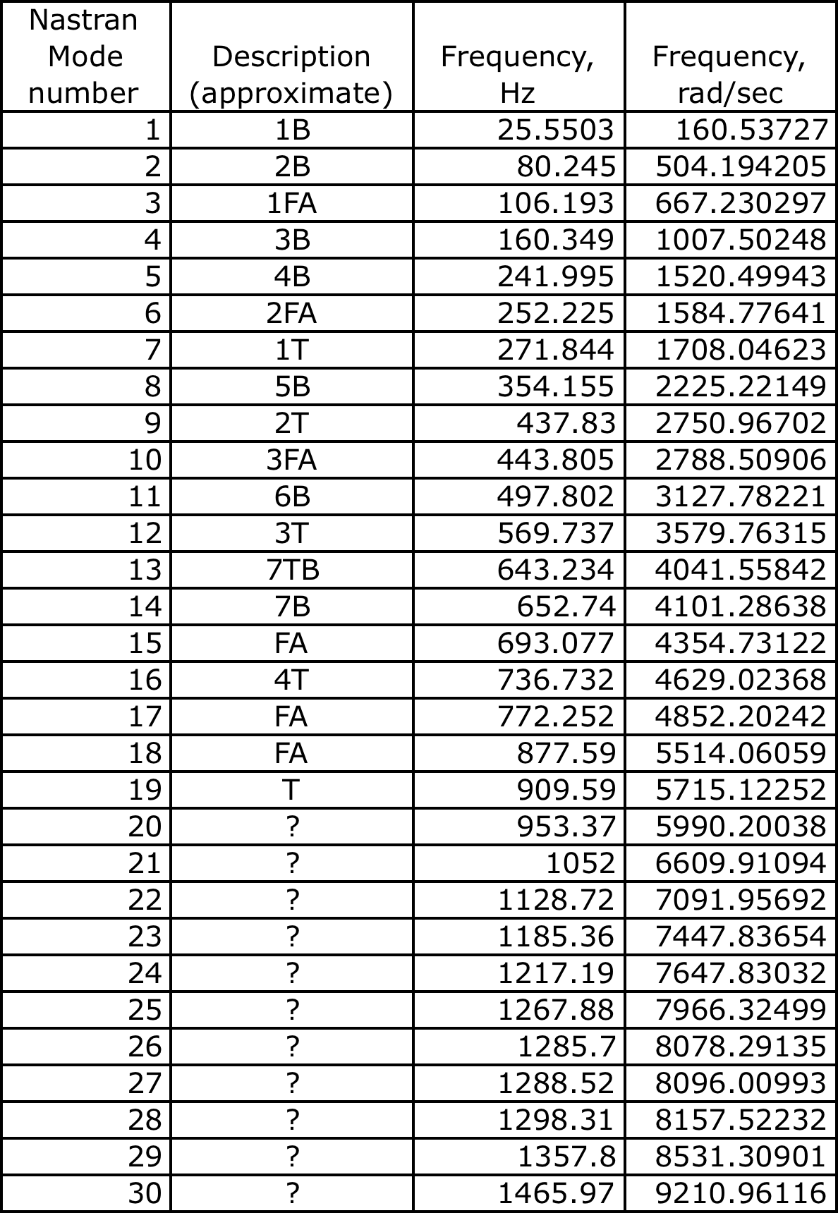
HIRENASD FEM Nov 2011
National Aeronautics and Space Administration —
Model with Tetrahedral elements includes wing, balance, exciter and modelcart Some files were too large and had to be split into parts. To combine the parts, use cat... -
Federal
BOREAS TGB-05 Fire History of Manitoba 1980 to 1991 in Vector Format
National Aeronautics and Space Administration —
Vector format data set covering the province of Manitoba and produced by Forestry Canada from hand-drawn boundaries of fires on photocopies of 1:250,000 scale maps. -
Federal
BOREAS RSS-16 AIRSAR CM V6.1 Images
National Aeronautics and Space Administration —
Satellite and aircraft SAR data used in conjunction with ground measurements to determine the moisture regime of the boreal forest. The NASA JPL AIRSAR is a side-...
4 datasets found